Buildings


Westboine Village Housing Co-operative
| Formerly: | Westboine Village |
|---|---|
| Address: | 32 Shelmerdine Drive |
| Constructed: | 1973–76 |
| Architects: | IKOY |
More Information
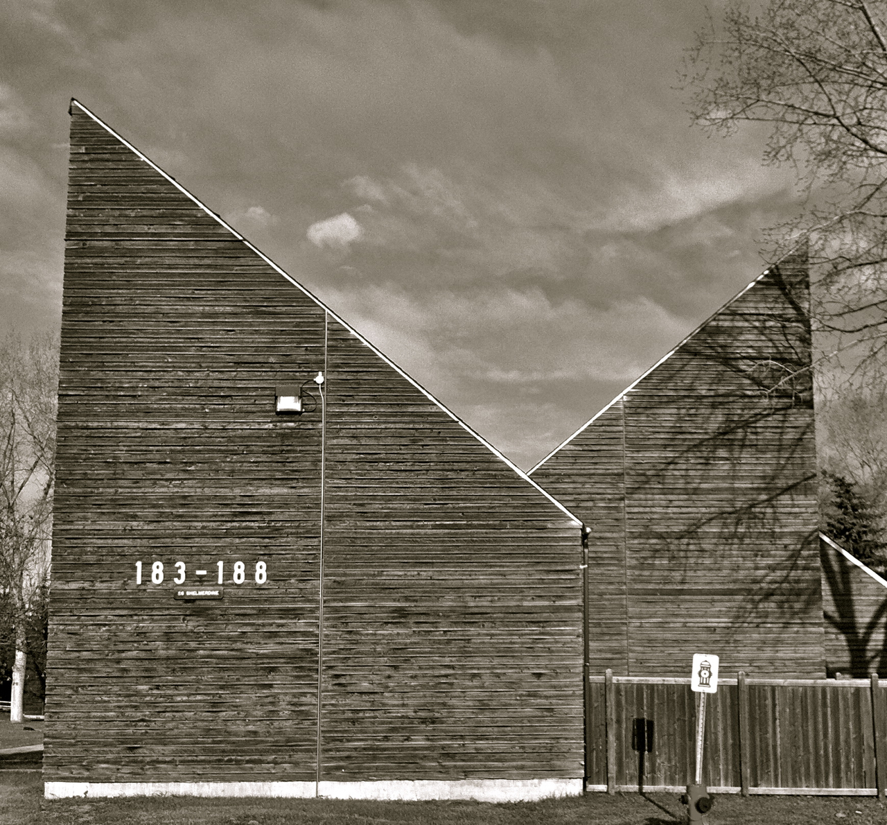
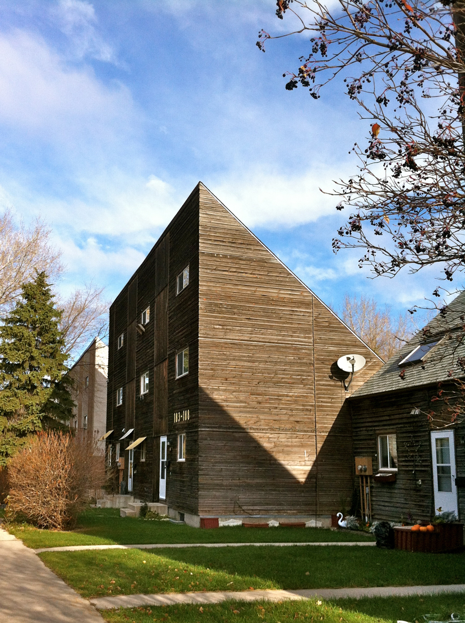
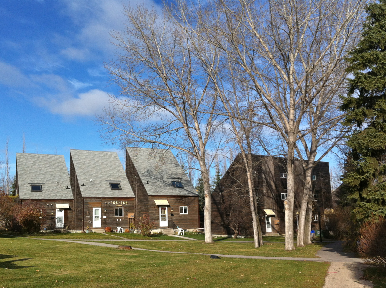
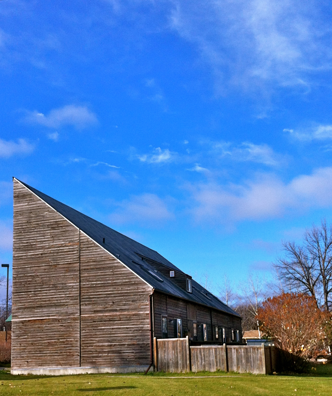
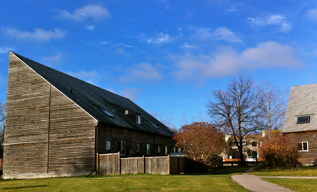
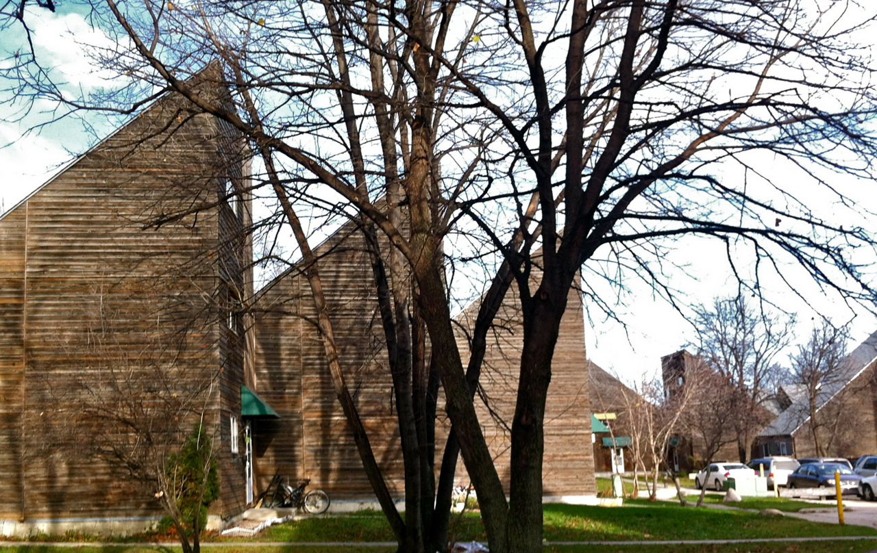
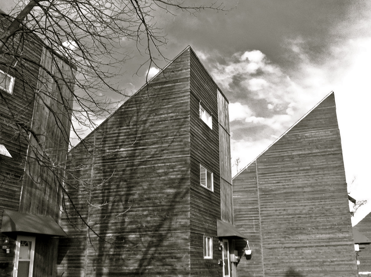
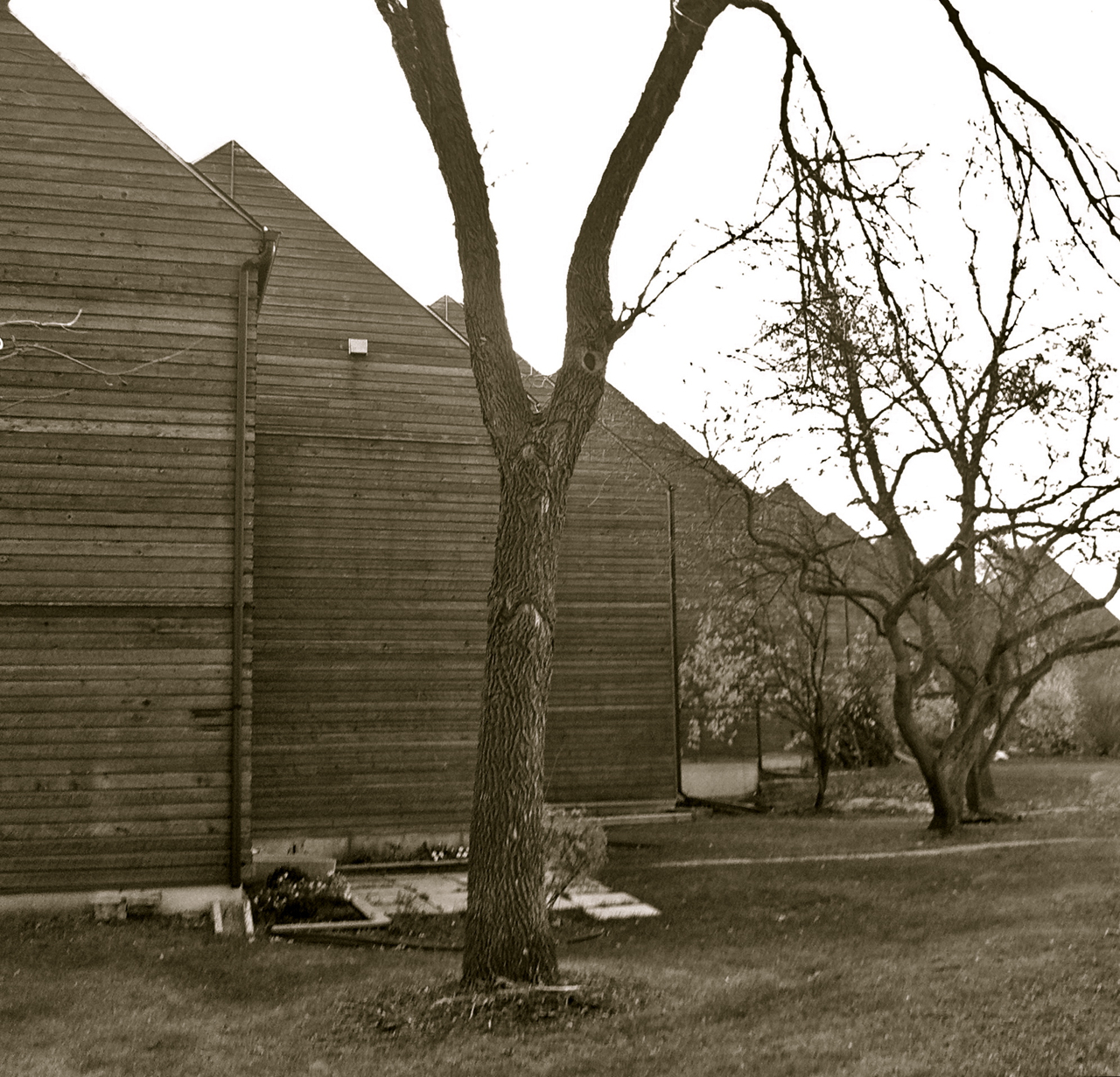
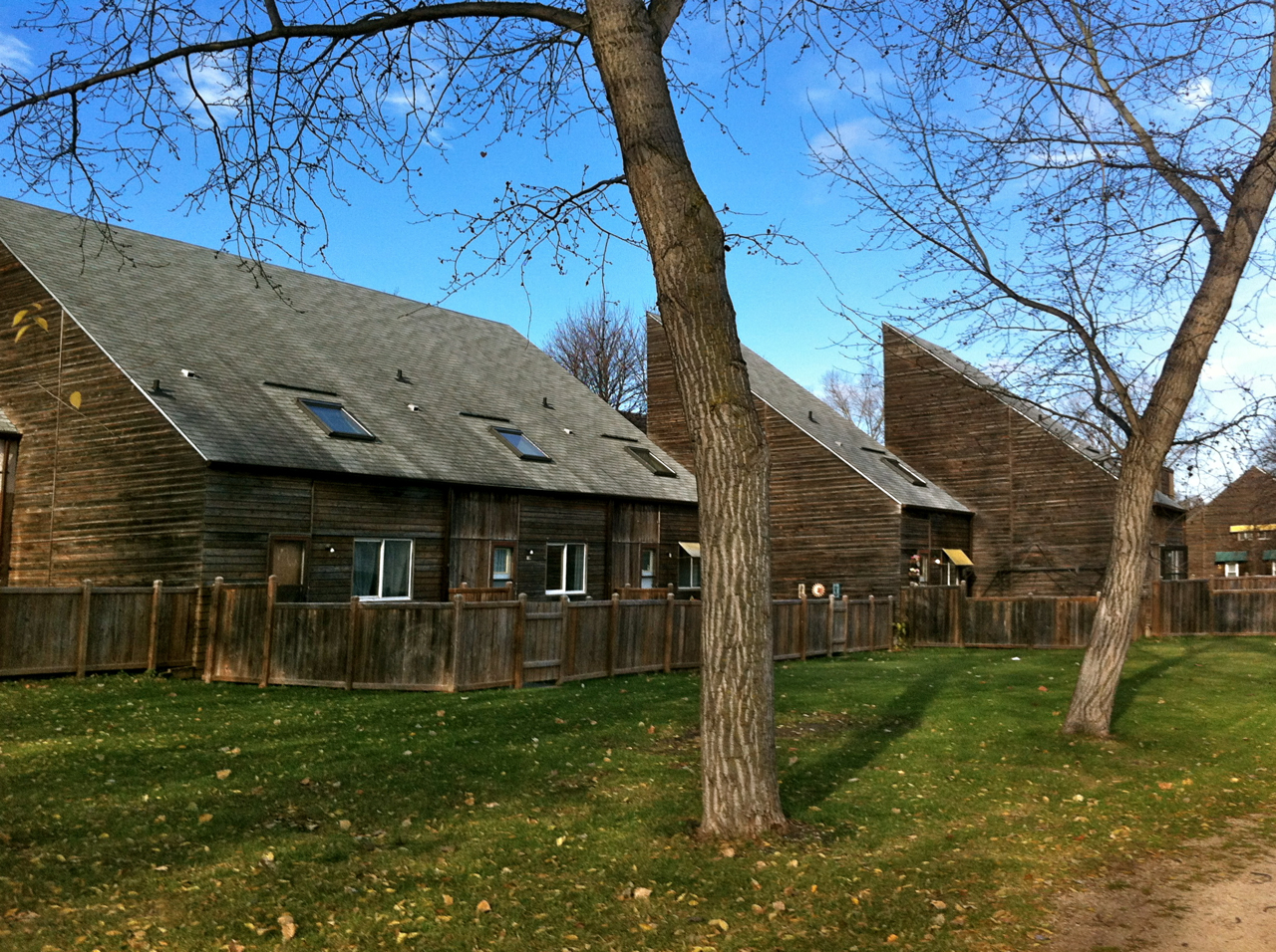
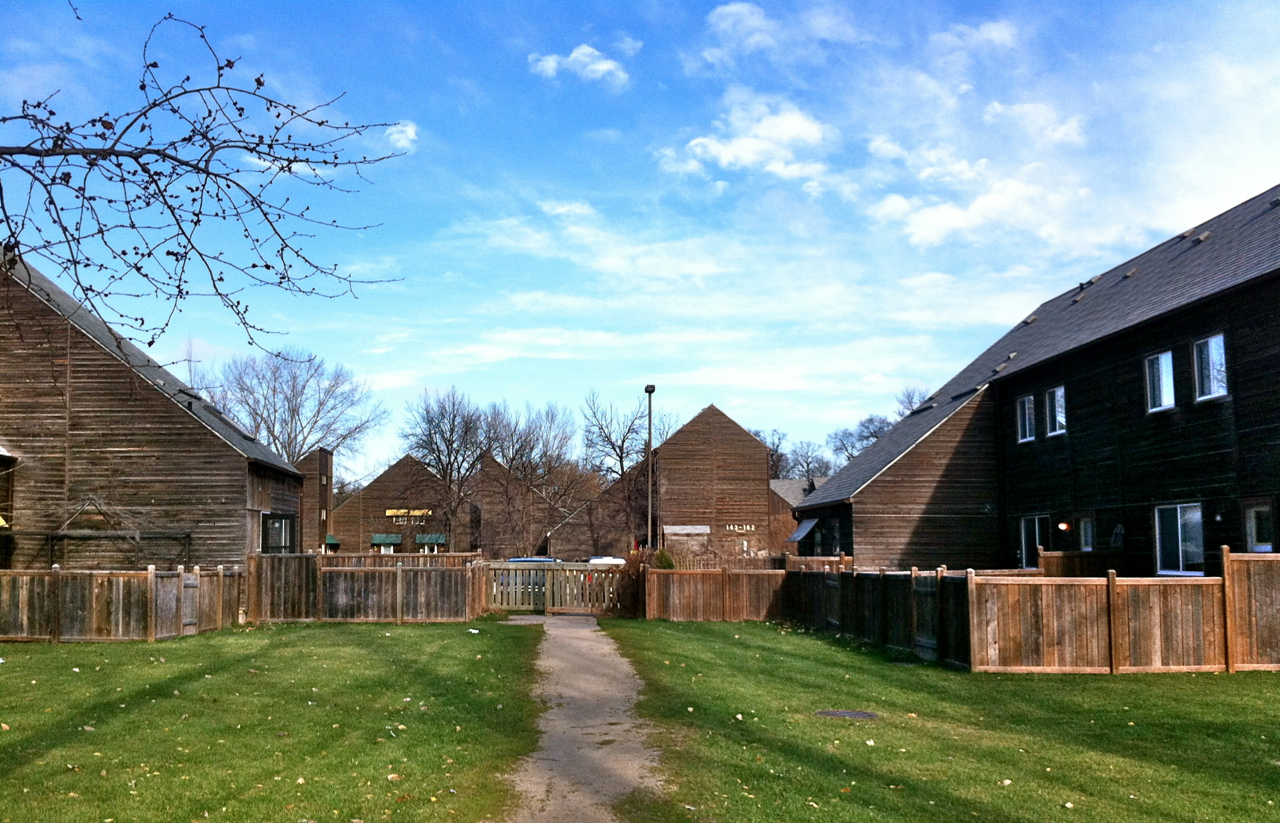
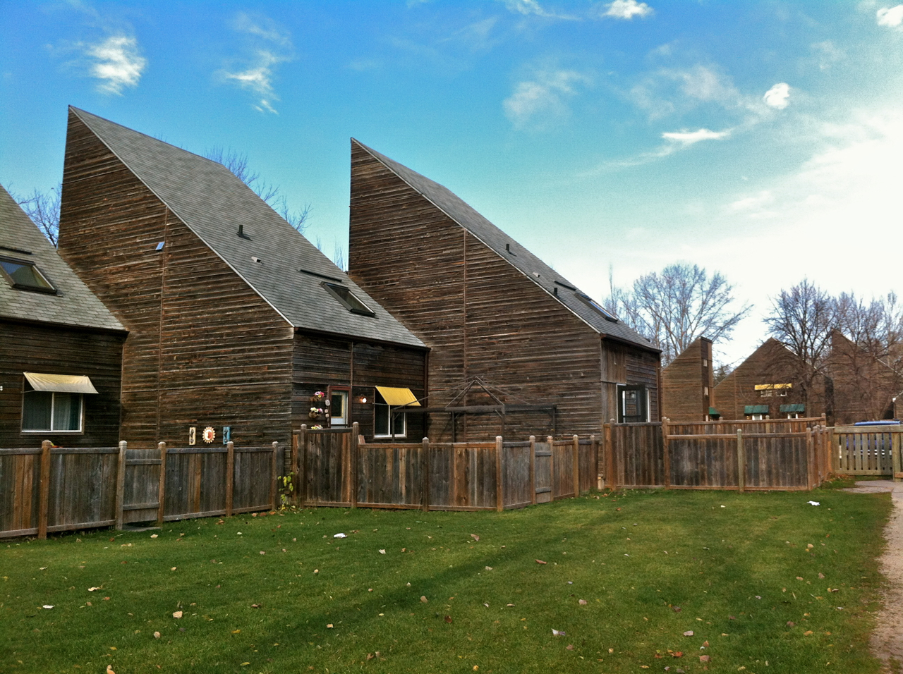
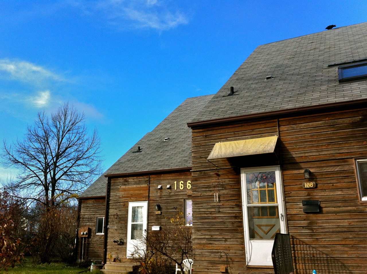
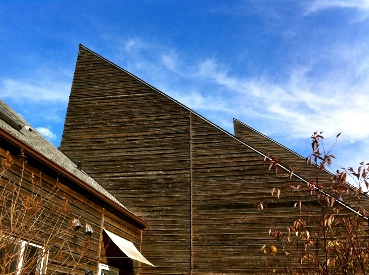
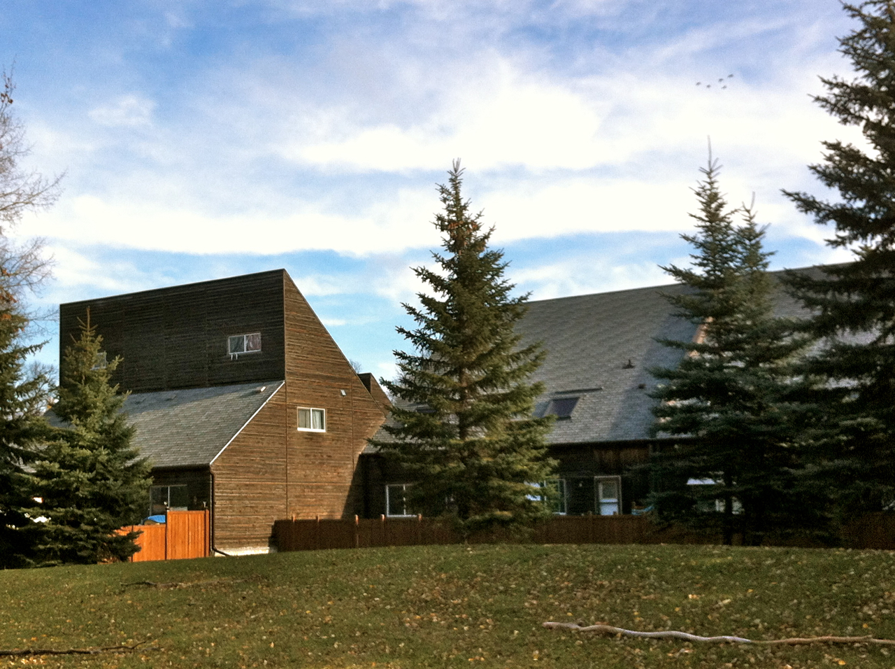
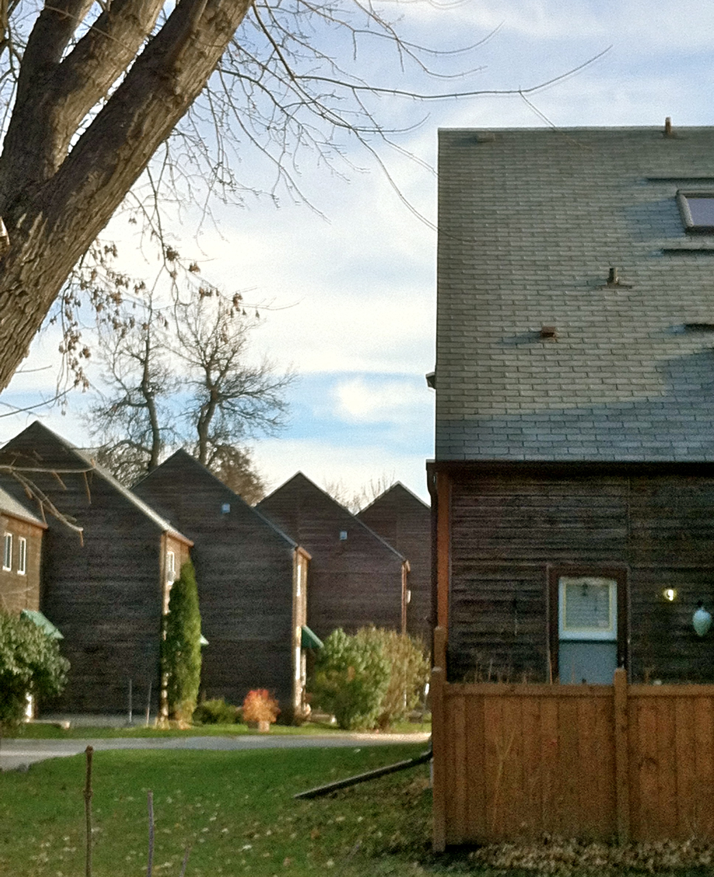
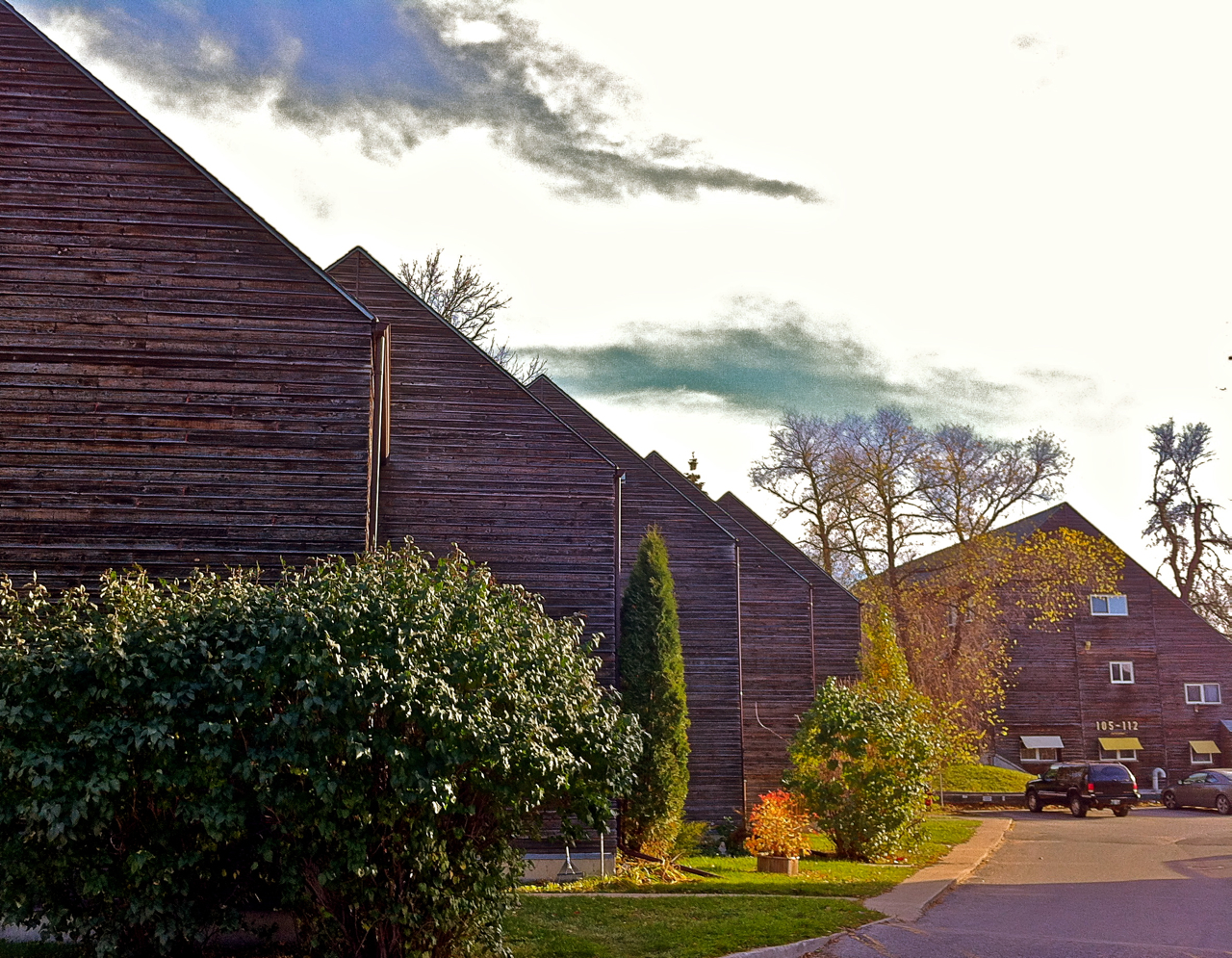
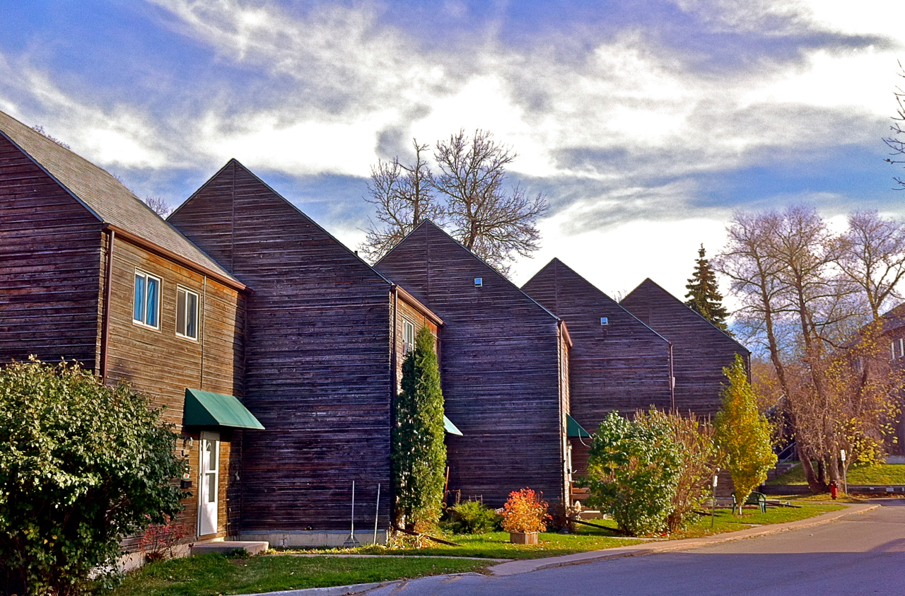
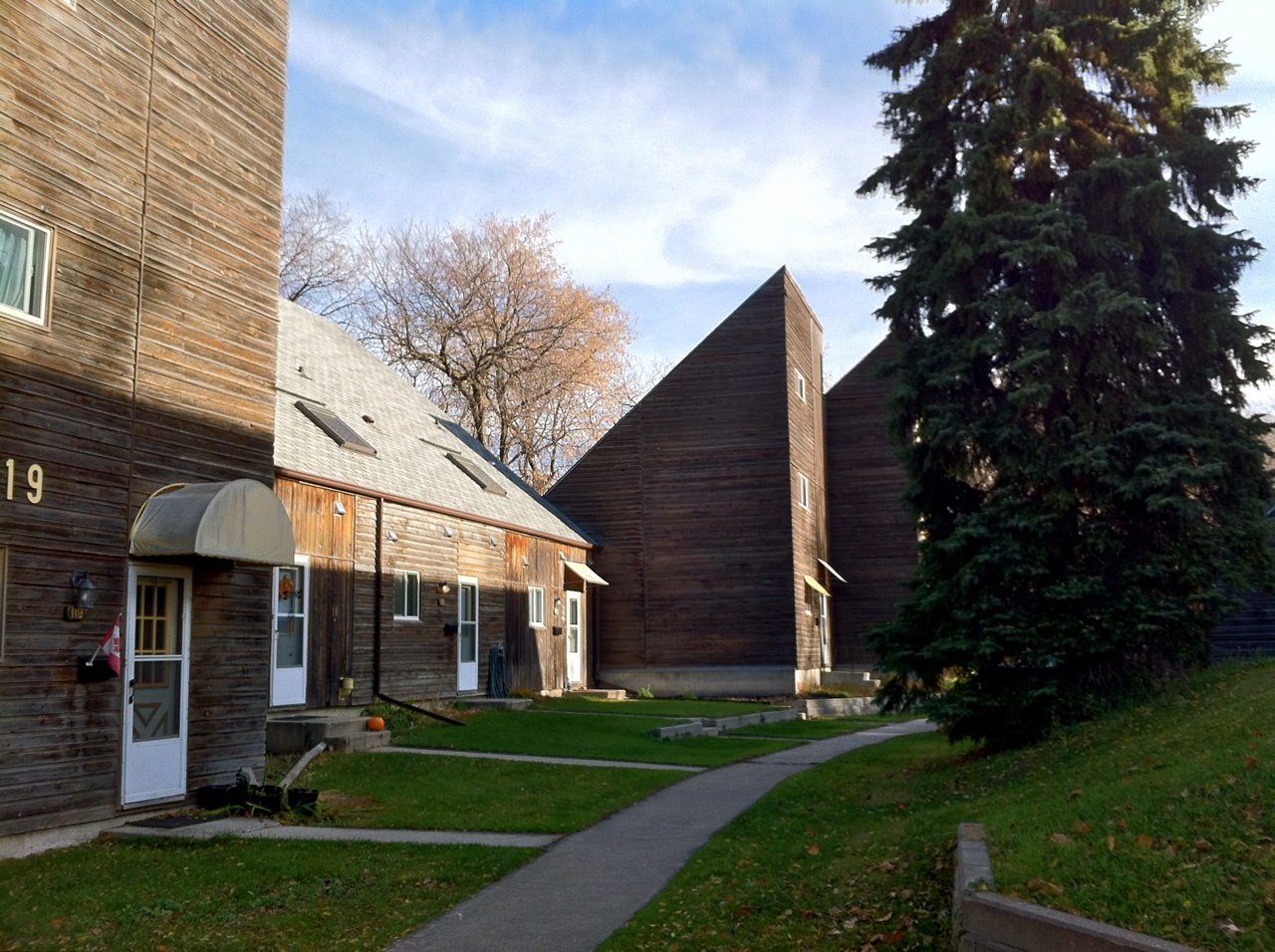
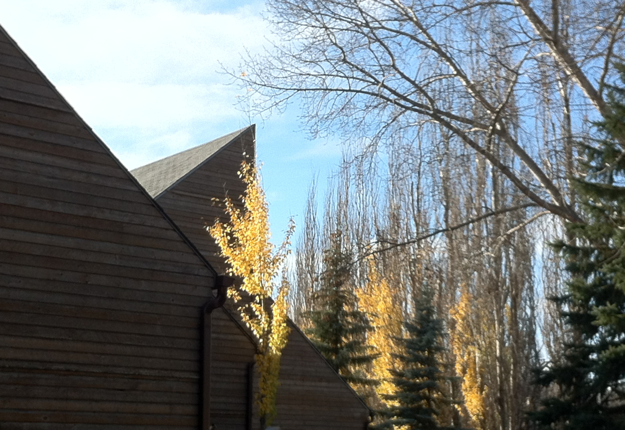
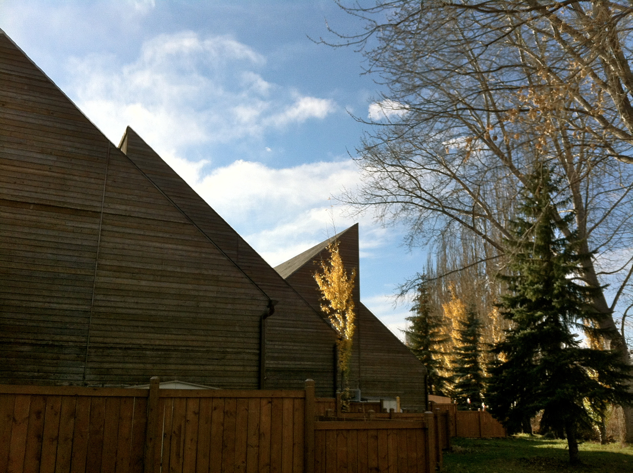
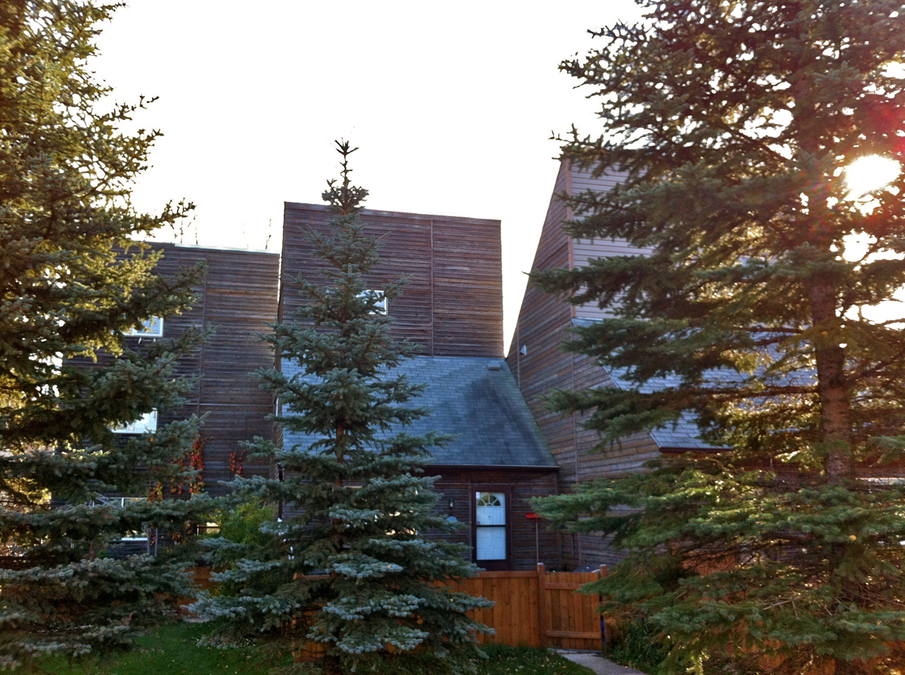
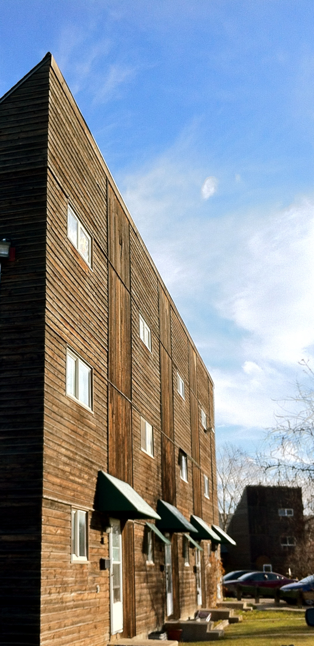
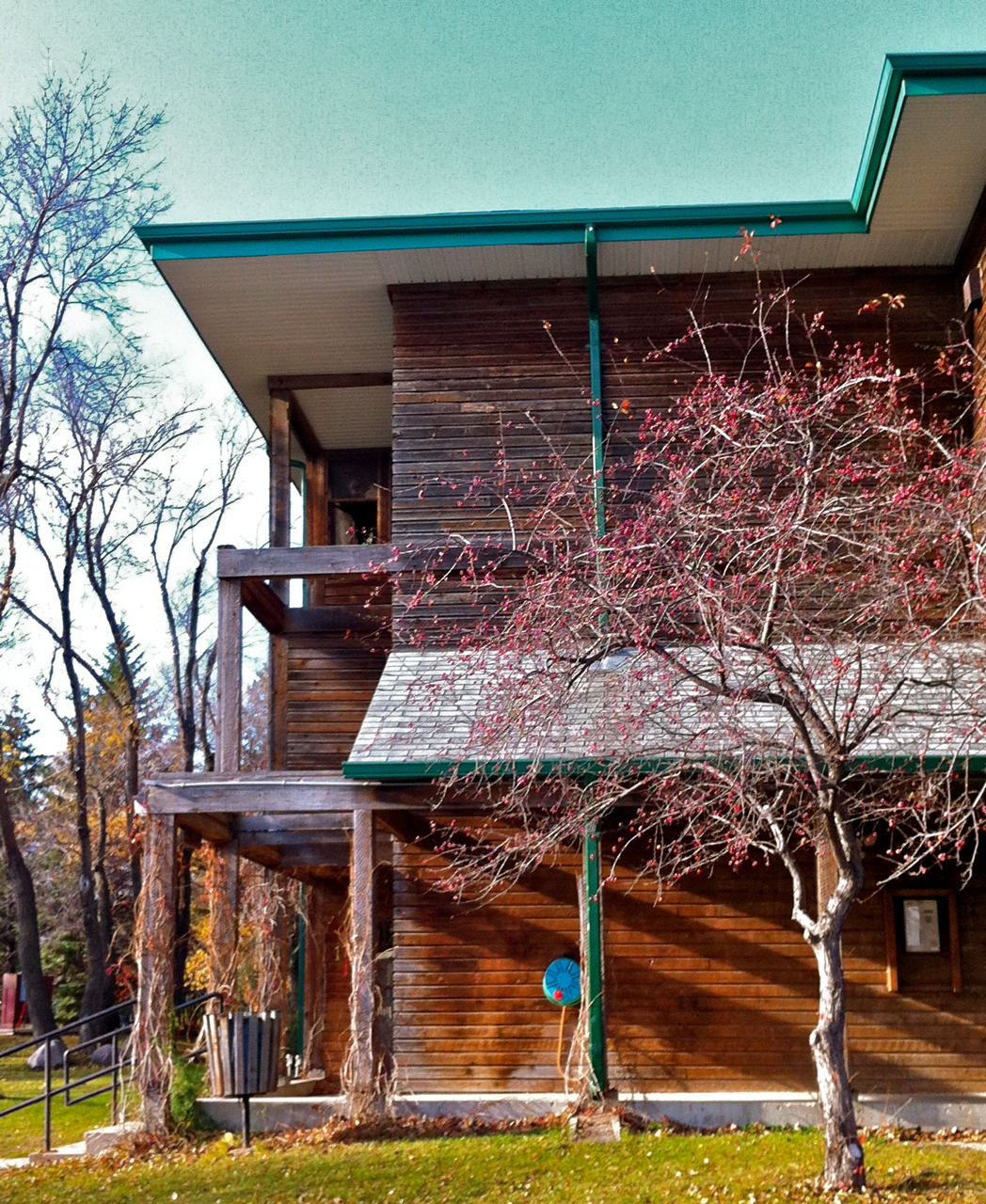
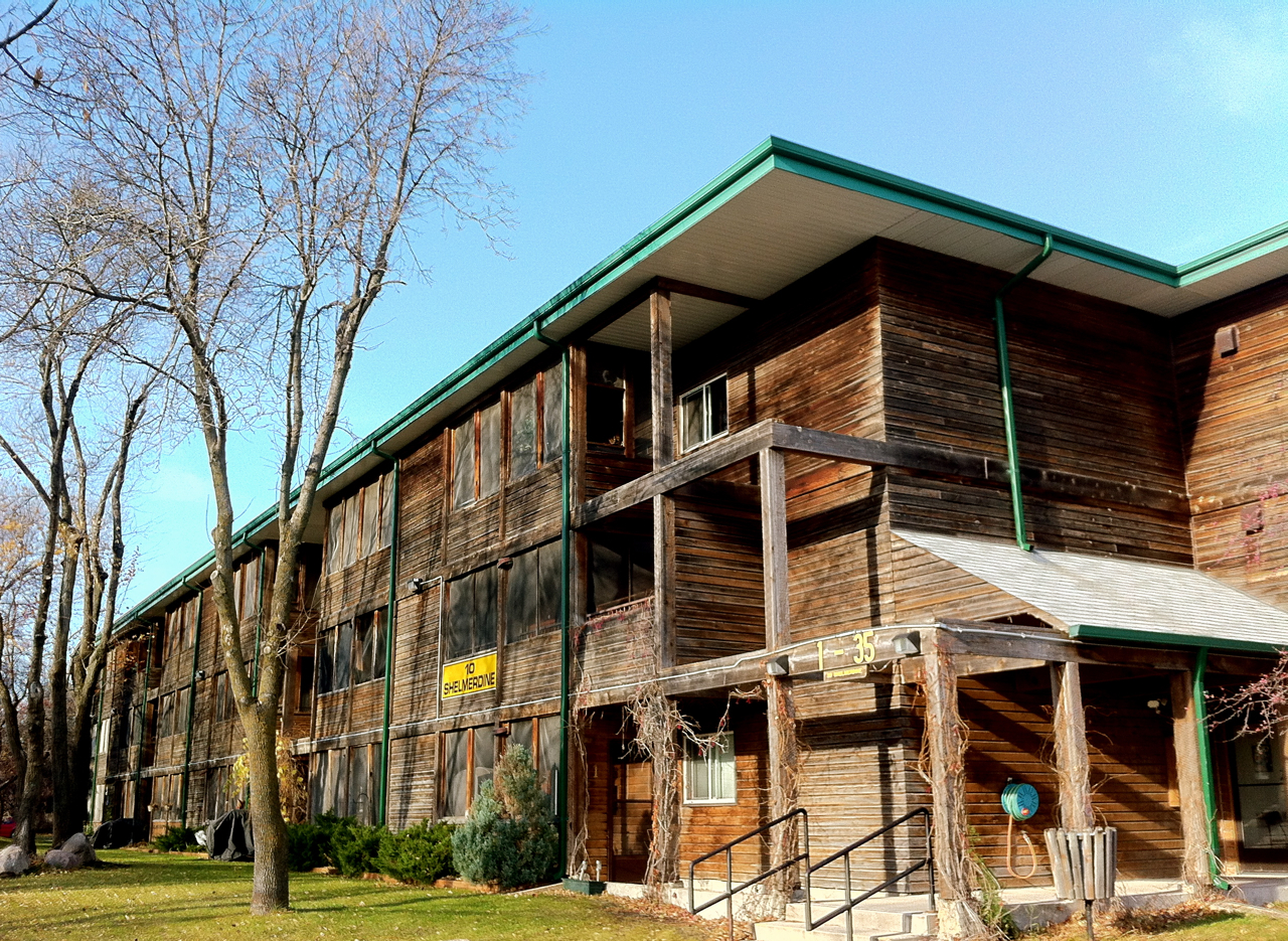
Westboine Co-operative Housing is a large multi-tenant project set on a large, seven-hectare site abutting the banks of the Assiniboine River. Architecturally, the project is somewhat unique among the oeuvre of its designer, IKOY, who is otherwise known for a high-tech aesthetic. At Westboine – begun in 1973, early in the firm's history – a more rustic feel predominates. The complex is comprised of over 20 clusters of multilevel town homes, arranged in staggered lines. There are 185 individual units. These buildings feature unpainted wood cladding, with sharply pitched roofs creating a further dynamic effect. Additional aesthetic interest is established through the use of distinctive signage and colourful awnings.
In its design Westboine might be compared to the 1960s and early 1970s buildings of Sea Ranch, California. That project, conceived by architect and planner Al Boeke, is an environmentally mindful community arrayed upon 2,100 hectares on the Pacific coast. It was given a similarly rustic modern mein employing local and natural materials, simple shapes, no overhangs and attention to site by its architects Donlyn Lyndon, Charles Moore, Gerald Allen, Joseph Esherick, William Turnbull, Richard Whitaker and landscape architect Lawrence Halprin. IKOY’s Westboine work echoes much of this approach on a semi-urban, semi-pastoral wooded prairie suburban site. Here, though, rather than an exclusive resort project, this approach is employed to render humanistic, pleasant and liveable a cooperative housing development. (Housing cooperatives provide not-for-profit housing for their members, controlled by members who have a vote in decisions about their housing, with no outside landlord.)
Charleswood, a Winnipeg neighbourhood of approximately 82,500, is located in the city’s southwest quadrant. The area is bounded to the north by the Assiniboine River, to the south by the Canadian National Railway Main Line, to the east by Assiniboine Park and Forest and to the west by Winnipeg’s Perimeter Highway.
Since at least the 1930s Charleswood has been known as “The Suburb Beautiful,” a slogan which is proudly displayed on the sign that greets entrants to the community along the area’s main street, Roblin Boulevard. The slogan seems to have been derived from that of neighbouring Tuxedo area, which was marketed as such by its developer Frederick Huebach’s Tuxedo Park Company Limited (later to become the South Winnipeg Company) in the 1910s. Tuxedo was one of Canada’s first planned communities. Its catchphrase echoed the intent of its planners – including the notable Brookline, Massachusetts, Olmsted Brothers firm – to create a district both pleasant and well-organized. Charleswood, which was to develop in a less controlled fashion, nevertheless suits the name: a treed locale spread across the pleasant land south of the Assiniboine River.
Charleswood celebrated its centenary as an officially recognized community in 2013, 100 years after the Rural Municipality of Charleswood was incorporated on February 15, 1913. The municipality was formed from portions of the Rural Municipality of Assiniboia and Parishes of Headingley and St. Charles that lay south of the river, while excluding territories held by the Town of Tuxedo and City of Winnipeg. The origin of the area’s moniker is uncertain. One likely source is the long-standing relationship the district had with its northern and more established neighbour across the Assiniboine River, St. Charles, to which it was connected by ferry crossings. The existence of convenient areas for Assiniboine River crossings was a key feature in the area’s early history, particularly at a location known as “The Passage” near the foot of the present Berkley Street, which connected on the north side to Rouge Road. This link is commemorated by Kelly Landing Park. Cross-Assiniboine ferry services operated in Charleswood until 1948.
Another possibility is that the neighbourhood was named in honour of one of the sons of early Charleswood settler and developer Patrick H. Kelly. The elder Kelly, who emigrated to the region from Ontario in 1906, was a crucial figure in the municipality’s growth. He organized area residents in their request for separate civic status and hosted early council meetings in his store. In addition, Kelly – who at one time held over 200 hectares (largely undeveloped bush) in the district – was responsible for building a general store and played a central role in establishing a post office and area school. He likewise was instrumental in convincing the Winnipeg Electric Railway Company to extend street railway service to the neighbourhood, a track that stretched as far west as Kelly’s store, near Beaverdam Creek and “The Passage.” The area was also served by the Grand Trunk Pacific Railway (later the Canadian National Railway), which operated a Pacific Junction station near the present site of Pacific Junction School (715 Cathcart Street) during the early twentieth century.
Charleswood’s early years were dominated not by suburban housing but by farming. The district had been surveyed into slender and long riverfront farm lots by the Hudson Bay Company in the 1850s. Local agriculture included a particular focus on mink ranching, with over 80 such facilities in the district, as well as dairy, poultry, market gardening and tobacco growing. During the 1910s the area was marketed as a potential residential locale by Huebach’s Company (developers of Tuxedo) as “Rydal.” The full flush of such growth did not come until later. Advertisements from the 1930s demonstrate a hybrid community, publicizing the potential purchase of lots for either market garden or home development purposes.
After the Second World War, Charleswood's suburban growth truly got underway. The post-war years saw the development of a number of areas, including the Marlton and Varsity View districts and Roblin Park subdivision. The latter was funded by the Veteran’s Land Act of 1942, which provided loans of up to $6,000 to veterans who wished to build their own homes. By 1948, veterans lived in 250 of Charleswood's 800 homes.
Development during the post-war years was rapid. The 10 years before 1951 saw a 90-per-cent increase in population, reaching 3,680. By 1966 the municipality's population was 7,334, and in the five years after that the area’s population again nearly doubled, with 14,000 residents by 1971. Land-use statistics tell a similar story: in 1948, 90 per cent of Charleswood’s territory was engaged in agriculture; by 1971, only 65 per cent was, and that number declined further in the proceeding decade. The area experienced strong 1970s growth, with more than 7,500 homes built during a 10-year span.
By and large the homes built during the early post-war period were fairly standard examples of North American residential design. By the 1960s more daring architecture appeared, including some modernist homes concentrated on river-adjacent sites near or on Roblin Boulevard. Another daring design was that of the Charleswood Motor Hotel, completed in 1962, nearly fully wrapped by an abstract relief mural by British-Canadian artist Jim Willer. During the booming 1960s Charleswood also received a new civic centre, located at 5006 Roblin Boulevard: a modernist complex featuring a heavier two-storey block and a protruding, glazed, entry wing. This project was located adjacent to the former civic office, which was soon converted into a library, and continues to serve as such. It was only seven years after constructing the new municipal hall and offices that Charleswood was incorporated into the new Unicity-era City of Winnipeg, 58 years after incorporating as a municipality.
By the 1970s and early 1980s, a strain of rustic late modern design was well represented in the area, with examples along the riverfront, along area streets and throughout the large Westboine Co-operative housing development. Residential and other development continued apace over the proceeding decades. Among other large-scale projects was the Charleswood Bridge in 1995, which connected the area with the suburb of St. James-Assiniboia. Charleswood remains a unique Winnipeg suburb in retaining a semi-rural atmosphere, with many streets unpaved, lacking sidewalks and lined with ditches.
Design Characteristics
| Suburb: | Charleswood |
|---|
- Large multiple tenant project on a seven hectare site
- Abuts the Assiniboine River
- Rustic Modernist design
- Over 20 clusters of multilevel town homes
- Structures arranged in staggered lines
- Unpainted wood cladding
- Sharply pitched roofs
- Colourful awnings
- Semi-urban, semi-pastoral aspect