by Sheila Grover & Greg Thomas Winnipeg Architecture Foundation
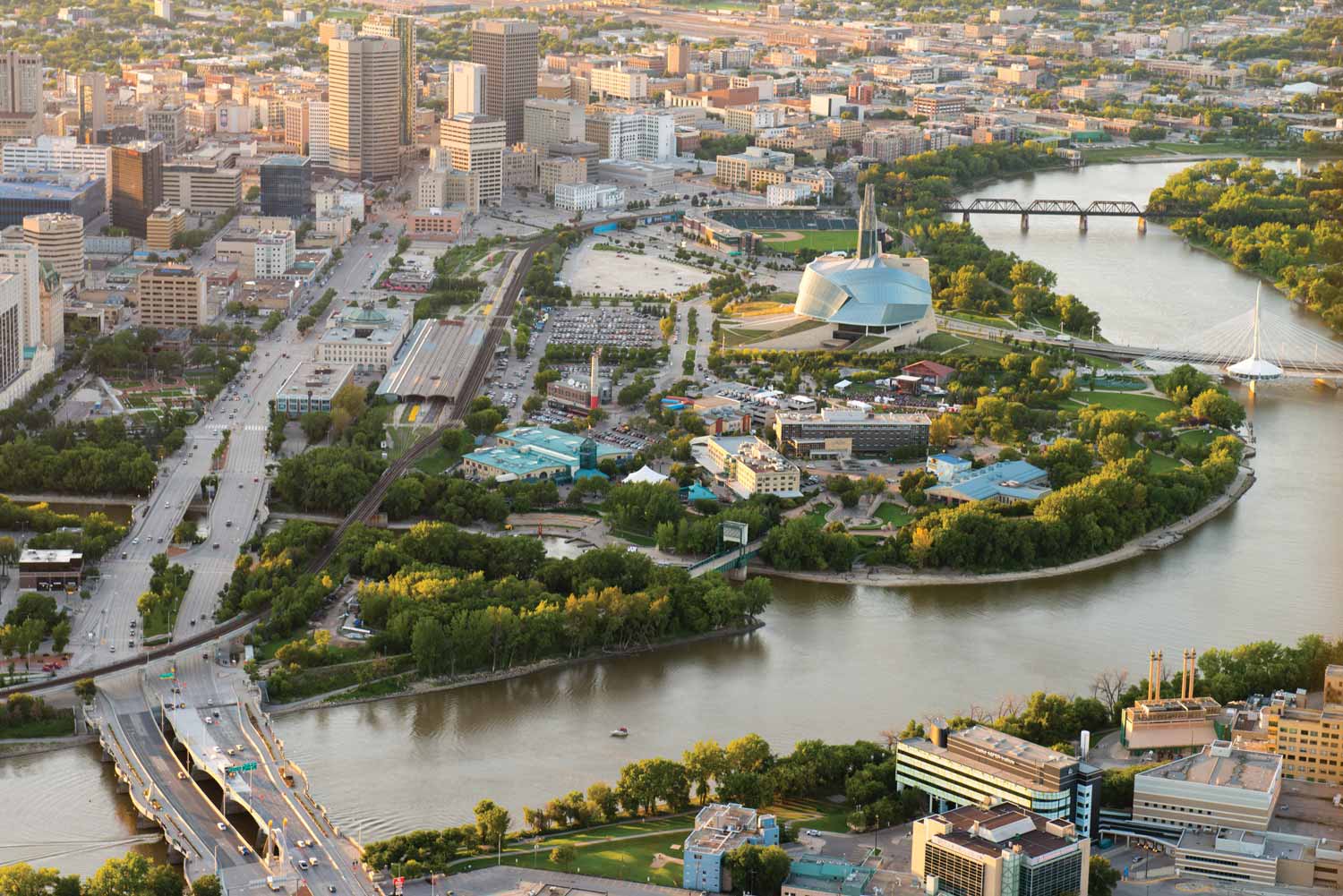
The Forks aerial (The Forks, 2015)
Preface
It took the vision, talents, tenacity, and hard work of many committed people to make The Forks district of Winnipeg a reality. For a hundred years, the 55-acre site was closed off physically and visually from the rest of the city, removed from public awareness, and abstracted from the realm of greater Winnipeg. Efforts to reclaim the obsolete railway lands behind the CN line and station began with a few individuals who climbed over the barricades, investigated the site, imagined what could be, and started the process towards reclaiming land which had been the intersection not only of rivers, but of cultures and economies for thousands of years.
First, the new vision had to be shared among many dedicated and tenacious individuals. It grew slowly but surely over the next 30 years. As the site’s industrial infrastructure needed to be removed, the stakes were too high for any one corporate entity or single level of government. Co-operation and broad visions needed to be grounded in dollars and cents. Priorities were identified within a planning framework developed by professionals who had to step beyond the confines of their disciplines to make it work. As the vision gradually took shape, there were hard choices and informed leaps; the path was not always smooth. What emerged in the process was dedication to returning this site to people, to restore access to the rivers, to replenish the natural habitat that had attracted First Nations people there for 6,000 years and to make The Forks a meeting place for all to enjoy. It is all this and more: it is the heart of the city, a national historic site, a place of commerce and recreation, a place of beauty. This is a salute to the many visionaries who made it happen.
The regeneration of The Forks transformed it from an industrial site to the number one tourist destination in Manitoba. We are fortunate to have retained the best of the physical aspects of its previous narrative: remnants of the fur trade era, the early urban development and immigration, the coming of the railway, and finally the evolution of the site to an internationally recognized public amenity. Integrated with the best of the surviving railway buildings are a number of purpose-built architectural statements to house a national museum, a luxury hotel, a children’s theatre, as well as innovative recreational facilities. In recognition of its significance to Canada, it contains an urban national historic park, The Forks National Historic Site. Natural elements of its riverbanks have been carefully recreated with indigenous materials, greening the site and providing beauty, education, and environmental sustainability. Walkways enlivened with cultural features criss-cross the site, deliver people to their next destination and integrate The Forks with the surrounding communities. And the two rivers that embrace and define The Forks are once again accessible year-round as an integral part of the cityscape.
Two Rivers Meet
In 6,000 years of human history at The Forks, two things remain constant: the two rivers that are the lifeblood of the site, and the use of the site as a meeting place. Located in the heart of modern-day Winnipeg, in the geographic centre of Canada, The Forks is a bustling hub of commerce, recreation, ceremony, transportation, and most of all, a place for people to gather. Taking its name from the confluence of the two rivers, the Red and the Assiniboine, The Forks links a vast North American network that has carried people here to trade, hunt, and socialize for hundreds of years. To commemorate its significance to the nation, The Forks National Historic Site was officially opened here in 1989.
The Forks’ setting is a meeting of two very different geographic regions—the vast plains and parklands to the west and the extensive boreal forest to the north and east.1 The physical geography of The Forks, situated on a floodplain, over limestone bedrock is an important part of its story. The bedrock is overlain with clay and riverine alluvium, residue from the stuttering retreat of glacial Lake Agassiz nearly 8,000 years ago. Low, flat, and subject to flooding, the site features remnants of the original riparian growth typical of the region, augmented through planted deciduous and coniferous trees.
The rivers continue to influence the contemporary setting. In recognition of the significance of the Red River, the Canadian Heritage Rivers System designated it as a Canadian Heritage River in 2007 for its “pivotal role in the history, culture and economic development of Western Canada”.2 Both the Red and the Assiniboine have become accessible as cultural and recreational resources for humans both summer and winter, and as wildlife corridors in the urban areas. The Red crosses two ecological zones in its path north from the American border and its headwaters in Minnesota.
Drawn together by the river system, the site has nurtured Indigenous cultures through adaptation to the resources. Using the rivers as a transportation corridor, Indigenous peoples established The Forks as a crossroads and meeting place in the movement of people and cultures. There is evidence in the form of campsite hearths and butchering sites that small groups of hunters and gatherers came to The Forks 6,000 years ago. These groups, following the bison herds and seeking more sheltered locations in the winter, visited the area sporadically for many generations. Beginning about 3,000 years ago, the area was used for longer, more extended periods of occupation within the annual cycle.3
Indigenous people formed trade relationships with the Europeans coming west to trade in furs and provisions. This reciprocal relationship would link the economy of North America to a mercantile system of trade that was international in scope and transformative to Indigenous cultures.4 The presence of the Hudson’s Bay Company after 1670, and the competing fur trading companies, influenced the beginning of European settlement at The Forks, a pivotal 200-year factor in early Winnipeg. The fur trade era wound down as settlement of the West gained steam, steam firstly from the boilers of steamboats and then from the iron horse, that isolated what we know as The Forks into a morass of rail yards, coal soot and huffing locomotives.
The Forks is situated on Treaty One land. Treaty One was signed in 1871 between leaders of the Ojibwa and Cree nations and the Crown in the newly-created province of Manitoba. In honour of this important story, the South Point at The Forks is a dedicated parcel of land on the south bank of the Assiniboine accessed by The Forks Historic Railway Bridge. The site has been set aside for future use to exhibit and celebrate First Nations’ lengthy association with this meeting place.
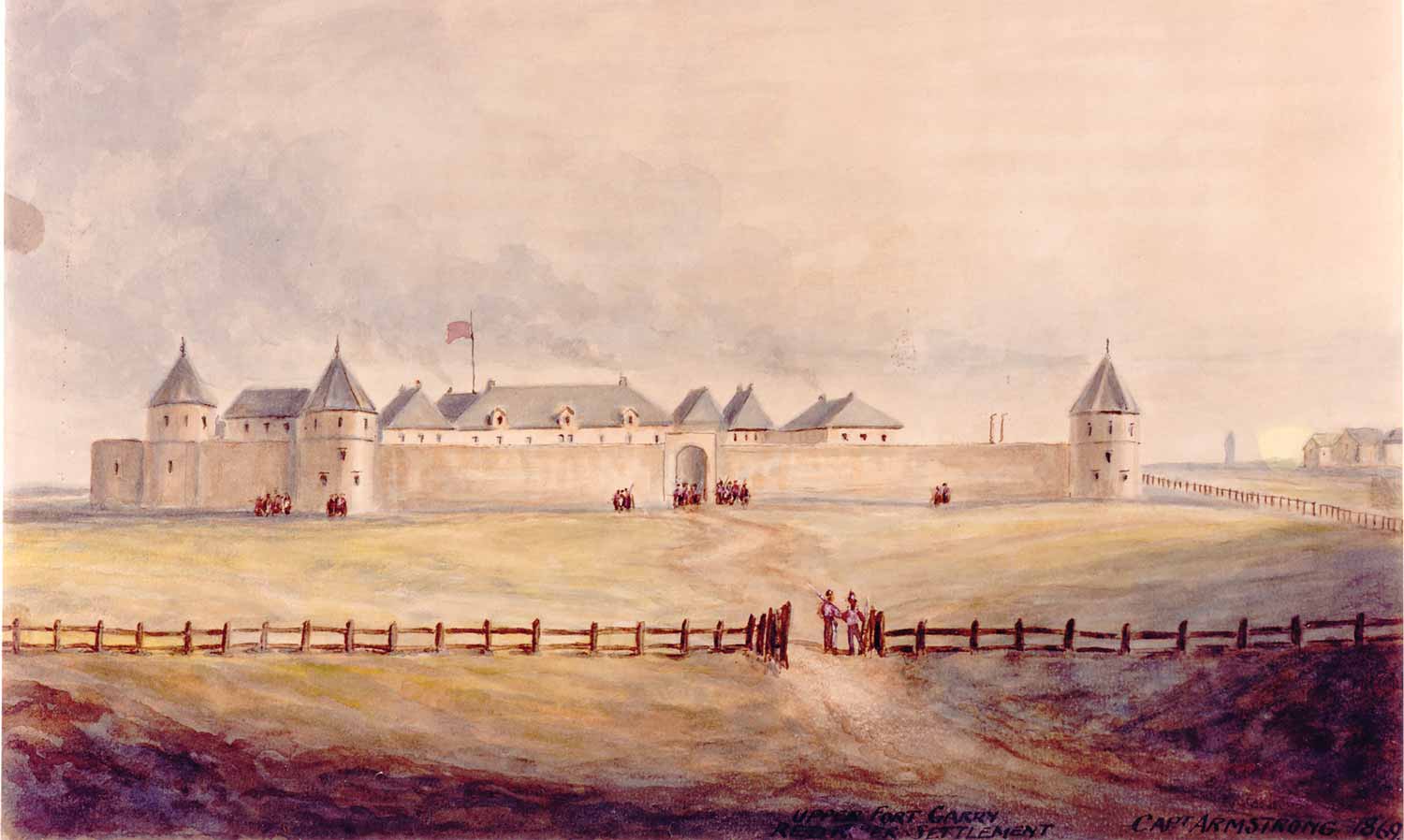
Watercolour of Upper Fort Garry Red River Settlement (Capt. Armstrong, 1869)
The Forks site consists of a 22.6-hectare (52 acres) site managed by The Forks North Portage Partnership; a 3.63 hectare riverside green space owned and operated by Parks Canada designated as The Forks National Historic Site of Canada (FNHS); and some adjacent parcels of property owned by the City of Winnipeg. At the recommendation of the Historic Sites and Monuments Board of Canada, the entire area was declared to be of national historic significance in 1974. The area, then called the East Yards and removed from the public view, had become obsolete as a rail yard and provided visionaries with an opportunity for change.
As the narrative of The Forks has been well documented in several excellent past studies, attention within these pages will focus upon the regeneration of The Forks as a cultural, natural and heritage landscape, with emphasis on its permanent structures, its architecture and design, and its evolution as a people place from the historic era to the present. Little attention has been paid to the built heritage of The Forks over time and its regeneration as a complex cultural landscape.
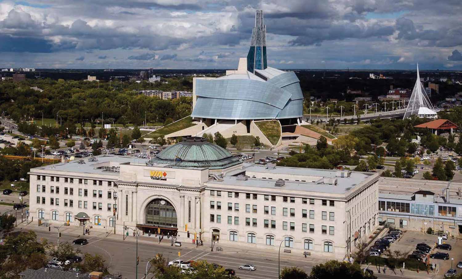
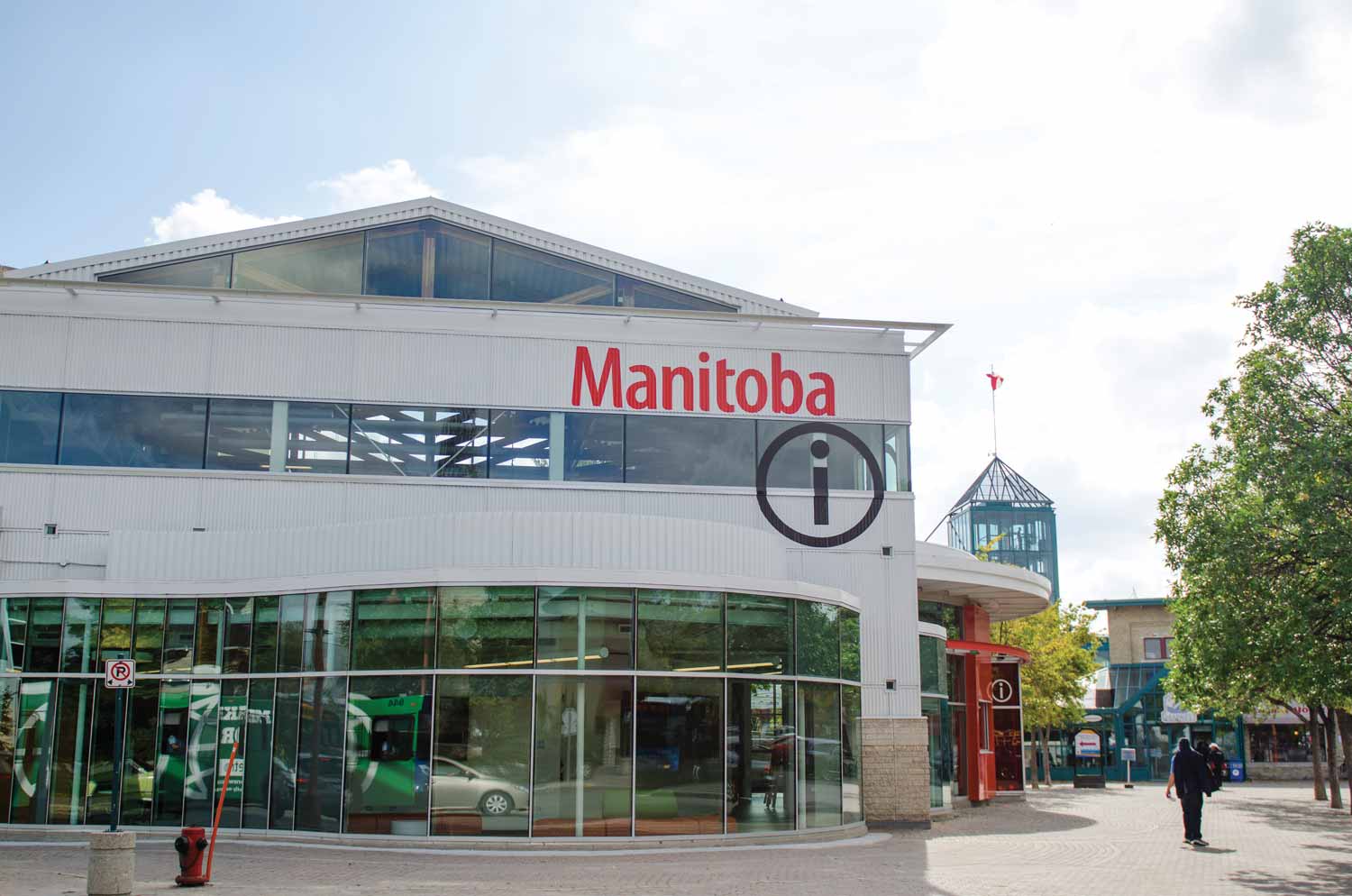
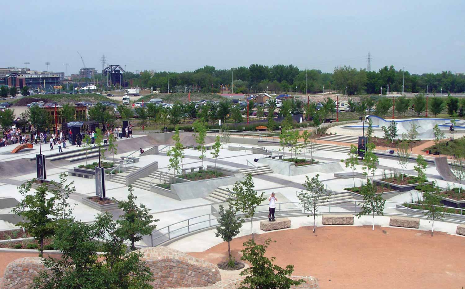
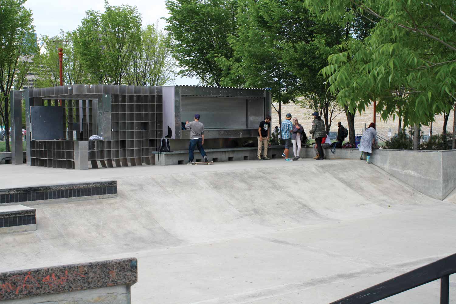
As a destination, The Forks attracts four million visitors each year, both citizens and tourists. In order to engage visitors young and old, The Forks has developed a broad range of facilities and attractions ranging from the subtle (engaging signage, creative use of landscaping materials), to the industrial and functional (the Manitoba Children’s Museum in a 1880s railway roundhouse), to the recreational (the skateboard park, skating on the river trails), and finally to the architecturally imposing and complex (Canadian Museum for Human Rights, Union Station). While the site’s architecture straddles nearly 200 years of commercial, industrial, transportation, and recreational structures with no fixed aesthetic, it does tell a formative and lively story. We will revisit and examine how these structures influence the overall architectural and cultural landscape in what had become a vibrant post-industrial landscape.
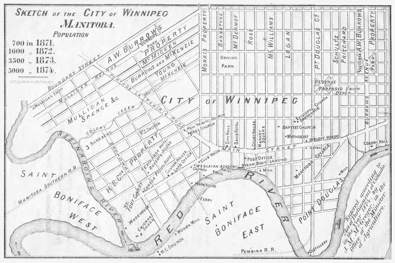
Map of Winnipeg (1874)
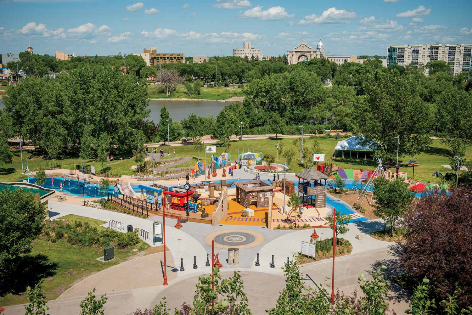
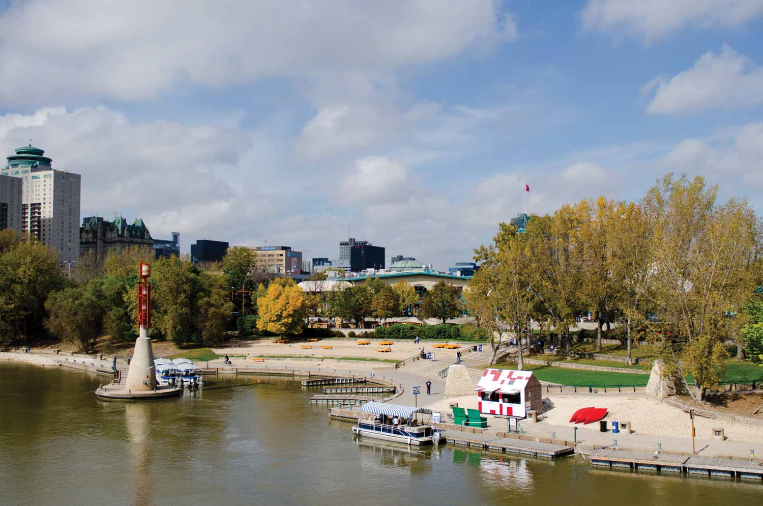
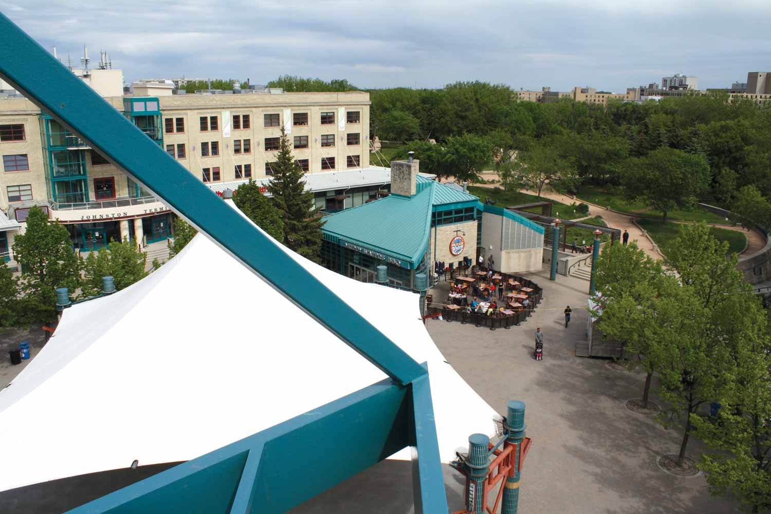
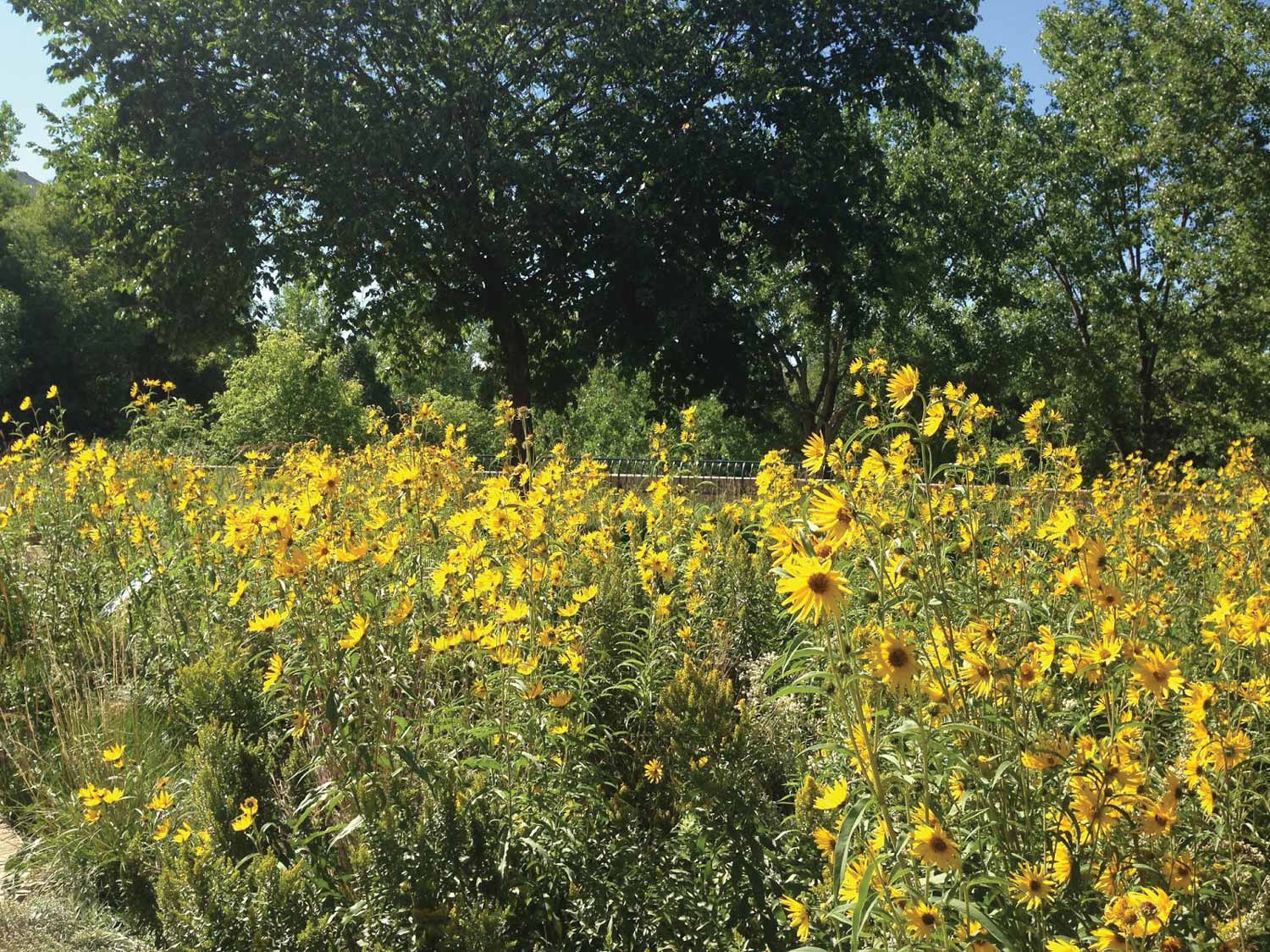
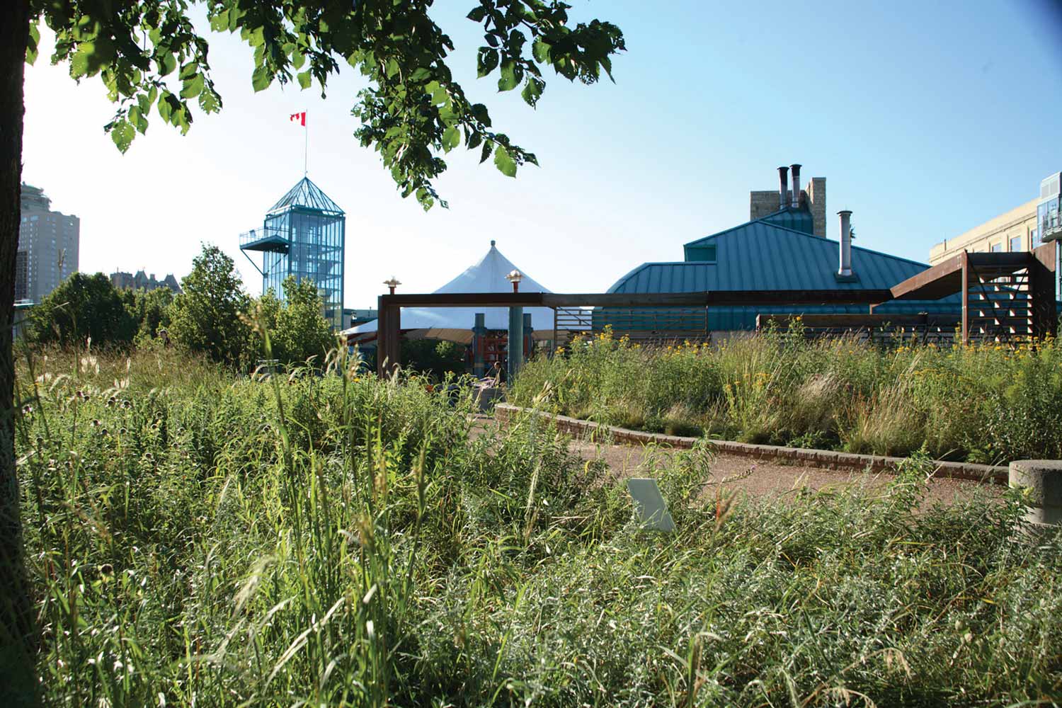
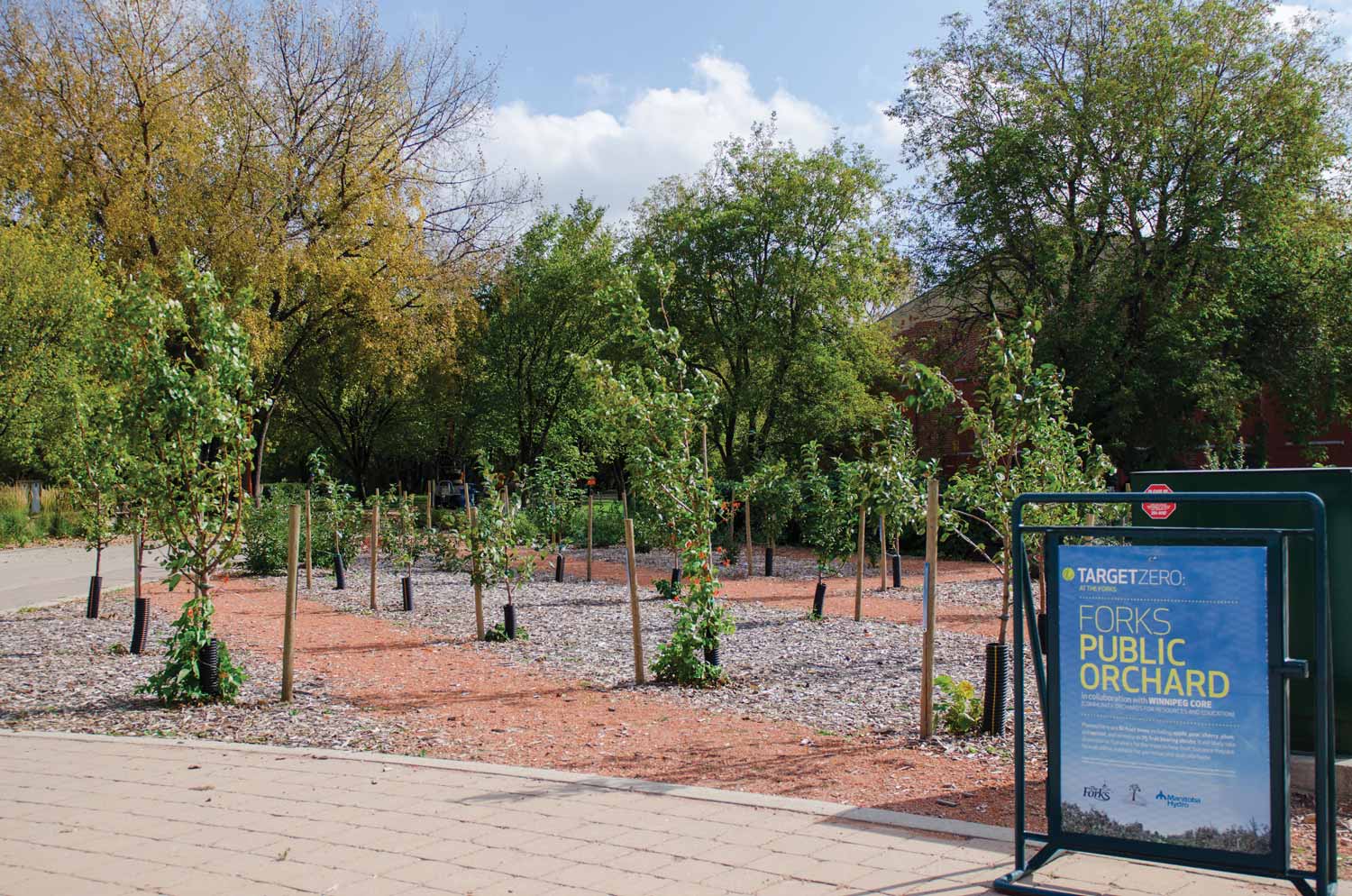
What do you see when you stand upon the land at The Forks? At The Forks National Historic Site (FNHS), you see the lush lawns, towering maples and cottonwoods, the amphitheatre, and the Parks Canada Variety Heritage Adventure Play Park (hereafter Play Park). Linked by walking paths to the rest of The Forks site, you see a panorama of structures large and small, formal and natural gardens, intimate places to sit on limestone benches under shady trees, and grassy lawns to watch a concert or enjoy the water taxis flitting by on the river. Leafy paths and formal axes draw your attention to features within the sprawling site or to the downtown skyline and adjacent neighbourhoods. The Forks Historic Port, now alive with patios in summer and skaters in winter was once the scene of arriving immigrants. Oodena Celebration Circle is an intriguing installation celebrating the connection of humans and nature with the universe through celestial signposts of world cultures and eras. The Wall Through Time interprets in tile, text, and photograph the evolution of the natural and human history of The Forks. A tall grass prairie garden, blooming with the wild flowers and grasses once blanketing the Great Plains but now elusive to city-dwellers, provides a subtle backdrop to two of the site’s popular restaurants. An extensive orchard of native fruit-bearing trees and bushes is available for public education and for harvest near the vibrant Children’s Museum.
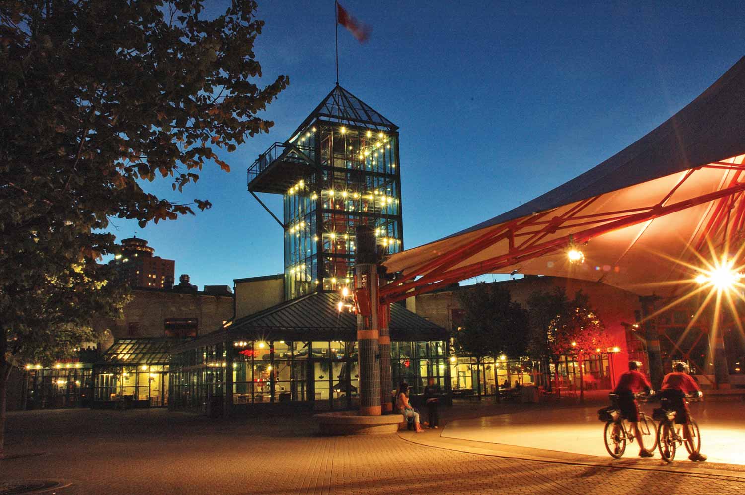
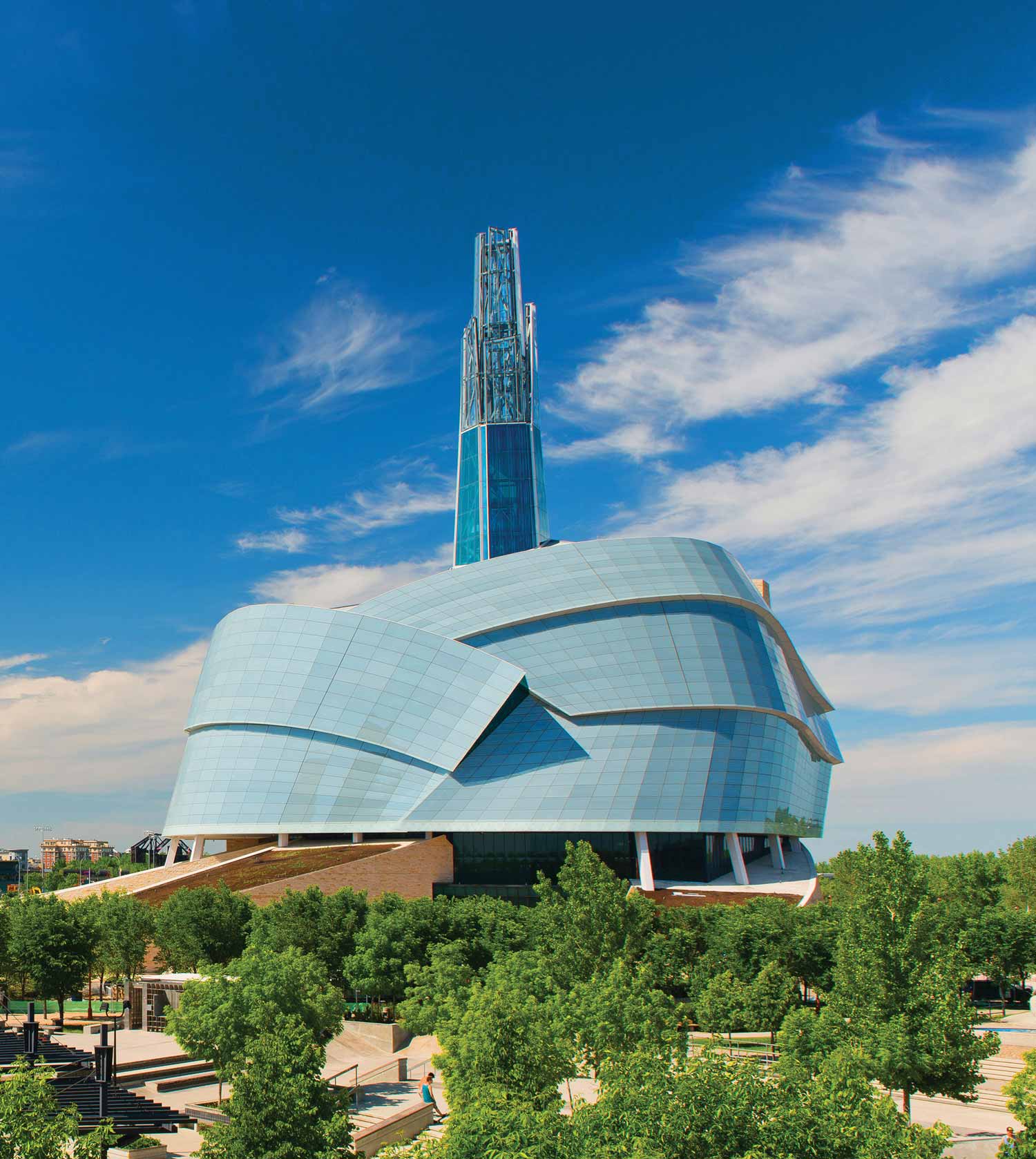
For a panoramic view of The Forks and the downtown, climb six stories to the top of The Forks Market tower. For a breathtaking view of the entire city, ascend the Tower of Hope high above Canada’s newest national museum, the Canadian Museum for Human Rights.
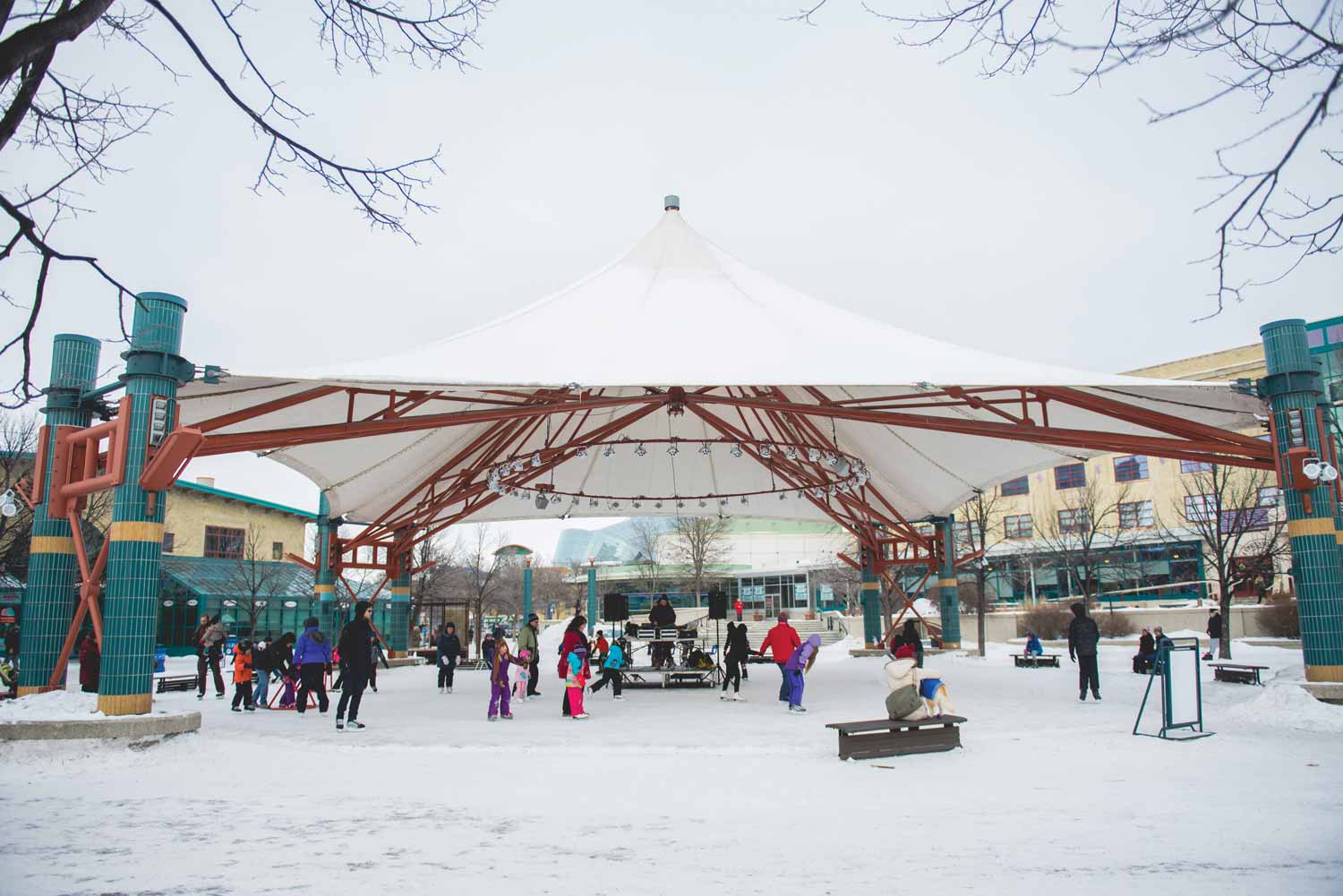
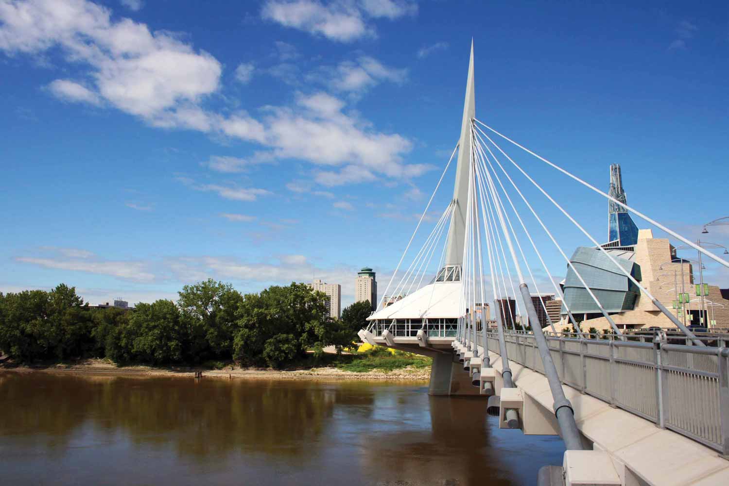
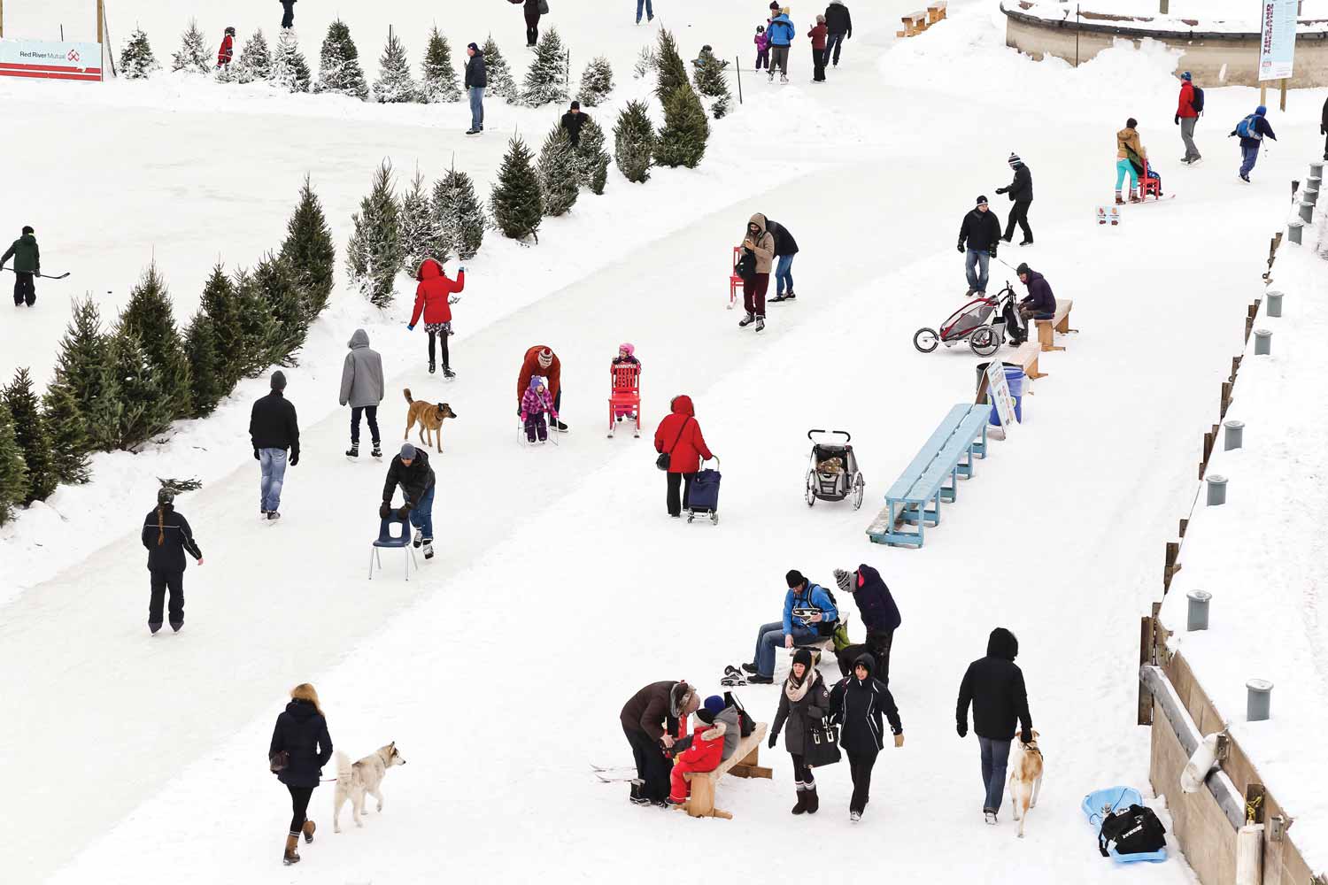
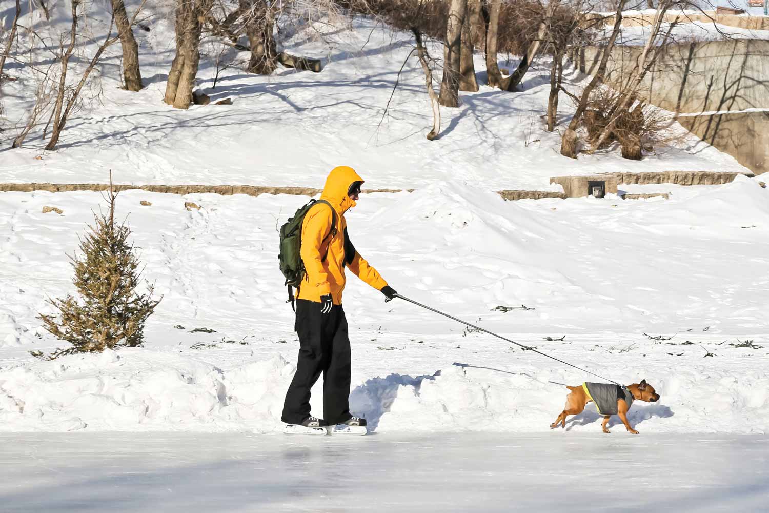
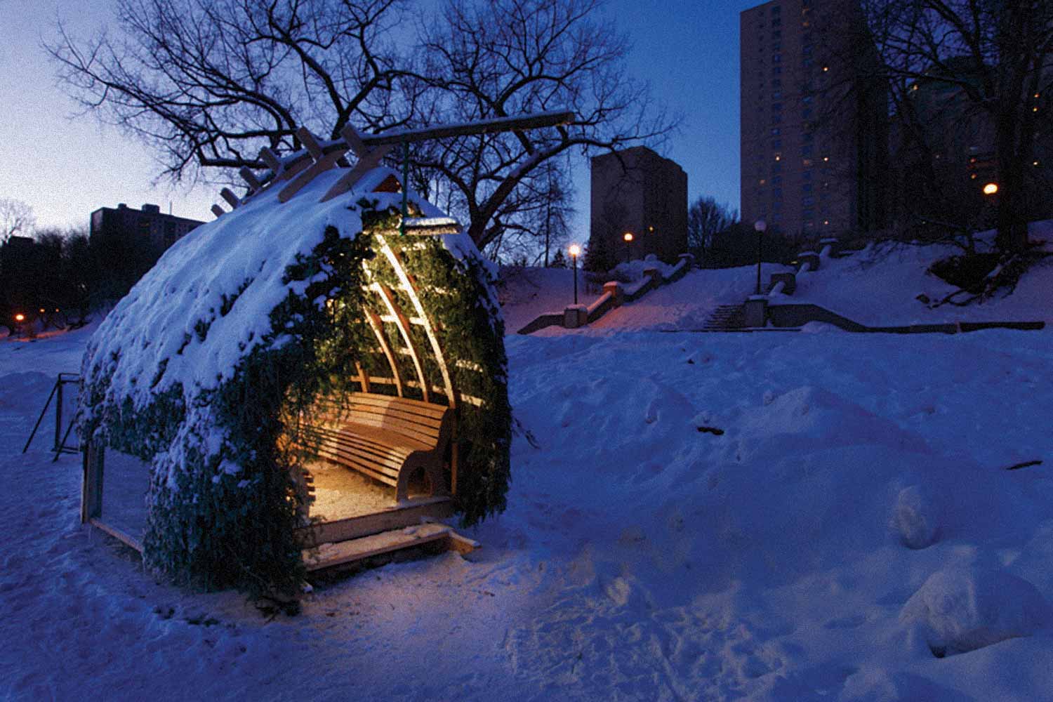
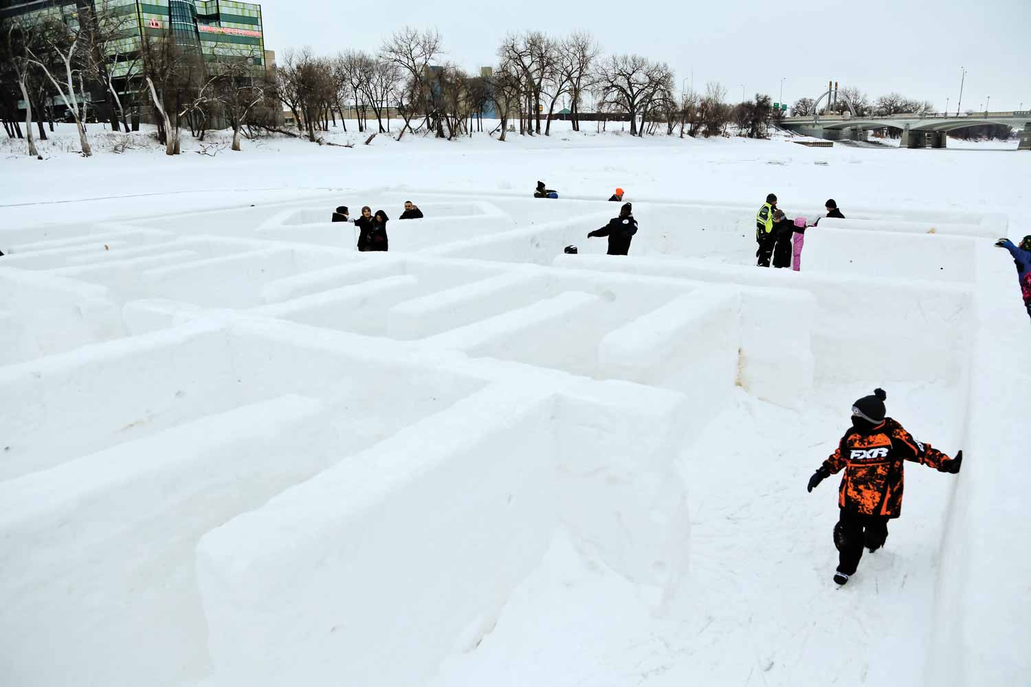
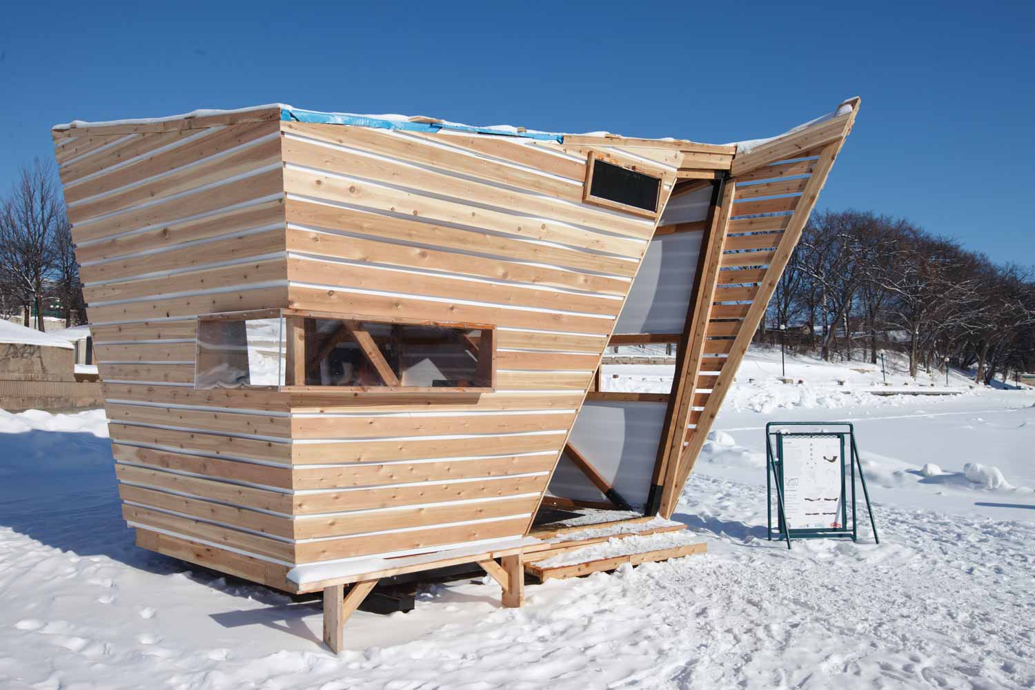
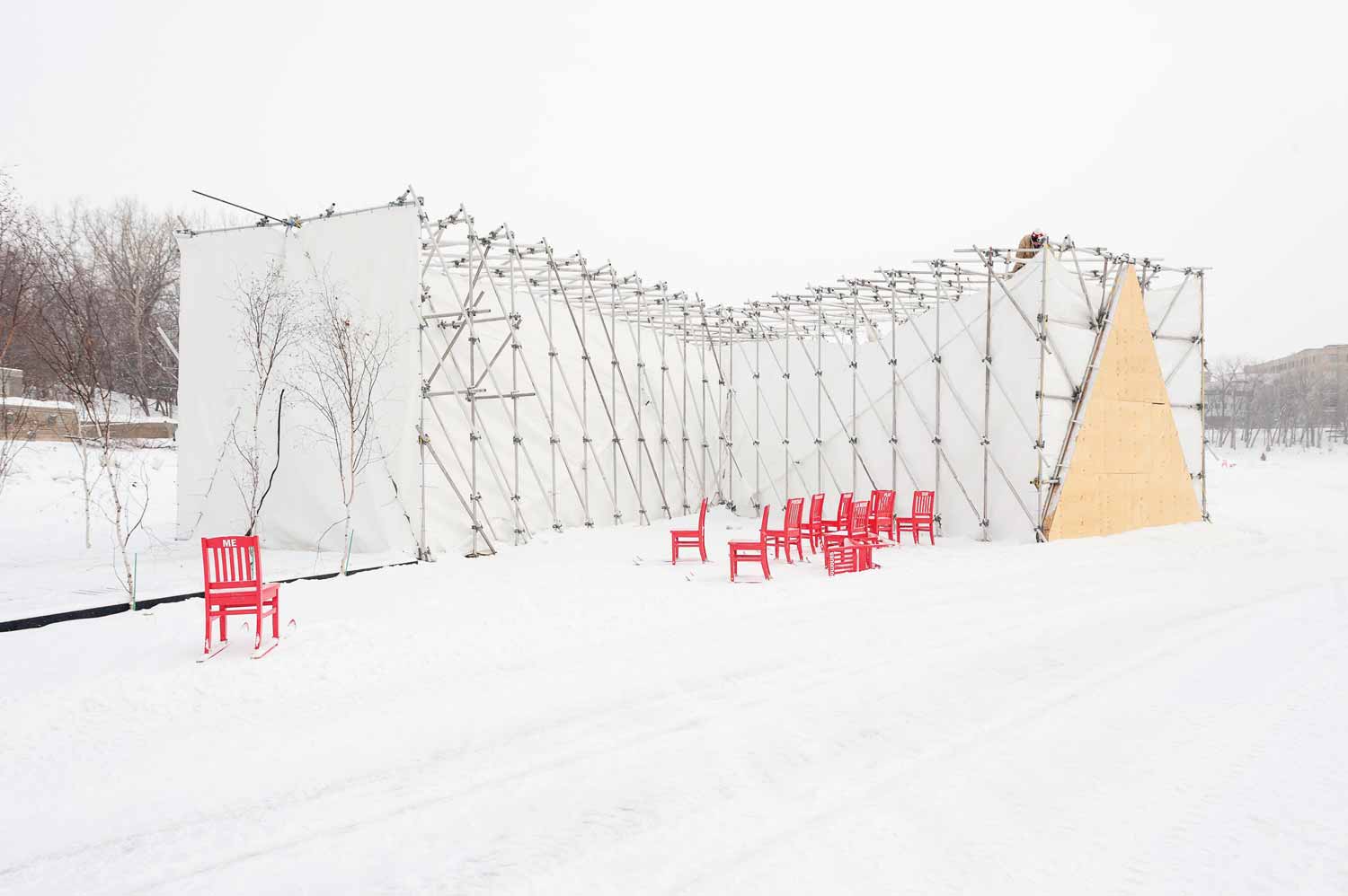
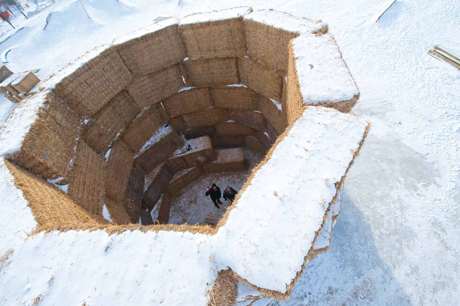
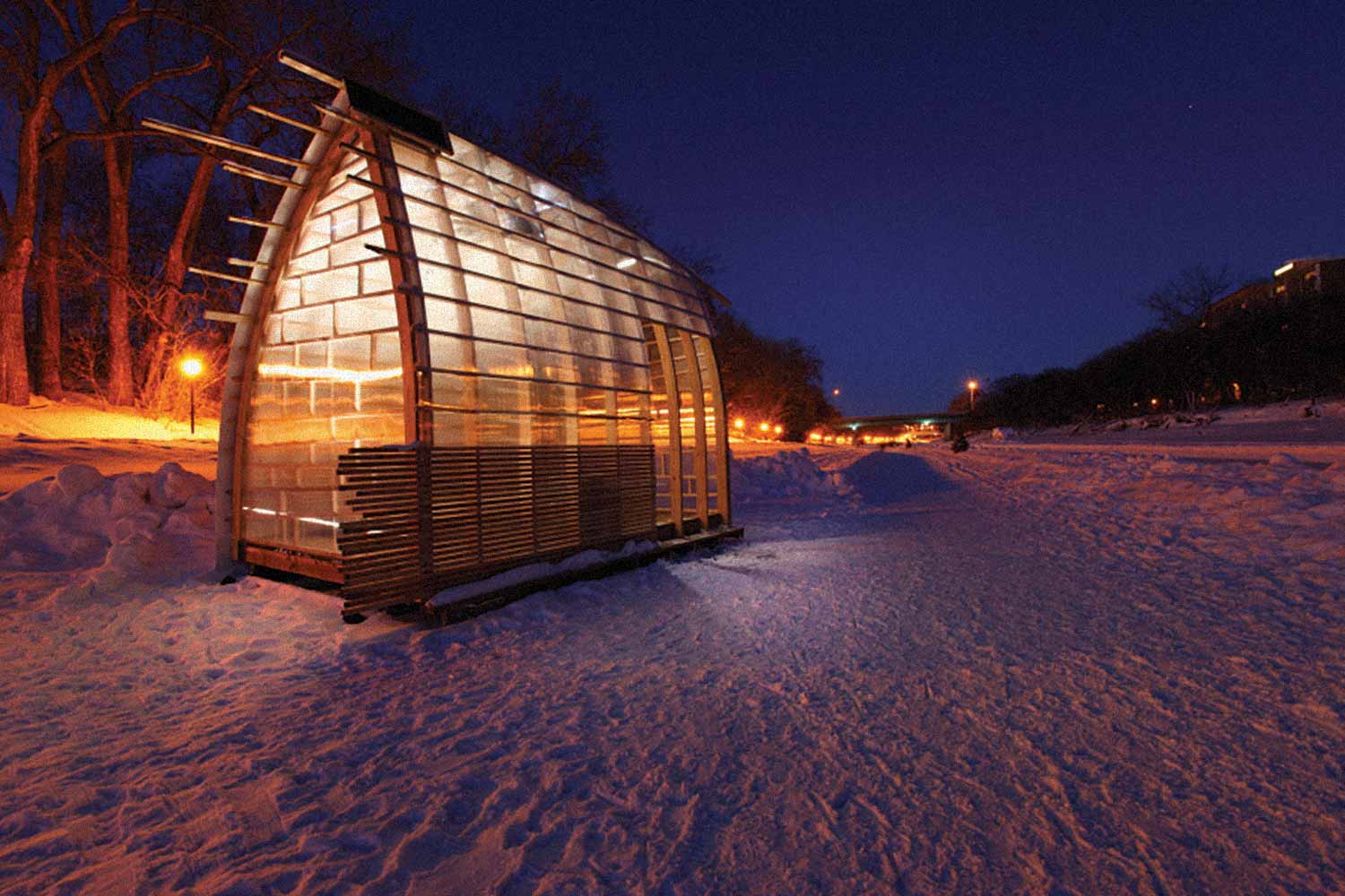
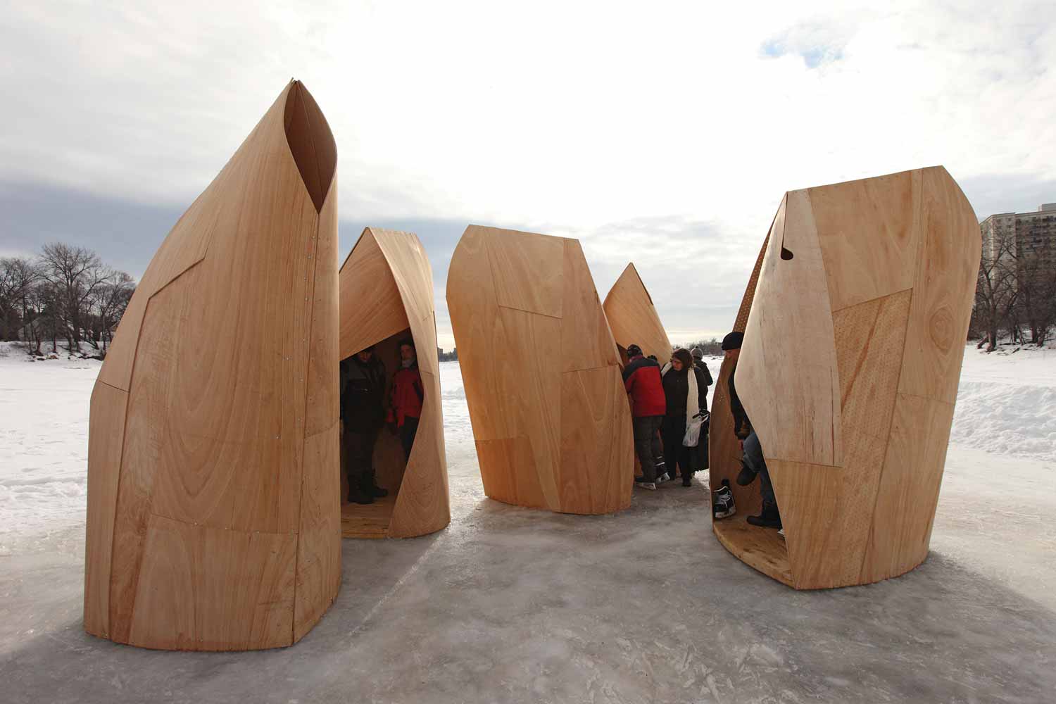
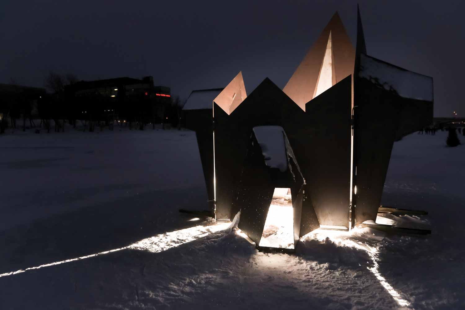
A wide range of public programming and community events is offered year round, with an emphasis on The Forks as a ‘meeting place’. Signature events include the multi-use winter trail dotted with its architecturally-designed warming huts; the Winnipeg International Children’s Festival; Canada Day; the New Year’s Celebration; and a wide variety of other annual or special events. The contemporary Forks site has a sphere of influence beyond the defined site from the CN rail line to the junction. It entails development of Upper Fort Garry Heritage Park, due west across Main Street, and integral to The Forks' story. Straddling the CN rails through The Forks, Union Station, another magnificent national historic site in daily use, speaks to the era of the nation’s settlement and immigration themes as well as underlining rail transportation as a driver in the opening of the west. St. Boniface, the French Quarter across the Red River from The Forks, contains the elements of Métis and Francophone settlement associated with Louis Riel, the rise of a bilingual culture and the contributions of that community to the west. A new traffic bridge from the downtown to St. Boniface was paired with a dazzling cabled pedestrian bridge with a soaring tower and a plaza at the base. This landmark is aptly named Esplanade Riel.
As The Forks site continues to grow and evolve, its scale, skyline, axes, and viewscapes become all the more important. The glass tower of the Canadian Museum for Human Rights and the cable tower of Esplanade Riel Bridge, dramatically lit at night, are visible from many parts of the city and especially from over the water by the two nearby bridges. But are these enough to keep The Forks in the public’s mind? Parking and pedestrian access must respond to the public’s use of area attractions. A creative refreshing of its programs and features must always be a consideration of its business owners, planners, and investors. While careful maintenance and updating needs to be ongoing, The Forks story needs mindful integration into the broader urban context to remain relevant; this is the challenge of future planning and development.
Early Years at The Forks
Geological time has witnessed massive change across the landforms of North America. Within the period of human history here, there has been altering of the course of the Red and Assiniboine rivers and reworking of the surface of The Forks, revealed on this site as an archaeological horizon of 6,000 years. The climate also changed over the millennia, causing the great herds of bison and caribou to alter their seasonal migrations, requiring humans to adapt along with them. Indigenous people also responded to these environmental changes by diversifying their economies and seasonal patterns, while continuing to rely on resources of the plains, river valleys, and the forest edges.
For thousands of years, the junction of the Red and Assiniboine rivers has been a focal point of human use. The rivers acted as transportation corridors on a transcontinental trade network. They provided a critical source of food, especially during travel. The intersection of two geographic regions and two watersheds became a place to socialize, trade, and exchange technologies. Bison hunters of the western plains interacted with people of the woodlands cultures to the north and east. Oral histories have been complemented by present-day archaeological discoveries to illuminate the pre-contact story. Analysis of archaeological findings beneath The Forks has revealed hearths from 6,000 years ago; projectile points for hunting from three or four different groups between 3,000 and 2,200 years ago; and, pottery shards from 2,000 years ago. More astonishing is that some of the stone used in knapping the projectile points, and patterns etched on the pottery, illustrate sources from great distances, speaking to the range and sophistication of the trade network.1
Although evidence of the camps of various groups has been identified and mapped through systematic archaeology at The Forks since the 1980s, it has also emerged that there was neither permanent nor year-round occupation. In 2006 oral tradition and archaeological investigation near the future site of the Canadian Museum for Human Rights affirmed that there had been a large gathering approximately 500 years ago. At that time, nine Indigenous groups came together to negotiate. A warming trend had caused humans to alter their territorial movements because the herds of buffalo had changed their feeding grounds. Although these conditions had potential for conflict from territorial poaching, this large meeting facilitated the diplomatic negotiations needed for continuing peace and stability.2 This seminal event is celebrated in the Path to Peace that winds around the Broadway Promenade on the north side of The Forks and weaves together First Nations and European forms and symbols.
By the 1700s, just prior to European contact, cultural groups from a wide territorial range left evidence of their presence at The Forks. It included groups from central and southern Manitoba, people from north-western Ontario, Minnesota and parts of North Dakota.3 The first Europeans mentioned Assiniboine, Ojibwa, Cree, and Sioux coming to The Forks on an intermittent basis. English fur traders, by way of the Hudson’s Bay Company, had traded with local people in their northern posts since 1670. Yet it was the French fur traders out of Montreal who aggressively pursued new opportunities in an ever-expanding trade web with Indigenous people west of the Great Lakes. With its strategic location on the continental transportation highway, The Forks was a pivotal point for communities to meet and trade. Furs, bison meat, and pemmican, robes, and hides were significant trade items, and the Europeans wasted little time in solidifying allegiances and building networks.
LaVérendrye directed a string of posts to be built along the east-west trade corridor, beginning with Fort Rouge (1738) at what is now called the South Point of The Forks. Competing companies expanded their networks from this point, eventually reaching the richest fur sources. The known archaeological remains of Fort Rouge plus the North West Company’s Fort Gibraltar of 1809 and Fort Gibraltar II (built 1817, renamed Upper Fort Garry in 1822) and rebuilt in 1835 as Upper Fort Garry II, speak to the intensity of the trade in the immediate area. Eastern economic and political interests gave a strong impetus for accelerating trade in furs and pemmican through the eventual formation of a competing outfit out of Montreal, the North West Company. Forts in this district quickly became critical supply depots and trans-shipment posts. This strategic network in the fur trade economy operated at The Forks for the next 150 years.
With the arrival of European traders came a terrible threat to Indigenous people throughout North America, European diseases. As isolation retreated, smallpox and other pathogens were introduced to a population that had no resistance, and the reaction was often catastrophic. From contact with fur traders and the missionaries who followed, First Nations suffered devastating sickness and loss of life and at times, debilitating blows to their communities. Neither was the European population immune to the devastation of communicable diseases, especially with no access to medical care, and both summer and winter ‘scourges’ took their toll.
The Fur Trade at The Forks
The seasons settled into a pattern of the excitement of the canoe brigades arriving at The Forks from Montreal, and the York boats from Hudson Bay, bringing in trade goods and supplies for the posts. Trade items and provisions were repacked into the more nimble canoes for distribution through the river networks of the west and north. The boats would be reloaded with the furs and then retrace the established routes east or, in the case of the HBC traders, north via Lake Winnipeg to the large warehousing post at York Factory on the bay. This was the era of the voyageurs and hardy tripmen, a labour pool of strong, rugged men who risked their health and their lives in the service.
With the merger of the two main fur trade competitors in 1821, a relative peace came to Red River. The HBC re-established exclusive rights over all the trade and lands throughout western Canada, no longer required to compete with any official opposition. It is after this merger that a tiny permanent settlement at the junction of the Red and the Assiniboine was able to grow, however slowly.
Some of the fur traders, many of them originally from Quebec, as well as retired HBC employees of Scottish and English backgrounds, settled in the community. Some married First Nations wives, and a new nation was born, the Métis in what became the Red River Colony. Métis men worked seasonally for the Company, freighted supplies, cut wood, and hunted bison on the western plains. They also became farmers and land owners in the lots along the Red, Assiniboine, and Seine rivers.4 The Hudson’s Bay Company began to sell off property throughout the district in a ‘river lot’ system of narrow strips of land, organized from the rivers back to the woodlots and hay lands. Communities were grouped into parishes around the local churches and schools. This pattern of land tenure in long lots became the genesis of the present-day street system in Winnipeg.
The depletion of the great bison herds and the diminishing woodlands nearby for fuel, created an ascending role for the Métis, who by being mobile while living locally, displaced the primacy of the First Nations as trading partners. This economic shift created both new strategic alliances and stark tensions among the competing groups. Ultimately many of the Indigenous people, mainly Ojibwa and Dakota nations, headed west or south into the Great Plains, while those who remained were pushed to the fringes of settlement as the Métis replaced them as the dominant labour and supply source.
The HBC established Upper Fort Garry at The Forks in 1835 to replace Fort Gibraltar, swept away in a major flood in 1826. The new fort became the epicentre of socio-economic activity in Red River. Historian Robert Coutts describes the HBC’s enterprise at Upper Fort Garry as the centre of a “system of resource extraction which led to over-trapping…and the decline of the buffalo to near extinction. It was a strategy designed for commodity export which moved away from the traditional mode of production and subsistence that had long characterized Indigenous cultures”.5
From Fur Trade to Agricultural Colony
Throughout the first three decades of the nineteenth century, the HBC continued with its chartered control over Rupert’s Land, administering it from the stone fort at the junction. What remains of Upper Fort Garry, redeveloped as a provincial park contiguous with The Forks, traces the outline of the former establishment. Limestone walls five metres high with rounded bastions on the corners enclosed a cluster of structures in what became the trans-shipment depot for the western and northern trade, as well as the administrative centre for the HBC’s corporate and burgeoning real estate interests. (The Hudson’s Bay Company corporate headquarters remained in London well into the second half of the 20th century.) Within its walls were the many warehouses to process and store the furs, trade items, and provisions, a granary and forge, kitchen gardens for locally-grown food, as well as staff quarters and the structures for the local political body, the quasi-administrative Council of Assiniboia.
Beyond the walls of the stone fort, there was much activity towards the junction of the rivers. This is where the York boats and canoes pulled up onto the north bank of the Assiniboine River, supplies and fur bundles hauled to and from the warehouses. This is where the HBC built their windmill to grind the settlers’ flour and grains for food security within the fledgling colony. The Company also established an experimental farm here, to test what species of crops and livestock could be grown in this unfamiliar environment. Although a challenging exercise to convince the plants and animals to thrive before hardier strains were developed, it represents the earliest institutional attempts at scientific agriculture. The fort maintained a kitchen garden where vegetables such as potatoes, carrots, turnips, and corn grew to relieve the monotony of the fur traders’ diet. An ice house and root house dug into the riverbank were used for cold storage.
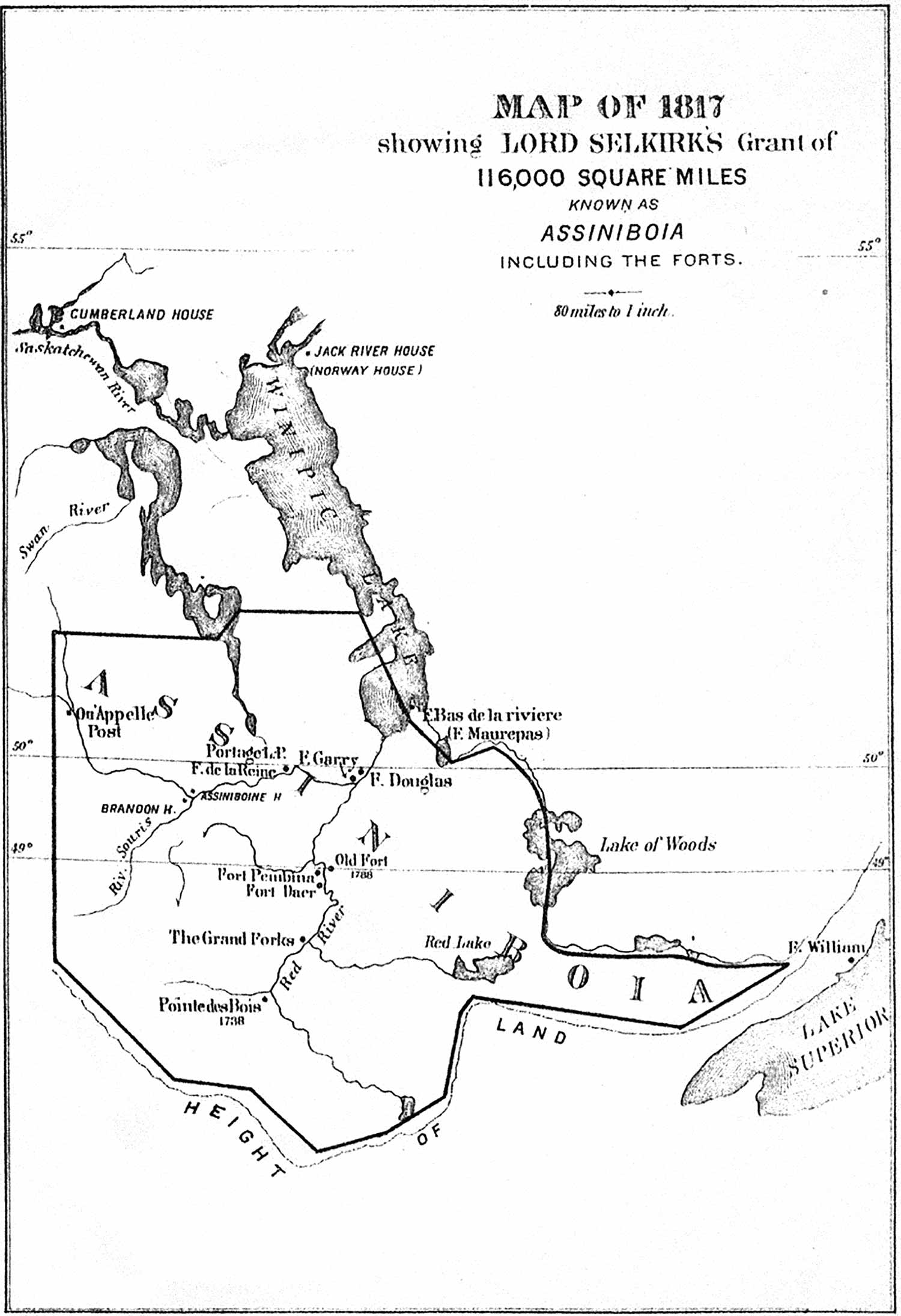
The story of the Selkirk Settlers is important to the Red River Colony as the west’s first European settlement. Scottish crofters displaced by highland clearances in the early 1800s had been subjected to terrible hardships. The Earl of Selkirk had envisioned establishing a colony for them in Rupert’s Land, but he was blocked by the chartered ‘owner’, the Hudson’s Bay Company, which feared disruption to its trade. Lord Selkirk managed to acquire enough shares of the recalcitrant Company to allow the granting of 300,000 square kilometres, an area five times the size of Scotland, for his resettlement plan. In the end, those settlers who came experienced formidable challenges in what became the Red River Colony, yet together with the more numerous Métis farmers and the few retired HBC families, formed the basis for a permanent agricultural settlement. It also represented a diversified aspect of the HBC’s enterprise as the sale of lands eventually became a lucrative arm of the company.
The fledgling settlement grew slowly in the first half of the 1800s. While striving to become self-reliant within the isolated district, the farming families were dependent upon HBC’s provisions for sale or trade at the Fort. Most of the English-speaking settlers and a few retired Orkney-men farmed north of The Forks, along the Red River up to St. Andrew’s Parish and Lower Fort Garry, while the French-speaking and Métis farming families generally settled in river lots to the south along the Red, Assiniboine and Seine rivers. To their numbers were added troops sent by Britain in 1846 and later by the Dominion government to establish a military presence for peace and order, and to support the rule of law in the colony. These soldiers were housed in barracks at Upper Fort Garry. By 1869, the population of the district approached 12,000 people.
Freighting of supplies by cart brigades in and out of the community became the link to the outside world. This is the era of the famed wooden Red River carts creaking along rutted trails behind plodding oxen. Trade escalated between Red River and St. Paul, Minnesota when the railway arrived there in 1858. The cart trails followed trade links established decades before along the Red River and beyond into the frontier. The Dawson Road, an arduous overland route connecting Red River to the Great Lakes district, was available but saw little traffic; it fell into disuse by the 1880s with the coming of the railway.
Map of Lord Selkirk's Grant of Assiniboia, 1817.
The Formation of Manitoba and its Role in Canada
The growing community at Red River and Rupert’s Land had been administered through the Hudson’s Bay Company with limited civil government and judicial proceedings. In 1841, the lands around Red River were organized into the District of Assiniboia, featuring a governor and an appointed council of a few leading citizens, although with no Métis representation. When the HBC charter was cancelled in 1857, there was no consultation with either the Indigenous people or the local inhabitants. The District of Assiniboia became a colony under British authority, and then a proposed territory within the new Dominion of Canada in 1869. Matters of critical concern to the growing settlement, such as protection of land titles, recognition of the languages of French and English, qualifications for suffrage, and local institutions of self-governance, had no formal democratic participation locally.
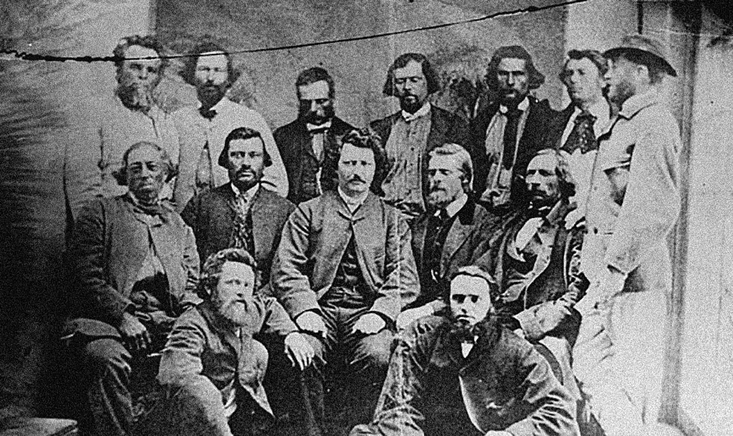
Into this void, the large Métis population found a leader in Louis Riel, an educated and charismatic young man who was able to express the concerns of many of the local population in a responsible way. Although the issues had not been discussed thoroughly among the affected population, the new Dominion government was acting hastily due to exterior pressures from the United States and internal struggles within the newly-minted nation. When envoys from both arenas failed to understand and respond to the other’s concerns, and given the challenges of distance and communication, local Métis organized themselves in an elected council to negotiate with Prime Minister John A. Macdonald and his representatives. They seized buildings and stores at Upper Fort Garry and formed a provisional government with Riel as leader in November 1869.
The Métis provisional government (William James Topley collection, National Archives of Canada, 1869)
Although it was a tense winter with communiqués and envoys shuttling between authorities, Riel and the Métis were successful in negotiating a more positive outcome which led to the creation of the Province of Manitoba the following summer.6 While the death of Thomas Scott was a regrettable event, the resistance of 1869–70 was otherwise bloodless, democratic and effective, at least in the short term. Upper Fort Garry and its immediate surroundings had been the cradle of the Province of Manitoba, leading to the creation of a transcontinental nation across northern North America at a time when that was not a sure thing.
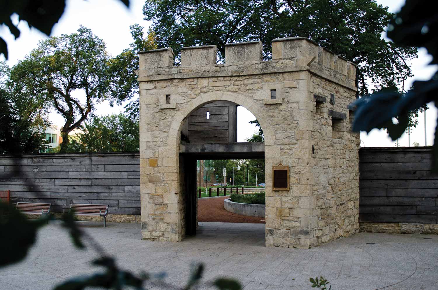
The fort continued as the temporary headquarters of the new provincial government until dedicated buildings were erected west along Broadway, just beyond the Hudson’s Bay Reserve lands. No longer of economic or military value, those sections of the fort that had not been claimed by a massive flood in 1882 were gradually demolished through to 1888. While the Company maintained and expanded its economic role at The Forks, only the Governor’s Gate of the old stone fort survived.
A large warehouse and a substantial dock were erected along the Assiniboine River bank as the Company shifted its emphasis to freighting by steamboat, retailing, and land sales. The grist mill continued operating well into the next century and its power plant was later adapted to generate electricity for an early iteration of an electric street railway. That land, now folded into Bonnycastle Park on the bank of the Assiniboine, eventually became a bus transit barn for several decades.
As the role of the fur trade receded, independent commercial operations sprang up three blocks north in the burgeoning settlement called Winnipeg. Survey expeditions sent out by the colonial government of Henry Youle Hind (1857–58) and John Palliser (1857–61), had provided positive intelligence as to the potential for agricultural development. Newcomers from Ontario, Québec, and Europe arrived in modest numbers. Individual migrations were joined by group settlements such as Mennonites from Russia in 1875 and 1,200 Icelanders in 1876.
Ramshackle housing arose in the area called ‘The Flats’ or Shantytown, north of the junction. It was a fluid cluster of wooden shacks and tents sometimes removed by flood and sometimes by the police. Squatter housing on The Flats was repeatedly rebuilt, and endured well into the twentieth century.
The Steamboat Era
The first steamboat, the diminutive S.S. Anson Northup, arrived at The Forks just after the ice broke up on the Red River in 1859. The Northup ushered in a brief but frenetic era of steamboats on the Red. The big paddle wheelers had capacity for transporting people and cargo, giving citizens access to the heavy equipment and raw materials for manufacturing, as well as consumer goods. They also provided a link to the outside world for local agricultural products. The route south for freight was by water to St. Paul, Minnesota, then transferred to the rails to eastern markets.
Steamboats were broad flat-bottomed paddle wheelers similar to those famous for plying the Mississippi. Sometimes pulling barges with the more cumbersome goods, the steamboats were made mostly of wood with tall smokestacks that spewed smoke and live sparks and burned copious amounts of wood. They required deft handling on the turns and shallows of the river7 as well as when they were being loaded. This short-lived but colourful era came complete with a cast of characters, including river-boatmen, confidence men, visionaries, investors, and even the district’s first tourists.
The arrival of a steamboat at Winnipeg’s docks was an exciting event, much as the arrival of the fur brigades had been in years past. Hanging onto their economic position, the HBC became a stakeholder in this new form of transportation and owned a fleet of paddle wheelers. As Upper Fort Garry transitioned to more of a retail operation, the HBC’s investment in a sturdy dock and warehouse had proved profitable.
Ferries plied the waters back and forth between the banks of the two rivers, serving the bustling settlement in St. Boniface and the new residential area of Fort Rouge. In 1875, the HBC financed the building of two bridges, the Main Street Bridge across the Assiniboine at the foot of the old fort, and the Broadway Bridge, linking Broadway across the Red to St. Boniface. The bridges served the company’s expanding retail business, opened its Reserve lands west of the fort for residential use, and increased the value of its adjacent land for future commercial development.
Flooding by the rivers continued to threaten long-term development. The Broadway Bridge washed away in the spring break-up of May 1882, which also ruined the vestiges of the stone fort. The Flats at The Forks suffered almost complete devastation, only to be promptly rebuilt by squatters. Other early businesses operating in The Flats in this period included a lumber mill, a sawmill, a sash and door factory, the ramshackle houses, a red-light area, and a small grocery supplier.8
The settlement of Winnipeg experienced its first modest boom between 1870 and 1872. As the largest disembarkation point, The Forks retained its position as an important landing, causing the Federal Government to build its first Immigration Shed in 1872. This was a large ramshackle wood-frame structure, capable of sheltering 30 families at a time, with a separate cook-house and privies behind. It was here that newcomers put to shore, made their arrangements and started their new lives in the west. That first wave portended the decades to come when newcomers by the thousands poured through this western portal.
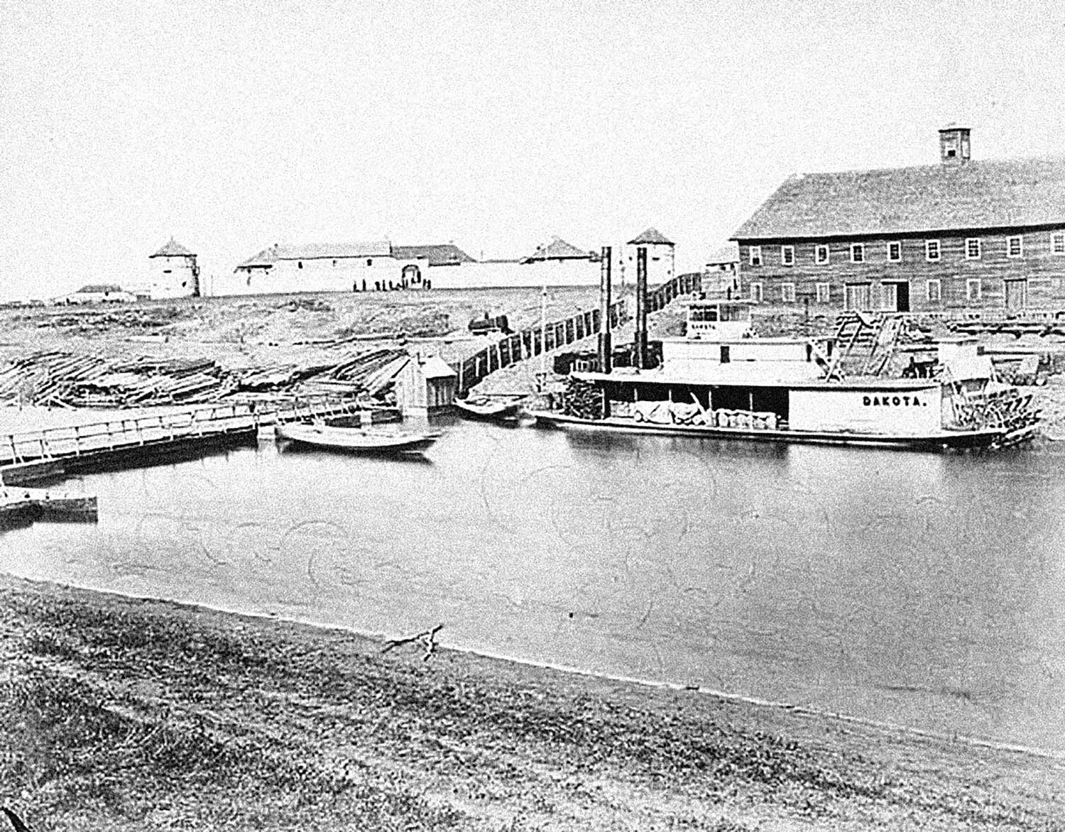
Steamboat landing: Fort Garry on left; Immigration Shed on right (William James Topley collection, National Archives of Canada, 1873)
A Dominion Lands office was established beside the Immigration Shed in 1873. While the arrival of the Canadian Pacific Railway (CPR) in 1881 precipitated a move of the federal immigration facilities north to the Point Douglas area, the facilities at The Forks (demolished in 1883) denoted Winnipeg as the first federal port of entry in the west. This designation as a port symbolized Winnipeg’s emerging dominance over its western Canadian hinterland for the next 40 years.
Although a valuable mode of transportation, and romantic in the telling, steamboats on the Red River declined after the 1870s. Steamer traffic did continue on the Saskatchewan River system, but the smoke-spewing paddle wheelers were no match for the iron horse. The construction of the St. Andrew’s locks at Lockport, Manitoba in 1910 opened the Red River to commercial freighting (cordwood, lumber, fish, and sand) along Lake Winnipeg and into the northern frontier. This commercial activity on the Red required a network of loading docks to support the industrial and commercial development. It signalled a retreat from the river as waterfront presence. While the many rivers and streams in Winnipeg had once been a source of drinking water, they became unusable, as riverbank erosion and the habit of using the flowing water as a garbage dump caused the water to be polluted.
The Railway Era
Despite the offer by the HBC of 20 acres of free land to build a station and yards across from the fort,9 finagling over the location of the trans-continental railway line, the Canadian Pacific Railway (CPR) caused the line to locate its track, station, and yards in Point Douglas, three kilometres north of The Forks. The first CPR train arrived from the east in 1881. The Countess of Dufferin, a locomotive, and six cars had arrived previously in October 1877, ironically, by steamboat at a landing off Lombard Avenue. The diminutive Countess and her working stock were used to build rail lines locally for the federal government. Now restored, The Countess is available for viewing in the Winnipeg Railway Museum in Union Station.
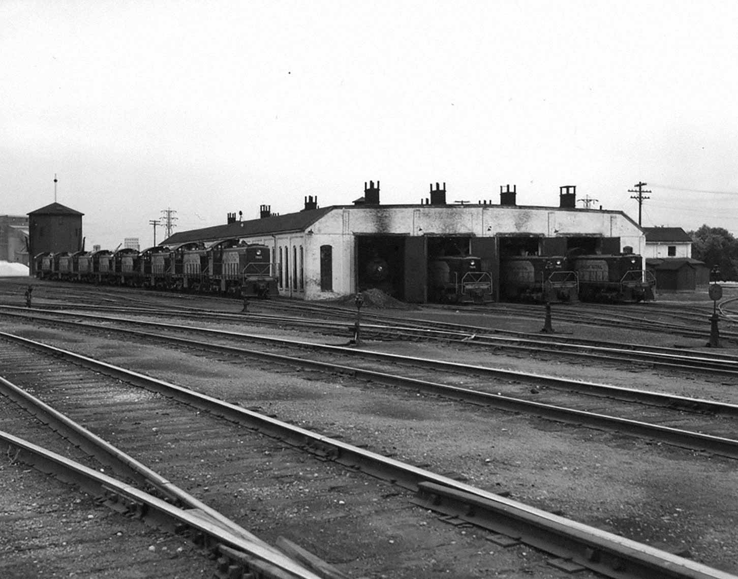
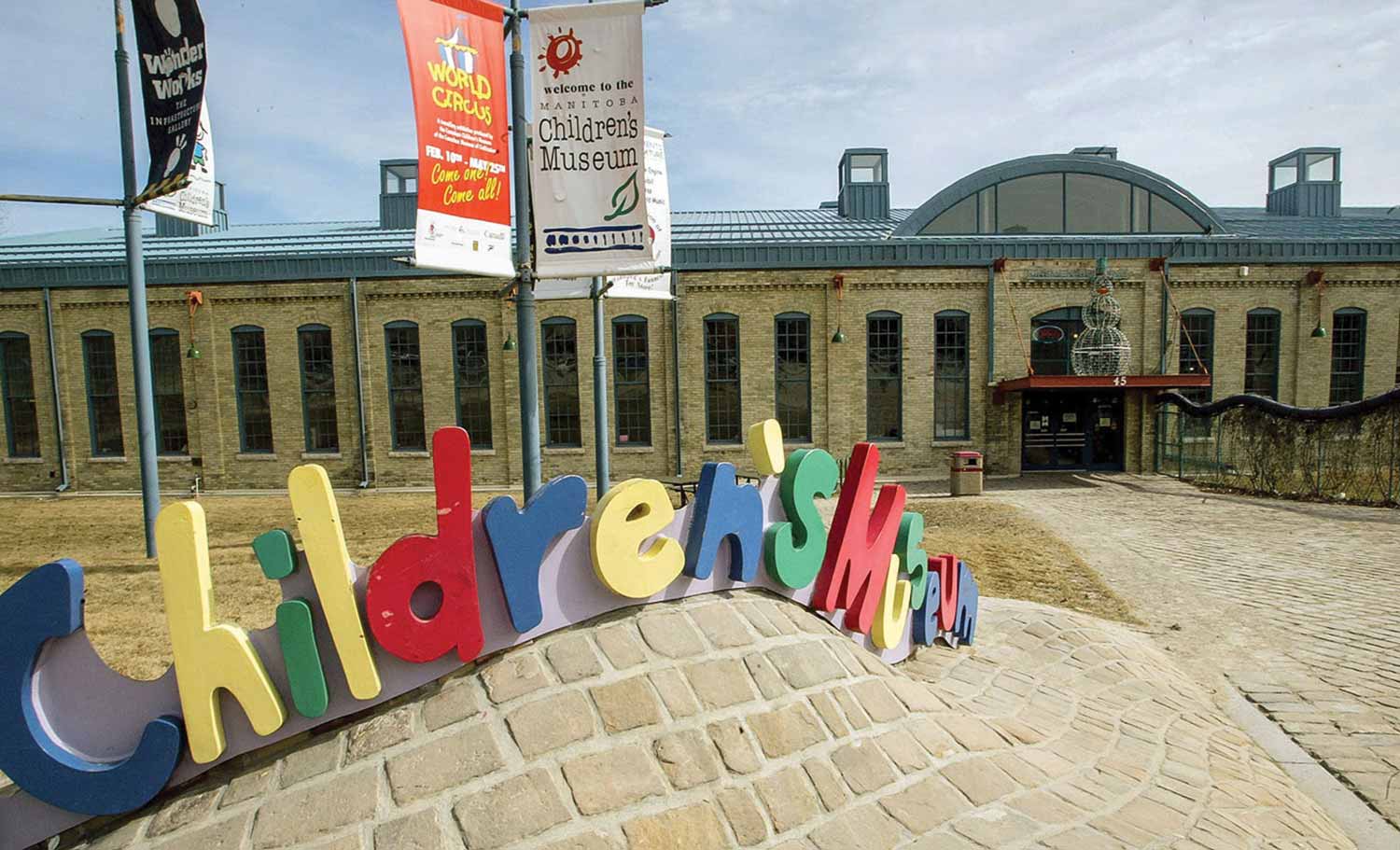
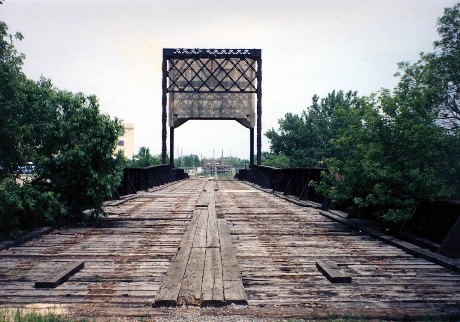
Discontented with the lack of branch lines to service the new wheat-growing areas of rural Manitoba, the Manitoba Government licensed the Red River Valley Railway, which later became the Northern Pacific & Manitoba Railway (NPMR) in 1887. This American-based line, which broke the monopoly of the CPR, served the agricultural economy of southern Manitoba through a series of modest branch lines. Twenty acres at The Forks for passenger and freight facilities for the NPMR were purchased from the Hudson’s Bay Company at a nominal price of $10,000.10 NPMR built a new railway bridge to cross the Assiniboine River. A second generation freight bridge, now called The Forks Historic Rail Bridge, remains. The engine repair shop for the rail line also survives as the Manitoba Children’s Museum. To complete the NPMR, a small passenger station and freight sidings were built, signalling the dawn of the railway era at The Forks, and the principal industry to be located here for most of the next century.
As a chapter in the Conservative government's National Policy, the story of Manitoba’s early railways is complex, a hot-button topic at the time, and formative to the development of Canada and Manitoba for decades. The Forks, once at risk of losing its relevance to the development of early Winnipeg, not only maintained but increased its significance with the arrival of this competing rail line in the 1880s. Ironically, as rail infrastructure took over the site, it eventually isolated the historic district.
Construction of the NPMR line through southern Manitoba went up the west side of the Red River, and arrived in Winnipeg in 1888. The river needed to be crossed with a secure structure and the line made safe from flooding. Four feet of fill (cinders and gravel) were added and the site graded for construction. A station with customs and baggage facilities was built, as well as freight sheds and marshalling track. The surviving engine roundhouse with its turntable followed in 1889. Platforms adjacent to the rails were paved with large cobblestones from a quarry in Boissevain. NPMR erected a large and luxurious railway hotel north of the yards at the corner of Main and Water streets, the present site of the Federal Building.
The NPMR rail infrastructure lasted through the 1890s until its network of lines and sheds was diverted to freight and repair only and later folded into the larger East Yards development. The line struggled financially through to 1897 and was eventually sold to the Canadian Northern Railway (CNoR) in 1899.
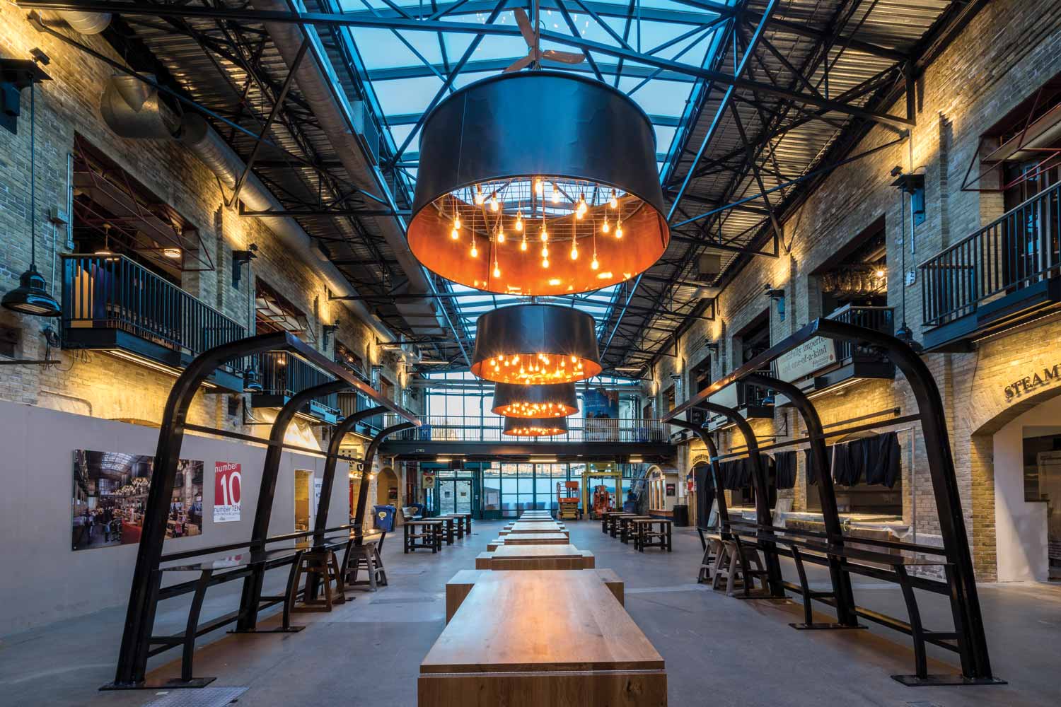
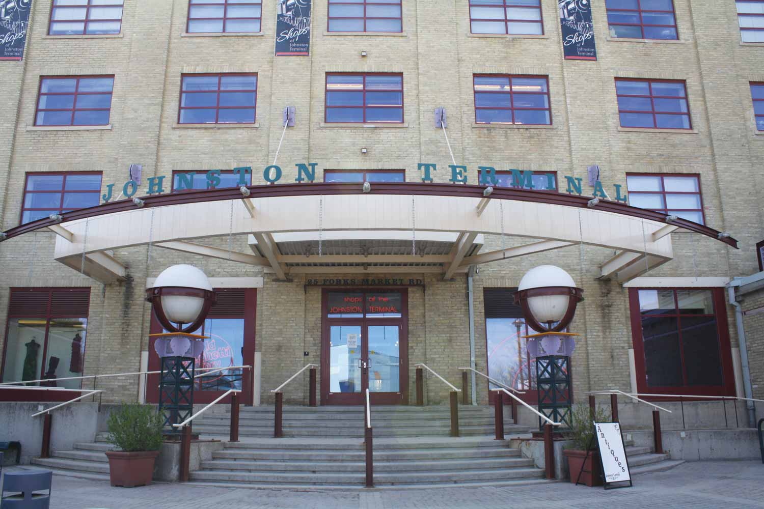
Many structures from the railway era remain intact: Union Station; the former engine repair shop (which houses the Children’s Museum); the bascule freight bridge (now a foot bridge to the South Point); a cold-storage warehouse (now Johnston Terminal); two former stable buildings which house the Forks Market and the former steam plant built to provide heat for the extended CNR facilities in the East Yards.
It is difficult to overstate the significance of the railways to the opening of the Canadian west. As settlers arrived, they required massive quantities of supplies and goods to establish farms and businesses, while crops and locally manufactured products had to be shipped to market. Saskatchewan and Alberta joined Canada as full provinces in 1905, signifying the development and sophistication of the west as well as the growth of the wheat economy as the ‘breadbasket of the world’. In particular, large amounts of wheat were redistributed through local rail lines on the way to the inland terminals at the Lakehead.
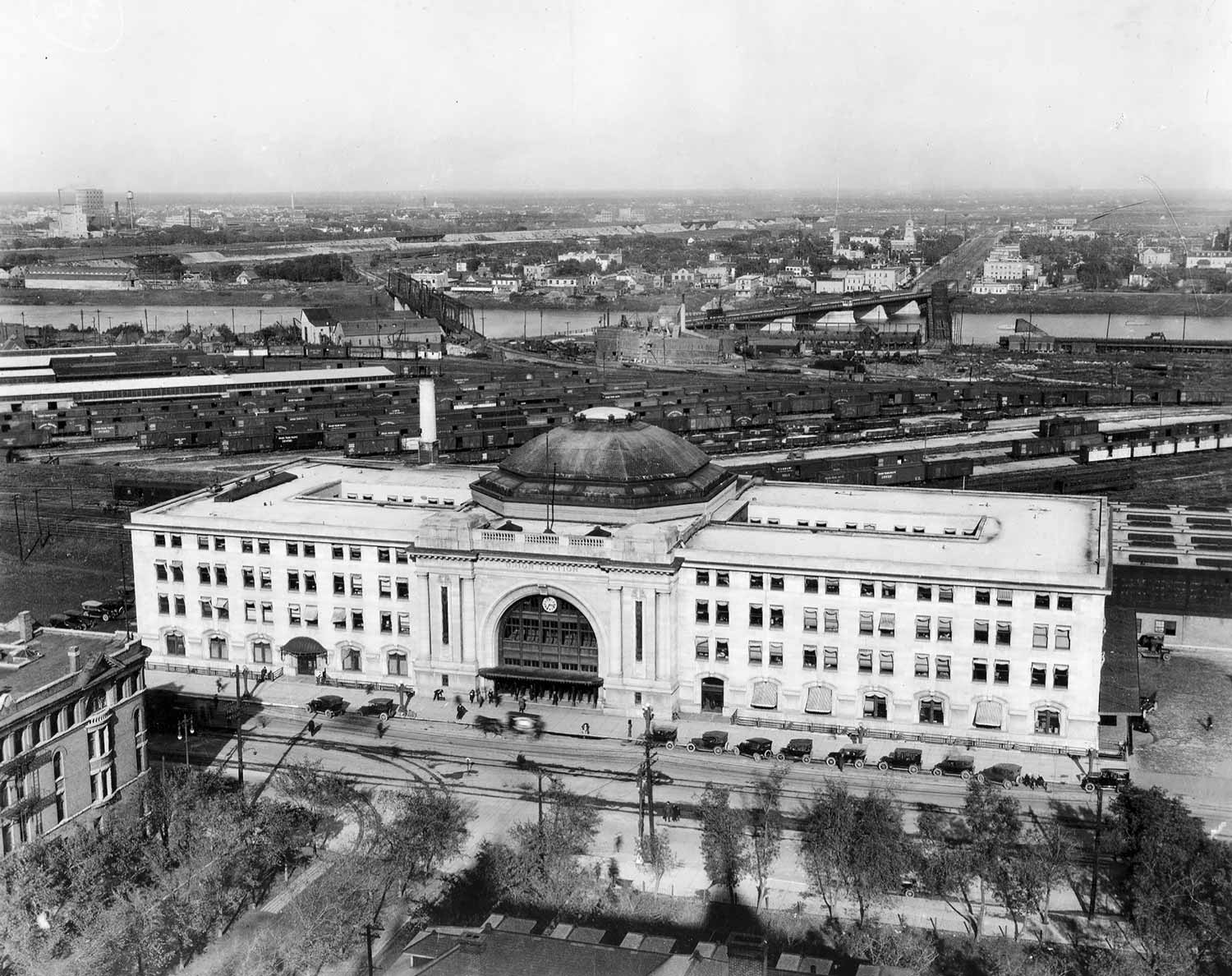
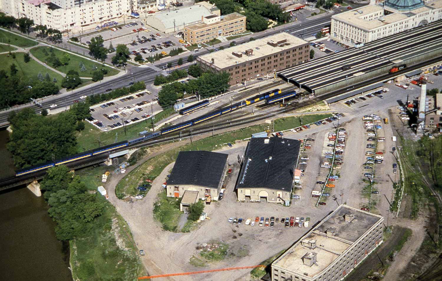
Union Station with the East Yards behind (Lyall Commercial Photo, 1918)
Railway contractors Mackenzie and Mann were on the ascendance in the 1890s, building and buying provincial branch lines that they stitched together to become the Canadian Northern Railway. The acquisition of the defunct NPMR gave them a large base in Winnipeg from which to expand. While they became a full transcontinental railway in 1899, the line struggled as some of its routes were not profitable. The federal government continued to give preferential treatment to the CPR. World War I further challenged the company until it was nationalized in September 1918 to become the Canadian National Railway (CNR).
At the same time as the Canadian Northern Railway was ascending, the Grand Trunk Pacific (GTP), another aspiring national line became financially over-extended. The GTP was also folded into the CNR in 1920, but not before it had built three luxury hotels in the famed railway chateau style: the Fort Garry in Winnipeg, the Chateau Laurier in Ottawa, and the Hotel Macdonald in Edmonton.
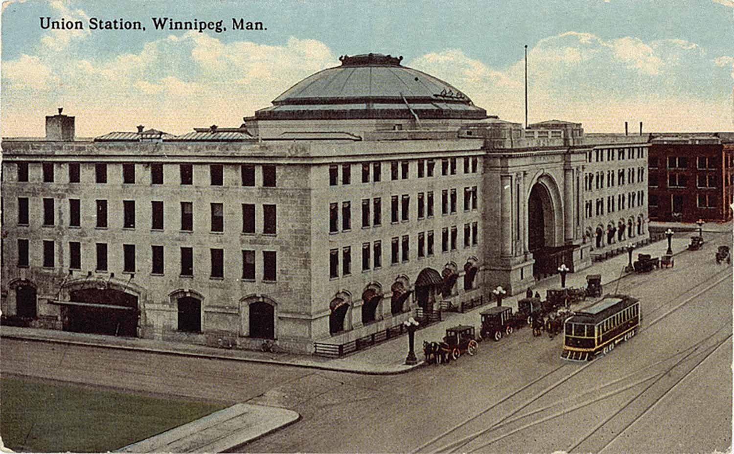
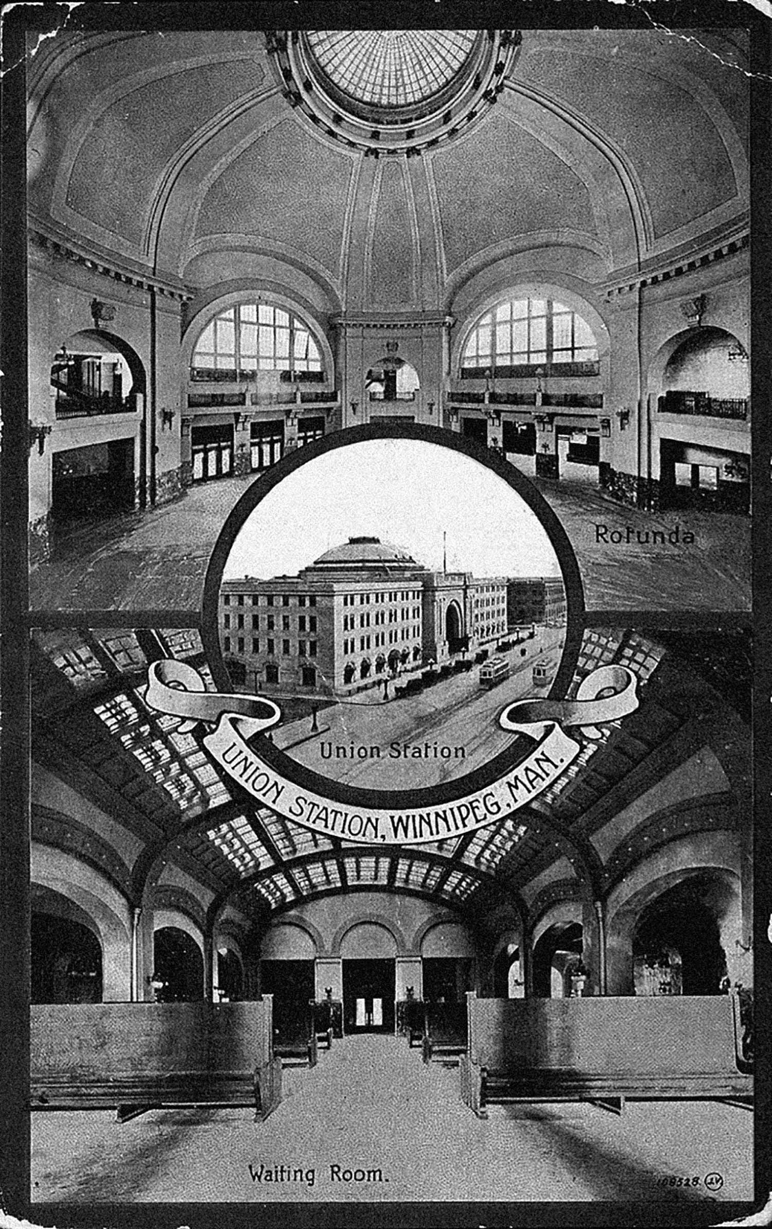
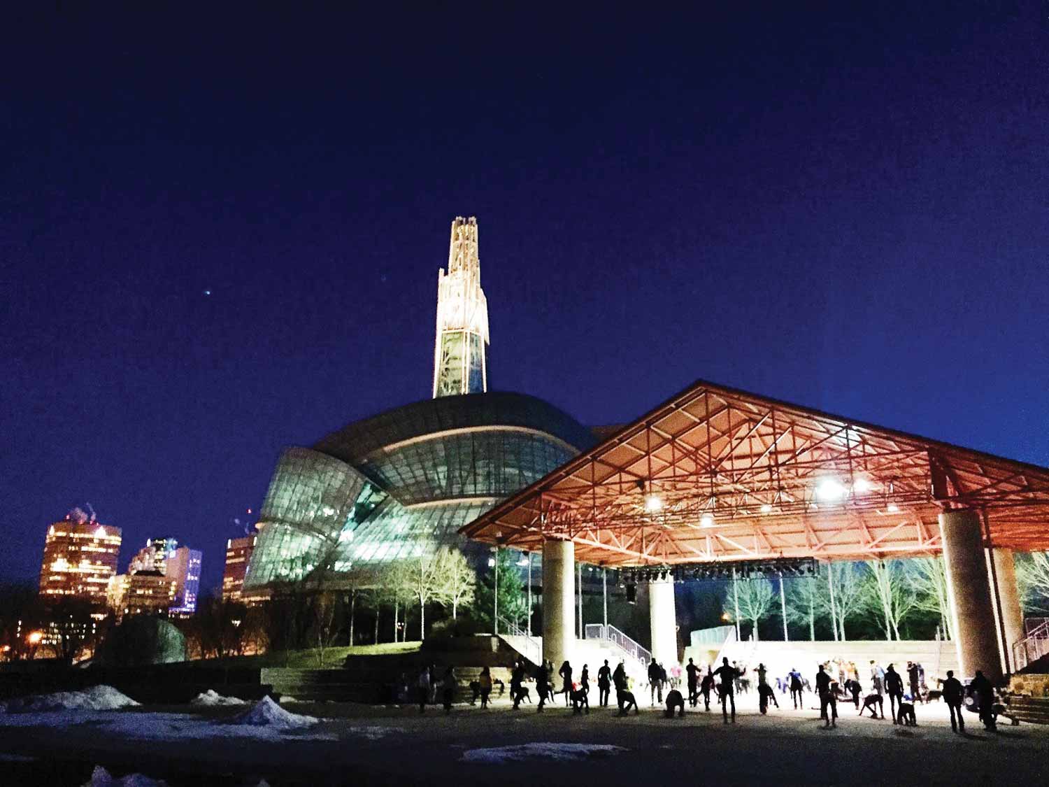
The new transcontinental railway took over Union Station at The Forks. Built jointly by the former railways between 1908 and 1911 on land purchased from the HBC, this magnificent Main Street station had eight tracks and four passenger platforms to serve the hundreds of people who passed through it each day. Designed by architects Warren and Wetmore of New York, Union Station is a magnificent Beaux Arts structure in the grand style, the portal for thousands of people arriving in Winnipeg, and an anchor for Broadway, the city’s European-influenced boulevard. It was designated a National Historic Site in 1976.11
Rail lines entered Union Station along a new High-Line Bridge built in 1905 across the Assiniboine River. Although the HBC grist mill remained for many years, and there was briefly a race track where the Forks Market now stands,12 the area, now called the East Yards, became heavily overlaid with track, rolling stock repair and freight facilities, and a scattering of heavy industries needing ready access to sidings. The Winnipeg Transfer Railway connected the East Yards with the CPR Yards; this former rail strip became Stephen Juba Park. The City Asphalt plant, some cattle pens and the storage depots of heavy equipment manufacturers completed the industrial use of the East Yards. In 1909 and 1910 the two stable buildings (one for the Grand Trunk Pacific and another for the Canadian Northern Railway) were erected. They were later adapted as garages and finally as The Forks Public Market. Both structures were also designed by Warren and Wetmore architects.
The railway and the other industries operating in the East Yards employed hundreds of workers. Many of these jobs were physically demanding, and performed in difficult conditions. Moving freight, repairing rolling stock, keeping the yards on the go, all these jobs were done working with heavy equipment, time-is-money pressure and the grime of trains, soot, cinders, and diesel. The workers were mostly unionized, which provided some cushioning against the conditions.
The High Line, Union Station, and the East Yards effectively became a barrier between Main Street and the junction of the rivers. Freight sheds and heavy industry hugged the access roads and the riverbank along Water Street (now William Stephenson Way), between Main Street and the Provencher Bridge, blocking visual access. The site was characterized by the constant rattle of trains and the pungent smell. The lands were strictly off limits and more or less faded from public consciousness except for those doing business there.
While the forced consolidation of the rail lines in the 1920s caused some redundancy of facilities, rail operations also were evolving to greater efficiencies in servicing the rolling stock and moving freight. CNR had become a major national corporation and a nerve centre for transportation on an international level. With this restructuring came the development of yards in Fort Rouge, the shops in Transcona (1913) and later the marshalling grounds of Symington Yards. This reduced some of the activity in the East Yards, in part because some of the older rail support facilities had been neglected and new railway systems required larger infrastructure. Toward the mid-century mark, truck and even air transportation also shifted some of the relevance away from the East Yards.
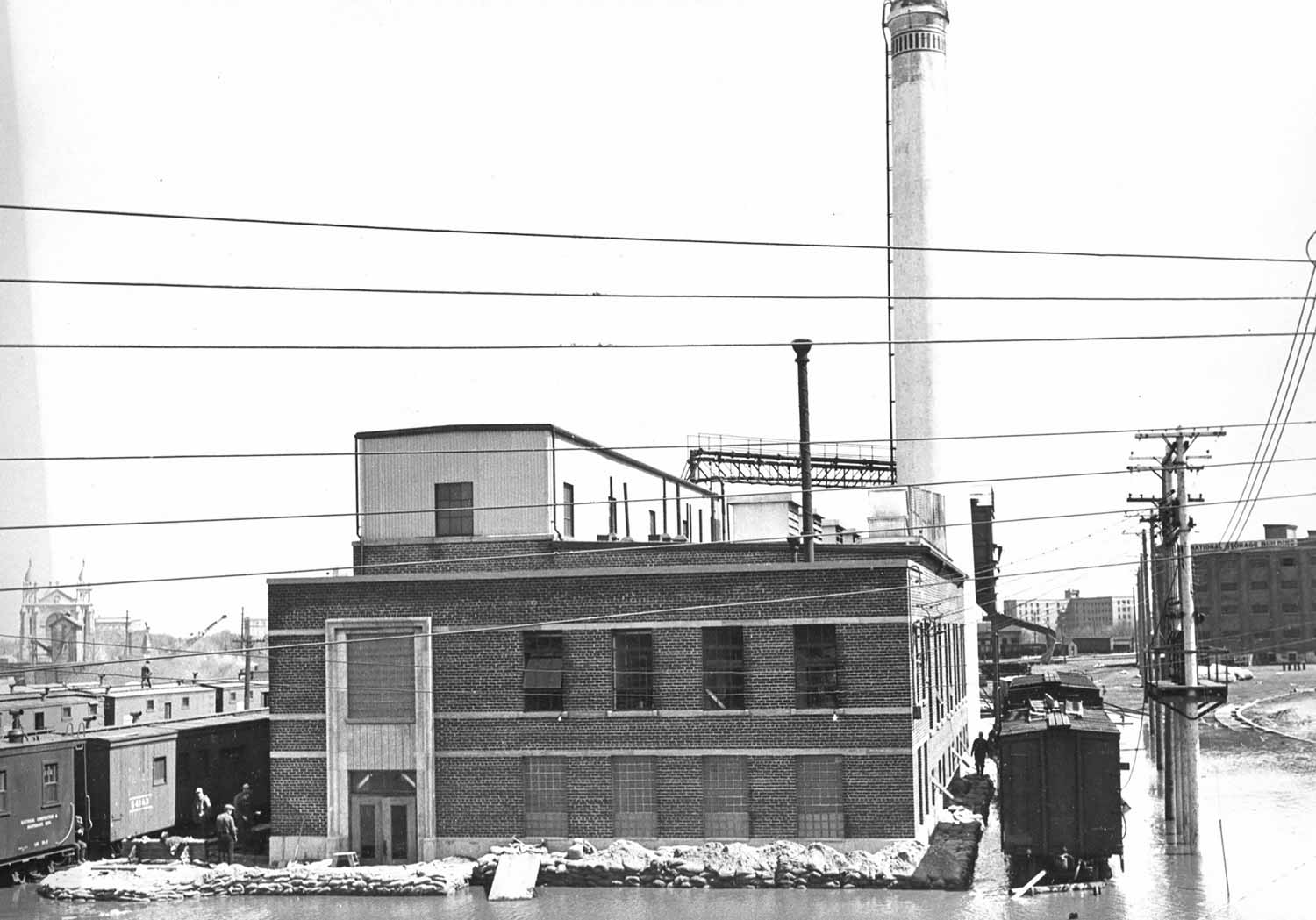
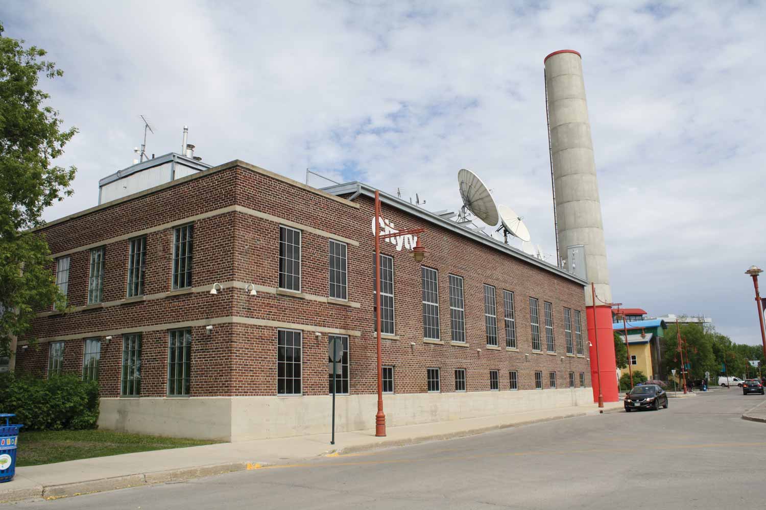
This is not to say that the East Yards were static—far from it. Although the rail activities were scaled back mainly to local freight and passenger activity, Union Station teemed with many people passing daily beneath its green dome. Moving newcomers, troops, tourists, and cottagers were all important uses of Union Station. In 1947, a steam plant was built behind the station to heat the East Yards, the station, the Fort Garry Hotel, and the Manitoba Club. The former steam plant is now the site of broadcaster CityTV, and familiar to visitors to The Forks due to its prominent corner location and its tall smoke stack.
Steam Plant with sandbags (The Forks Archives, 1950)
The Forks on the Verge of the Modern Era
Floodwaters in 1950 inundated the lower-lying East Yards but mercifully left Union Station and its lines dry. Tiled poles supporting the big white canopy in The Forks Plaza tell the flood story graphically in coloured tiles that mark the water levels of the devastating floods of 1826 and 1950. As it became obvious that the city could not grow much more due to the ongoing threat of flooding, the city, province and federal governments came together in the late 1950s to plan a permanent long-term solution. This engineering marvel is known as the Winnipeg Floodway, or “Duff’s Ditch”. A 47-kilmetre-long channel diverts floodwaters around the city and discharges it back into the Red River through a dam below Lockport. Construction for this massive project broke ground in 1961 and opened in 1968. It has been activated many times since, particularly during the ‘Flood of the Century’ in 1997. The Floodway has stabilized the flow of water in the Red River to alleviate flooding within the city, although the lower portion of The Forks Harbour and River Walk are still subject to damage by high water on a yearly basis.
While the Floodway was an important step in transforming the East Yards into The Forks, it was not the only influence. Early recognition of its historical importance came from the Historic Sites and Monuments Board of Canada (HSMB). In 1924, the HSMB designated the four fur trade forts closely associated with the junction of the two rivers: Fort Rouge, Fort Gibraltar, and the two forts named Upper Fort Garry.13 A plaque was installed at the Governor’s Gate on Main Street, which was all that remained of the second Fort Garry. While this designation did little to revive any physical vestiges or archaeological remains of the forts, it did identify historic associations which formed a platform for future federal involvement at The Forks.
With the use of the East Yards as a railway facility clearly in decline, opportunities for redevelopment began to emerge in the public realm. The challenge was how to connect this riverside property to Winnipeg’s downtown in a sustainable way.
The Regeneration of The Forks
When you marvel at the panoramic view of The Forks and downtown Winnipeg from the Tower of Hope in the Canadian Museum for Human Rights, it is difficult to imagine that 50 years ago, the CN East Yards was a largely isolated assembly of railway lines and industrial buildings locked away from public view and consciousness. How this parcel of land has been transformed over the past 35 years is a fascinating case study of political will, inter-governmental negotiation, a diversity of urban planning concepts, and, ultimately, the emergence of an exceptionally popular public destination.
When examining the regeneration of The Forks in the early period, it is important not to isolate the site from what was happening elsewhere in Winnipeg. In 1970, to celebrate Manitoba’s centennial, the city and province created a new crown corporation to revitalize the civic precinct through the design and construction of the Concert Hall, Manitoba Museum, and a new City Hall campus. This assembly was a strong expression of modern architecture and a commitment to the downtown. At that stage, city leaders had not yet recognized the potential of the surviving historic buildings and warehouses in what later became known as the Exchange District. The rejuvenation on Main Street was complemented, in the early 1970s, by a number of new office buildings along Broadway, as well as construction between Portage Avenue and Broadway on buildings such as the Convention Centre complex.
While this resurgence of development in Winnipeg’s large downtown did not instantly translate into pressure to develop the East Yards, a variety of disparate influences were beginning to emerge. As early as 1968, Tribune columnist Val Werier and his close friend Don Macdonald, (soon to become the first commissioner of the unified City of Winnipeg), were walking through the East Yards. They mused publicly about this land as a heritage resource of national significance that should be liberated from its declining use as a railway facility.
Growing interest in the East Yards was complemented by a stronger activist role by the federal government in urban Canada. On August 1st, 1972, Prime Minister Pierre Trudeau announced his government’s Byways and Special Places initiative in Winnipeg, “to commemorate historic communication routes in Canada by preserving them for recreational use”.1 Under this program, the Red River from the American border to Lower Fort Garry National Historic Site was identified as a significant historic route in Western Canada. It had not only served as a transcontinental waterway for the fur trade and the subsequent settlement, it had been an artery for travel for centuries for Indigenous peoples. Trudeau’s announcement led to the preparation of the Red and Assiniboine Rivers Tourism and Recreation Study in 1974, overseen by Manitoba’s Assistant Deputy Minister of Tourism and Recreation, Mary Liz Bayer, and coordinated by the landscape architecture firm of Garry Hilderman and Associates. This study identified 17 sites along the Red River corridor, including the junction of the Red and Assiniboine rivers.
While gaining the attention of three levels of government was a challenge, Canadian National Railway (CN), as owner of the East Yards, particularly needed to be brought into the discussion. By the early 1970s, CN knew that the East Yards’ facilities were underutilized and, after the creation of Symington Yards, all but obsolete. Yet the land itself, under-developed real estate in the heart of the city, was a valuable commodity. CN Real Estate would prove to be a formidable and stubborn negotiator.
Emerging interest in the East Yards for redevelopment generated at least four separate proposals through the 1970s. The first, most intriguing proposal was a joint partnership in 1973 between Great West Life and CN. Then, in 1975 the City of Winnipeg’s Board of Commissioners put forward an ‘All-Park Proposal’. In 1977 Oxford Developments with Smith Carter Partners, in league with New York-based Skidmore, Owings & Merrill, pitched a second proposal involving Great West Life and CN. This was followed in 1979 by Lakeview Development submitting their ‘Riverside Park’ concept.
The most intriguing of these proposals were the two involving Great West Life, a major Canadian corporation then employing 1500 Manitobans and with $2.7 billion in assets. Driving the interest of Great West Life was their search for new corporate headquarters for their rapidly expanding company. Their proposal, in partnership with CN, was a combined office, commercial, shopping, and residential complex in the CN’s East Yards. This concept included two park areas, a 41-acre parcel contouring the river banks, and an ambitious six-acre enclosed atrium. Great West Life would move its corporate headquarters to the East Yards as the anchor tenant of a $500 million project spread over 20 years. This intense commercial development would “assure public access to the rivers for recreational purposes and also preserve and re-emphasize the historical significance of this important river junction.”
To develop this concept, the East Yards Study Group was formed with representation from Great West Life, the City of Winnipeg, and CN. In the words of John Bruce, Director of Corporate Properties for Great West Life, “we are very intent on this project as it presents an extraordinary opportunity to develop a pedestrian city within a city with a controlled environment, and place Winnipeg in the forefront of urban renewal and design in Canada."2
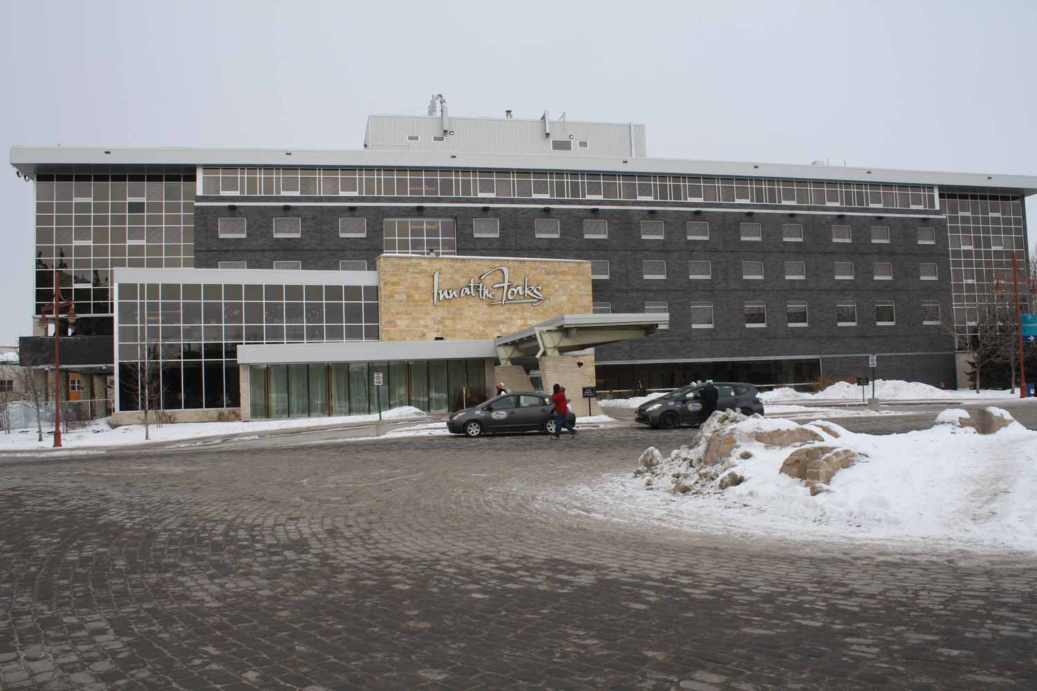
What was significant about the 1973 and 1977 proposals was the scale of the development. The 1973 concept consisted of seven huge components: an office block (1,000,000 square feet), a retail concourse (800,000 square feet), a recreation hotel (400–600 rooms), a housing complex (10,000 units), an enclosed public space or atrium, a public park along the rivers, and the renovation of Union Station to include a public transit station, all to be phased in over 25 years. This massive concept included components that ultimately were built but under different sponsors, scale, and governance. These ambitious 1970s concepts were ultimately abandoned, in large part because CN was not ready to transfer valuable real estate to either the private or public sector until the deal was right for them, nor did the City of Winnipeg have a cohesive vision for the modernization of the downtown. The riverbank park ultimately did emerge under the ownership of Parks Canada, there was commercial development of some of the surviving railway buildings and a smaller-scaled hotel was constructed and flourishes today.
Meanwhile the federal and provincial governments continued to be interested in the future of the East Yards. In 1974 the Historic Sites and Monument Board of Canada designated The Forks as a national historic site because of its strategic location at the junction, “a spot that has witnessed many of the key events of western Canadian history."3 Although this designation did not guarantee any formal protection or development of the land at The Forks, it did justify the involvement of the federal department for national historic sites, Parks Canada, to initiate the research and planning associated with the land base. Coincidently, Parks Canada had opened a regional office in Winnipeg in 1973. Professional staff had expertise in planning, archaeology, architecture, landscape architecture, and historical research which would prove extremely useful as The Forks land base became available.
Agreements for Recreation and Conservation (ARC)
During the 1970s, the federal government’s Byways Program evolved into the Agreements for Recreation and Conservation (ARC). In October 1978 The Forks was included within the Canada-Manitoba ARC Agreement on the Red River Corridor, the first agreement of its kind in Canada where two senior levels of government invested in the planning, development, operation and management of sites containing important heritage resources. The general agreement objectives were:
To identify, preserve, interpret and develop the natural, historical and scenic heritage resources of the Red River Corridor and;
To increase the educational, recreational and cultural benefits to be derived from the use of these resources for the benefit of the people of Canada, in general, and for the residents of the Province of Manitoba, in particular.4
The inclusion of The Forks in the $13-million agreement focused attention on a site that had been the historical hub for the development of transportation and commerce in Western Canada. The ARC program was a catalyst for developing what became the core of the heritage conservation network along the Red River corridor from Netley Creek on the northern boundary to the Trappist Monastery in St. Norbert. It was also designed to provide a boost to Manitoba’s tourism infrastructure. Under the leadership of Director Ian Dickson and his staff, this agreement developed 17 sites along the Red.
The 1981 Red River Corridor Master Plan included another $2.8 million in federal money for The Forks Visitor Interpretive Centre and $825,000 provincial money for a riverbank park. The Visitor Interpretive Centre was intended to provide a public facility to relate the role of The Forks in opening the Canadian West and to orient visitors to the opportunities within the Red River Corridor. Within this phase of the development, the ARC funding, supplemented by funds from the federal Core Area Initiative Program, would be used to acquire the property in the East Yards from CN. The riverbank park section was intended to create a scenic recreational area to complement the Interpretive Centre, provide access to the Corridor, and create the City of Winnipeg’s urban edge onto the Red River. This would include amenities such as cycling trails, conversion of the old CN freight bridge to a pedestrian bridge, interpretive resources at Upper Fort Garry Gate, and a docking facility.
Despite the ARC program funding and concept plan for The Forks National Historic Site (FNHS), its implementation stalled with the impasse on land ownership. In May 1984, the logjam over public access to and ownership of the East Yards railway lands was partially broken by CN’s agreement to release a 13-acre strip of waterfront (extending from a point just south of the Provencher Bridge to the junction of the Red and Assiniboine rivers) into the custody of the federal and provincial governments. In exchange for this land, both parties agreed to CN’s participation in future redevelopment of the larger portion of the East Yards “if and when it occurs”. This agreement allowed the federal government to approve a second ARC Agreement in May 1986, earmarking $3.5 million for the creation of a national historic site, owned and operated by Parks Canada.
At last the first projects at The Forks could proceed. Although this new national historic site would only encompass 5.5 hectares of land, it was a toehold in the railway lands. The new site included a multi-use open area for events, festivals and heritage programming, an amphitheatre, a river walkway, a boat dock, and a pedestrian link northward to Stephen Juba Park. What was missing was the original commitment to an Interpretive Centre to present the historic themes associated with The Forks. With the site development plan prepared by Lombard North Group and the detailed design by Hilderman, Witty, Crosby, Hanna & Associates, site work began in 1987, a full fifteen years after Trudeau’s announcement of the Byways and Special Places Program in Winnipeg.
Core Area Initiative (CAI)
While the ARC program was an important catalyst for Forks development, the other key program was the Core Area Initiative (CAI), a tri-level funding agreement aimed at revitalizing Winnipeg’s core. Its key targets were the north Logan industrial area, the north Portage retail and commercial area, and the East Yards. During the first five years of the CAI, from 1980 to 1985, senior Manitoba cabinet minister Lloyd Axworthy used his considerable influence to negotiate an agreement with CN over the East Yards but the price was simply too high. In addition to payment for the land, the railway demanded assistance with rail relocation.
By the time the Core Area agreement came up for renewal in 1985, the Mulroney Conservatives were in power and Jake Epp had become the senior Manitoba minister responsible for the CAI. Although the government had changed, Epp continued to pursue a deal with CN. In the end, it was land and not money that made an agreement possible. The federal government turned over a $12 million office tower in Vancouver in exchange for 58 acres (23.7 hectares) at The Forks. CN retained seven hectares along the main railway thoroughfare.
The Forks Renewal Corporation (FRC)
While Epp was shepherding the East Yards land deal through the federal cabinet, planning began under the leadership of the tri-level East Yards Task Force in 1986 with Tony Reynolds representing the federal government, Peter Diamant the province, and Nick Diakiw and David Henderson for the city. These senior bureaucrats had to forge new relationships and decide upon the best managerial framework to develop the railway lands. To their credit, they leaned upon some talented professional expertise in the personages of architect Etienne Gaboury, financial planner Cam Osler, city planner Ross McGowan, as well as Core Area Initiative staffers Jim August, Janet Walker, and Al Baronas, who would be the key agents of implementation down the road.
The task force moved quickly. By late 1986 its report recommended the establishment of the FRC, to be run by a board of ten appointed members. With a budget of $20.1 million for the first five-year phase, the board would oversee the public development corporation that would make decisions at arm’s length from government, with a focus on the mandate of The Forks moving toward an ultimate goal of operational self-sufficiency. By December 1987, the interim board had confirmed the Phase One plan, approved the land transfer, and completed the search for the first CEO, former senior City Commissioner Nick Diakiw, a career civil servant with a reputation for ‘getting things done’.
When you read The FRC’s Phase 1: Concept and Financial Plan, the pent-up energy in the ideas presented is almost palpable. Based upon a comprehensive pubic consultation process, The Forks Renewal Board concluded that the overall vision for The Forks should be a ‘meeting place’, a distinctive all-season gathering and recreation resource at the junction of the Red and Assiniboine rivers.
Several key principles captured in the 1987 Phase One plan are synonymous with The Forks today. These include multi-use, year-round recreation with public access to the river fronts and special attention to pedestrians, bicyclists, and handicapped access. Protection of heritage resources and the development of cultural and historic themes were to influence design and programming. Private and public sector involvement and financial self-sufficiency were goals as well.
In retrospect, this energetic plan for the first phase of development was overly ambitious. The management team only had $20 million capital dollars to work with, and buried among the signature projects was the daunting task of removing the railway lines and cleaning up the industrial remains of a century of accumulated cinders and derelict buildings. But from a conservation perspective, this was a responsible plan. Many modern urban developments could not resist the temptation to demolish the heritage buildings or cultural features and start with a clean slate. Instead of ‘blowing away’ the surviving buildings, The Forks Renewal Corporation proceeded to protect and adaptively reuse five buildings on the site. This involved the inventory and analysis of existing physical resources and buildings to determine their condition and potential for reuse. In 1988, they undertook the massive job of removing the track and extraneous structures and installing below-grade services such as hydro.
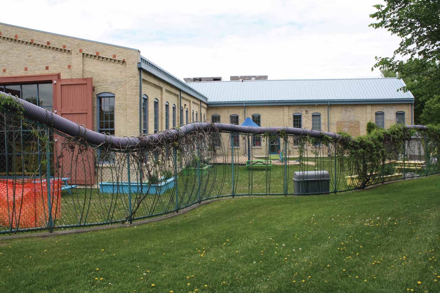
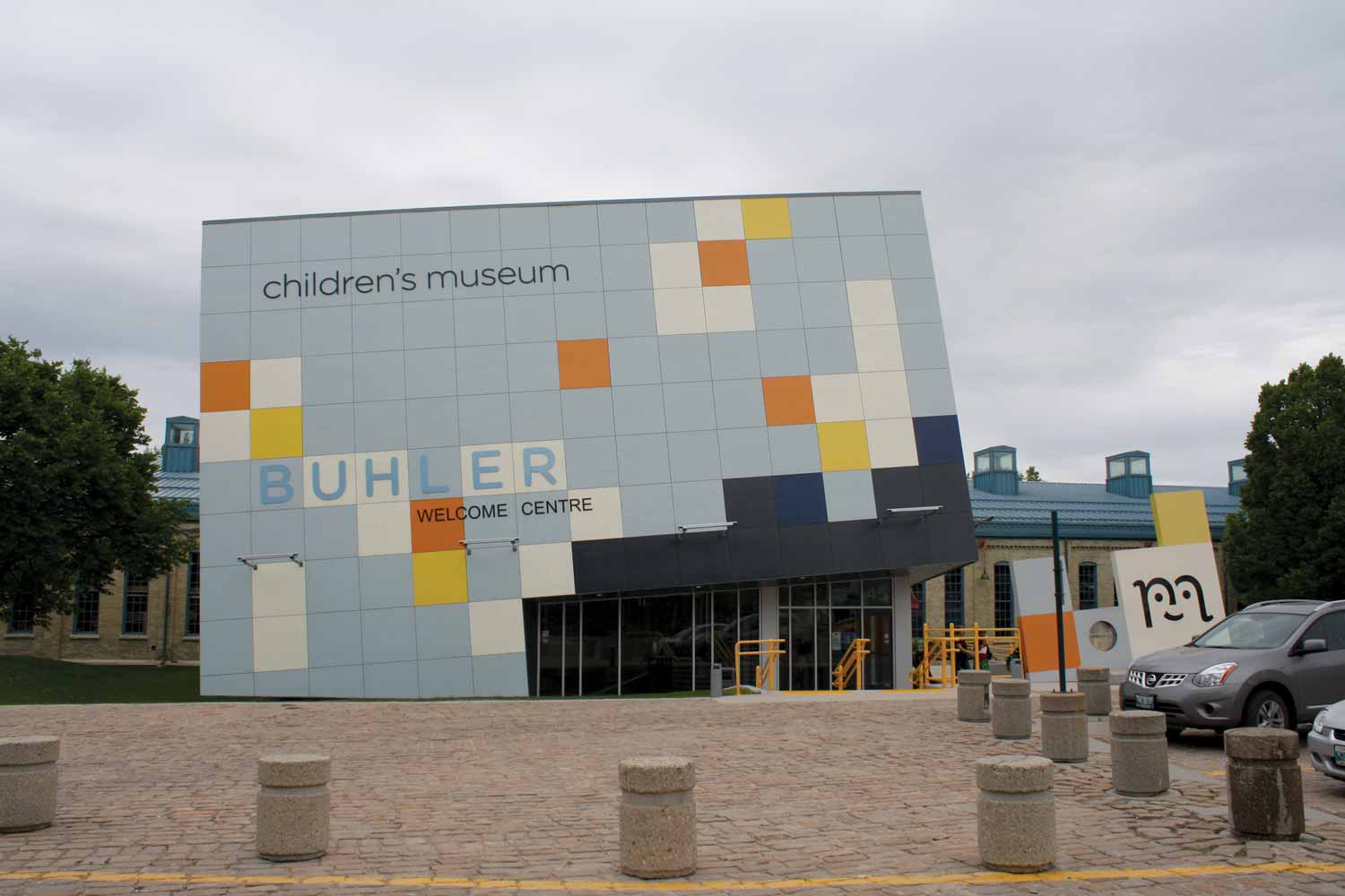
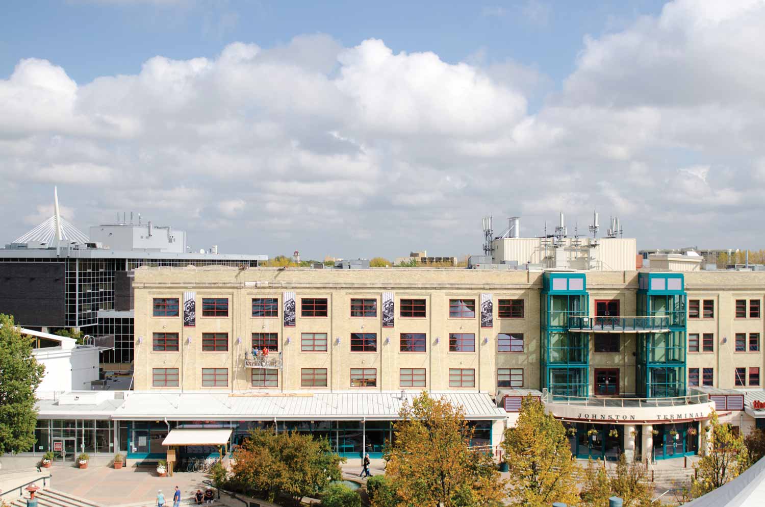
The first successful building reuse opened in 1989 with The Forks Market in the two former railway cartage stables. The nearby Johnston Terminal, built in 1929, was initially slated to be redeveloped as a hotel, but when the financing failed to materialize, it was adapted as commercial/office space with the Manitoba Travel Centre constructed on the west end to provide tourism information. Arguably the most successful conservation project in this first phase was the old railway engine house, the B&B Building, the oldest structure on site. In 1994, after a successful rehabilitation designed by Cooper Rankin architects, the Manitoba Children’s Museum moved from its original home in the Exchange District into the completely renovated space. It quickly became a popular destination. The last redevelopment of a railway structure was the former steam generating plant into CityTV in 2000.
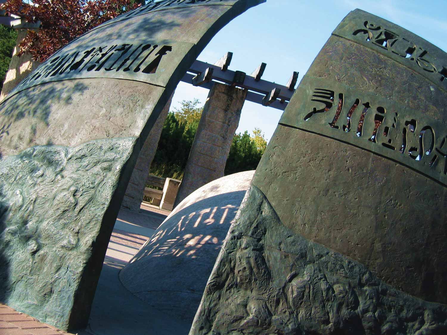
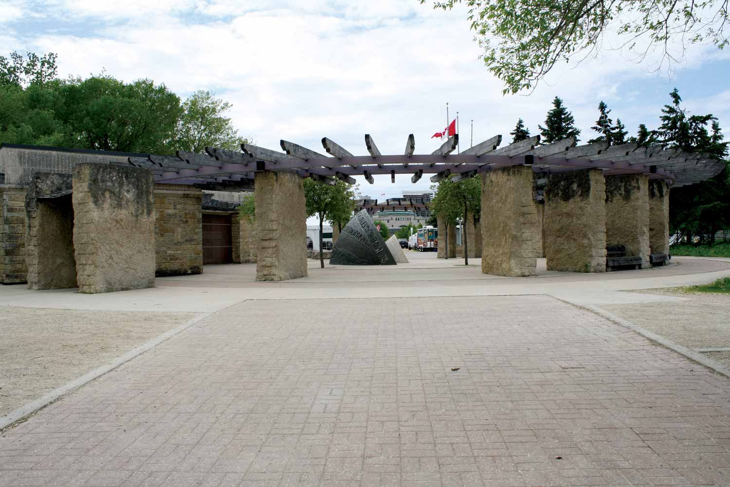
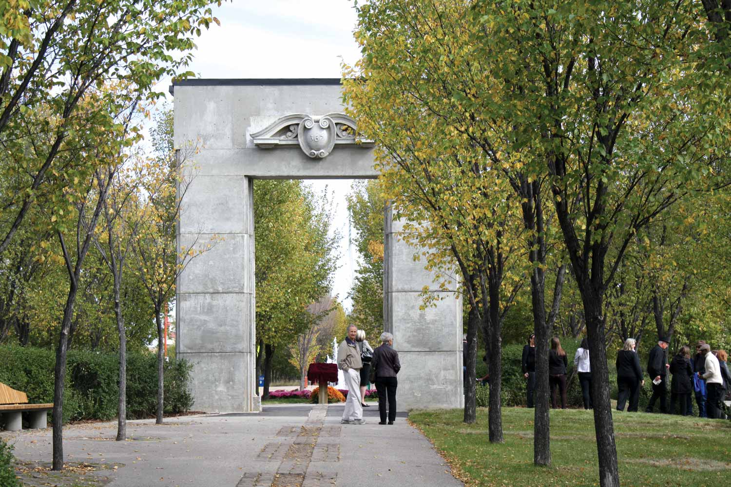
The Forks National Historic Site opened in the summer of 1989 under the management of Parks Canada, just as The Forks Renewal Corporation began Phase I of the transformation of the East Yards. While the modern Forks can boast a seamless delineation among the various property owners, in these early years the FNHS was physically isolated as a public destination. Site designers chose to pick up the use of limestone as a signature building material, which had been showcased in many ARC projects. The entrance to the FNHS was defined not by a structure but by an award-winning sculpture created by Marcel Gosselin, titled ‘The Path of Time’. The sculpture is made up of two bronze shells surrounding a limestone centrepiece, and accompanied by stone benches and an interpretive wall.
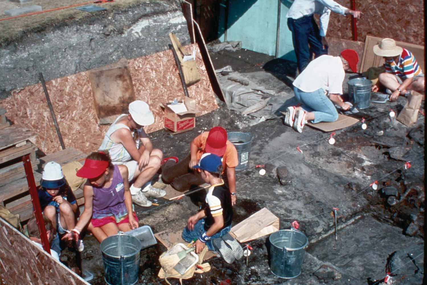
This decision by Parks Canada and the FRC not to dedicate one specific heritage building to narrate the overall history of the site, influenced other heritage resources and activities. Attention and investment in the site’s rich archaeological base formed an important component in the development process. Parks Canada’s professional archaeologists initiated study through projects and surveys to complement the site development nodes. Sid Kroker’s retention as site archaeologist by the FRC began a 20-year professional association that consolidated the site as a rich repository of cultural knowledge and an important gathering and trading site over a 6,000 year time span.
Between 1989 and 1994, a program of very popular public archaeological digs took place under the direction of Sid Kroker and the Manitoba Museum’s longtime Curator of Archaeology, Leigh Syms. In the first year, the program had 25,000 visitors and hundreds of participants who worked directly on the archaeological resources under the supervision of a professional. For three years, investigations continued at Fort Gibraltar II and Fort Garry I, and then relocated for two more years to the 3,000-year-old campsite near Johnston Terminal. Despite the positive response to these public digs, funding challenges brought the program to a halt after the 1994 season. Fortunately, Kroker and his archaeological team continued to pursue excavations associated with The Forks’ developments right up to the construction of the Canadian Museum for Human Rights.
Parks Canada introduced other activities to tell the broad story of The Forks site including interpreters to lead tours. The Forks Renewal Corporation developed The Forks Ambassadors program, volunteers who assisted at special events, met VIA trains, and patrolled the site offering general information. Another innovative and popular interpretation program sponsored by the FNHS was its Heritage Theatre program. Costumed animators from different historic eras interacted with visitors at various locations, presenting vignettes on themes such as the fur trade, immigration to Manitoba, and other site-related stories, which became an effective way to engage the first generation of visitors to The Forks.
Public archaeological dig (Parks Canada Agency, Terrestrial Archaeology)
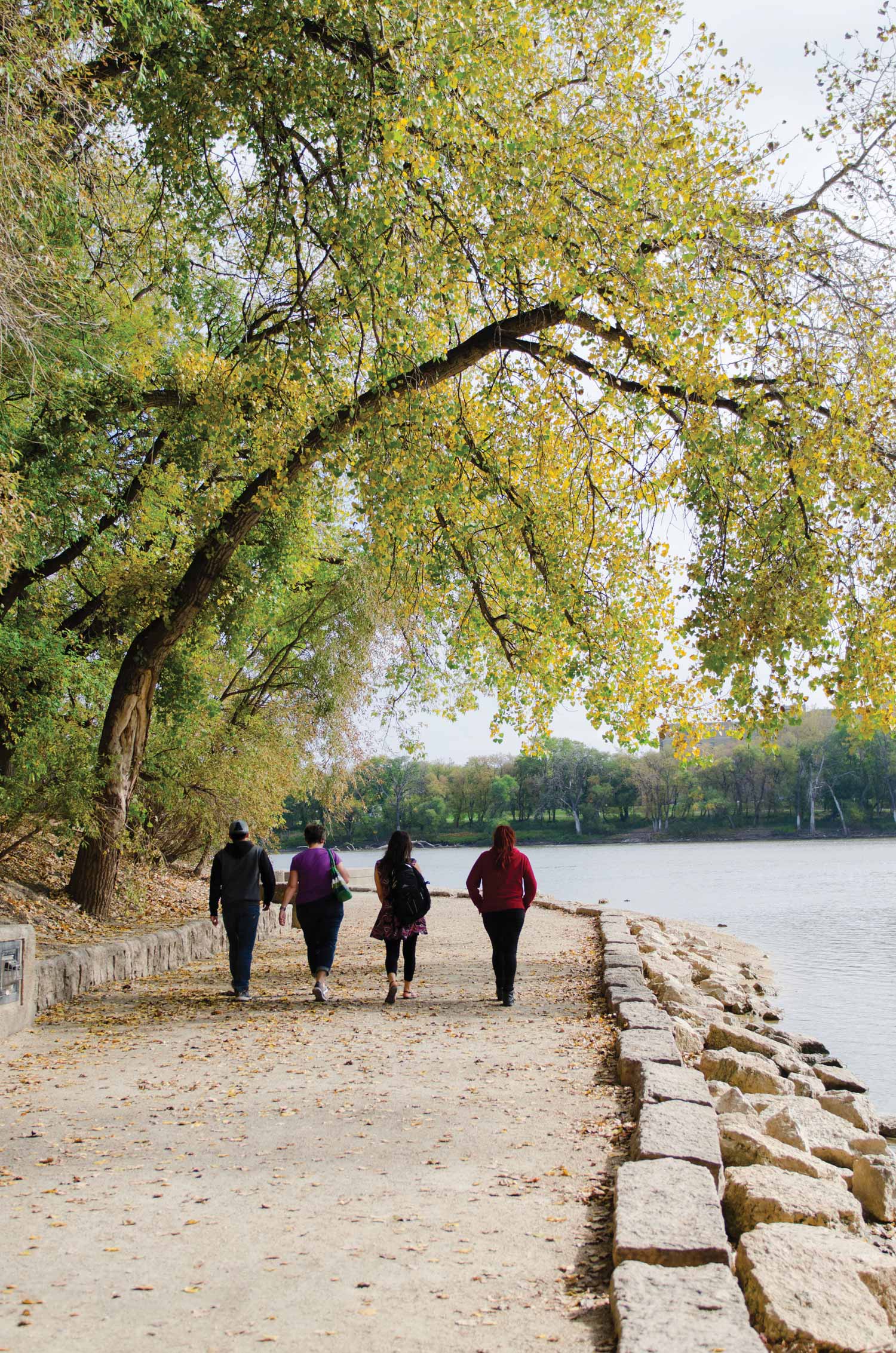
During this first phase of development, emphasis was placed upon physical amenities that allowed for pedestrian access, particularly to the riverbank. The opening of The Forks River Walk was an immediate hit with Winnipeggers. Initially designed by Garry Hilderman as part of the FNHS, a second stage of the walkway was completed in 1989 from the river junction to the Main Street railway bridge, designed by architect Steve Cohlmeyer. Convinced that the River Walk should continue along the north bank of the Assiniboine River, the Province invested $3 million in the early 1990s to extend it to the Manitoba Legislature and its major access node. While this walkway provides users with an all-season resource to connect with the Red and Assiniboine rivers, its engineering model did not predict the changing nature of the climate that saw increasing flooding. The resulting inconvenience and cost to clean up the layers of river gumbo is challenging. However, when it is open, joggers, walkers, fishers, and other users enjoy this tremendous recreational resource.
Planning The Forks
A significant challenge during the first phase of development was to find creative ways to connect the buildings with the landscape. While a generation of professionals from different disciplines have applied their skills, landscape architects Garry Hilderman and Cynthia Cohlmeyer, complemented by architects Steve Cohlmeyer and Etienne Gaboury, have arguably exerted the most influence over defining the landscape features at The Forks. While Hilderman was instrumental in shaping the physical character of the national historic site, the Cohlmeyers oversaw the design of The Forks Market Plaza and canopy and The Forks Historic Port, as well as distinctive elements such as the Tall Grass Prairie Garden. Steve Cohlmeyer was retained as the planning advisor for The Forks Renewal Corporation from 1995 to 2007.
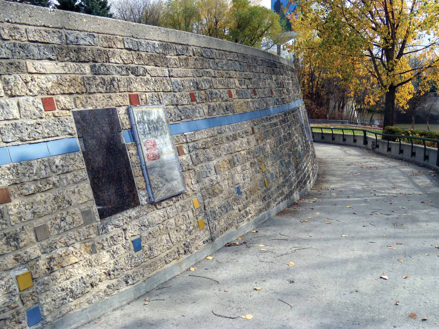
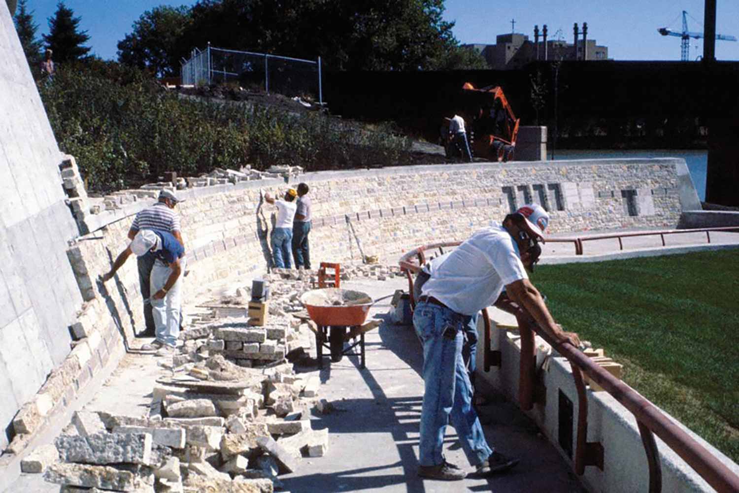
The Cohlmeyers’ creative approach to public space emphasized that a design must always be mindful of what attracts people. The design should make them comfortable and give them an incentive to explore and to return.5 An excellent example of this philosophical approach translated into a practical design is The Forks Market Plaza and Historic Port. With its many levels, beginning with open space by The Forks Market, the site proceeds across the Plaza, and connects to the Port by stairs and by the ‘Wall Through Time’, a curving limestone wall around the edge of the Archaeological Preserve down to the River Walk.
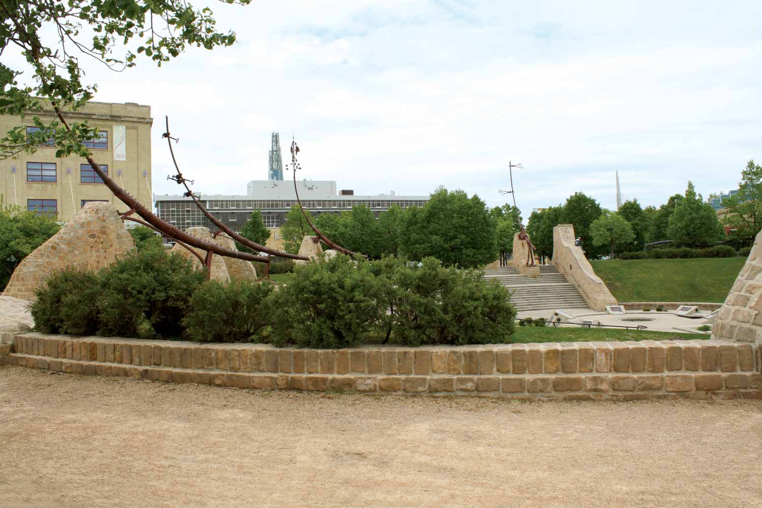
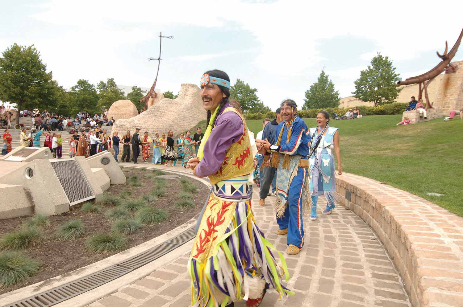
Another key landscape feature in this first phase plan was a design and installation of landscape architect Garry Hilderman and his associates, commissioned in 1993 to create a spiritual and ceremonial ‘heart’ for The Forks. Oodena Celebration Circle is a rounded bowl, constructed of cobblestones with buttress surrounds, open to the elements, and designed to put visitors in touch with the Earth’s natural forces of air, water, earth, and sky. “Oodena was created to remind us how man related to the elements before technology came along," commented Hilderman. Over the years Oodena has become a centre of activity, particularly for Manitoba’s Indigenous population who gather there for events and celebrations.
The FRC has supported a network of advisory committees with expertise in the areas of heritage, planning, First Nations’ issues, and site design. A key player in this early Forks phase was The Forks Heritage Advisory Committee, established in 1988. This committee, which still meets today, includes expertise in archaeology, history, aboriginal affairs, architecture, and site operations, as well as individuals with a passion for presenting Winnipeg’s past. This lens on heritage was captured in the 1993 The Forks Heritage Interpretive Plan, a comprehensive review of the site from the perspective of its natural and cultural heritage. The plan set out how The Forks could approach the interpretation of its heritage resources. It established seven major historic themes and topics that should be emphasized and it provided guidelines for appropriate resource management and public history activities.
The Heritage Interpretive Plan strongly advocated that the First Nations’ stories at The Forks, which span 6,000 years, should be provided with a prominent place to celebrate their cultures. While proposals have been contemplated and not pursued, The Forks Board committed South Point, a six-hectare tract of land on the south side of the Assiniboine River at the confluence of the rivers, to be used by the Indigenous community when they are ready to proceed. This peaceful, treed green space, crisscrossed by paths and backed by the Norwood Bridge, is a counterpoint to the busy developments on the north side of the Assiniboine.
By the completion of the Phase One Plan in 1994, The Forks had emerged as a popular site combining commercial and cultural entities located in several adapted historic structures, surrounded by landscaped green space and anchored by the Forks National Historic Site property. The north end of the site leading up to Provencher Bridge remained largely undeveloped, its future a source of vigorous debate in public meetings. There were basically two camps of public opinion: those who supported a continuation of mixed-use development highlighted by public attractions and a vocal community who believed green space should be the dominant land use. This tension would characterize public discussion over the next two decades of Forks development.
Planning The Forks, Phase Two
The Phase Two Plan began in 1995 with a new board under the chair of Ernie Keller and CEO Kent Smith. The new master plan divided the site into seven precincts ranging from the ‘South Point Precinct’ on the southern boundary to the ‘Marina Precinct’ on the western river edge beyond the Provencher Bridge. Despite the popularity of The Forks, the site was not paying its way. The new board was faced with the challenge of operational sustainability as the federal and provincial governments wound down their financial support. To meet this situation, the Forks Renewal Corporation was merged with the North Portage Development Corporation in 1995, allowing annual revenue shortfalls to be absorbed by the newly created Forks North Portage Partnership. This allowed North Portage parking revenue to be allocated to The Forks for its ongoing operation and capital development.6
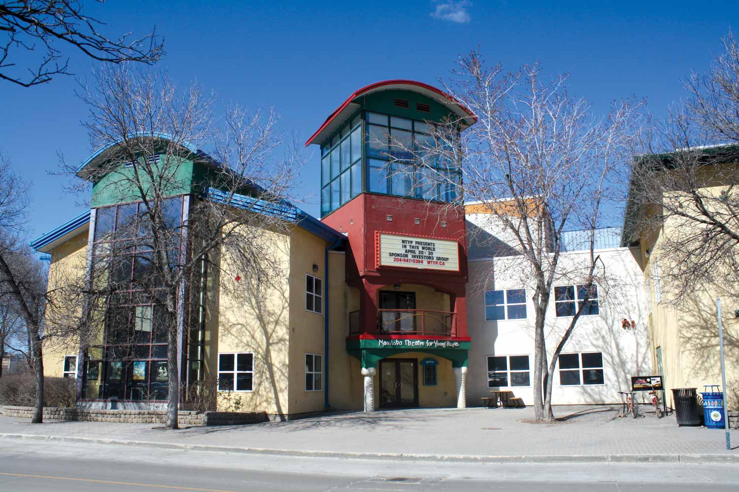
This new entity met the financial challenge in part by transitioning into public-private partnerships as a business model. In 1995–96, the old steam plant was converted into studios for A-Channel Television (now CityTV) with the financial backing of the Craig family from Brandon. In 1998, preparation for the Pan-American Games led to a partnership between the federal government, the City of Winnipeg and Winnipeg entrepreneur Sam Katz to build CanWest Global Park, a baseball stadium beautifully situated slightly beyond the northwest corner of The Forks, north of Water Street (now William Stephenson Way). In 1999 the Manitoba Theatre for Young People (MTYP), joined forces with CanWest Global and the Forks North Portage Development Corporation to build a new $4.6 million theatre complex on Forks Market Road. MTYP was the first free-standing new construction at The Forks.
These changes to the built environment in the late 1990s overshadowed a key goal of the Phase Two Plan to focus upon a greater integration between The Forks and its neighbours. To accomplish this ‘making connections’ theme, program funding was set aside to enhance road linkages integrating with the downtown, an improved pedestrian and bicycle environment, and most importantly, arrival gateways to emphasize the unique sense of place. The best representation of this gateway concept is the dramatic improvement to the York Avenue thoroughfare on the north end of the site. In 1996 The Forks Access Project was approved by City Council. The scope of the work included replacement of the railway bridges and the widening of York Avenue to four lanes, as well as a vignette sculpture of a family travelling by Red River Cart. In addition, the two lane section of Pioneer Boulevard was upgraded to four lanes and extended to Lombard Avenue.
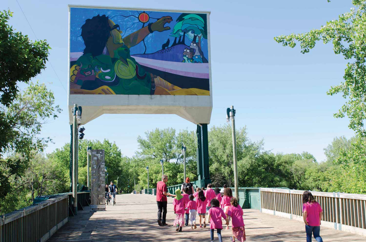
Refurbishment of the Historic Rail Bridge was undertaken through the Winnipeg Development Agreement in partnership with the City, the Province and the Pan Am Games Society. This was a $785,000 project that included restoration of the bridge for pedestrians and cyclists, lighting and a pathway connection through the South Point to Main Street. The Forks Aboriginal Planning Committee launched a design competition that rendered an Indigenous-themed mural on the large concrete counter-weight in the middle of the old bridge. Slowly but surely, The Forks property was connecting with the surrounding urban environment.
The Challenge of Water
As the regeneration of The Forks gained momentum in the late 1990s, there was a looming threat along its river boundaries. From 1994 onward, high water levels interrupted access to the Red and Assiniboine rivers, the River Walk, and The Forks Historic Port. In the summer of 1996, the water did not recede until the end of June. Then in 1997 the rivers rose twice. The spring inundation, declared the ‘Flood of the Century’, brought the highest water levels since the devastating 1950 flood. The Forks became the epicenter as local, national and international media were dispatched to record this destructive phenomenon. As a precautionary measure, temporary dikes were constructed behind the Manitoba Children’s Museum and through the Parks Canada property. The annual cleanup and repair bill as a result of the high levels of water has continued to grow annually.
The scale of the flood and the yearly costs associated with the River Walk cleanup tested the resolve of the managers responsible for the National Historic Site and the Forks North Portage Partnership. While the two organizations continued their operational support for the popular River Walk, Parks Canada shifted its summer programs away from its amphitheatre. The Forks management, however, was committed to the Historic Port and its link to the year-round activities to the degree that it had little choice but to continue its investment.
The 1999 Pan American Games left a significant footprint at The Forks and created a whole new level of public expectation. Fifteen nights of free evening concerts drew thousands of people to the newly-constructed Royal Bank Stage (later renamed Festival Stage). That summer, visitors were also introduced to the Tall Grass Prairie Garden situated on the Archaeological Preserve. This creative garden was a re-creation of the ecologically diverse grasslands that had once swept the landscape of Manitoba. Planned and designed by landscape architect Cynthia Cohlmeyer, plants and herbs were gradually added over the next five years. When the Tall Grass Prairie Garden was completed in 2005, it contained a collection of 10,000 plants augmented by two interactive interpretive kiosks developed in partnership with the Nature Conservancy of Canada.
The Forks Turns 20
The new millennium marked the introduction of the Ten Year Concept and Financial Plan for The Forks North Portage Partnership (FNPP).7 While this planning document set out the organization’s vision for the 2000–2010 period, it built upon the legacy of the first 20 years of development which had seen The Forks become Winnipeg and Manitoba’s most popular tourist attraction. This plan would be shepherded by a new chair, former Winnipeg mayor Bill Norrie, with CEO Jim August, former manager of The Core Area Initiative and an individual steeped in experience working collaboratively with the three levels of government. Norrie and August would draw upon this extensive public experience because projects contained in the new plan, such as the hotel and parkade, rekindled public debate between advocates of development and champions of open space. Ultimately, The Forks administration met this challenge by balancing new infrastructure with carefully considered additions to the green space such as Broadway Promenade leading to Esplanade Riel and St. Boniface.
In 2002, the Forks North Portage Partnership approved plans for the Inn at The Forks, a 116-bed hotel, after considerable controversy. Its careful design and implementation under the ownership of the Sparrow family was recognition that The Forks would benefit as a tourism destination by having an on-site hotel. The Inn opened in 2004, complemented by the construction of a 285-stall parking structure north of the Inn and adjacent to the Manitoba Theatre for Young People. While these two structures had to weather considerable criticism that The Forks was becoming overly commercialized, Esplanade Riel and the water taxi service were well received by Forks aficionados.
The tall, cabled design of Esplanade Riel pedestrian bridge over the Red River not only added a striking portal, but it strengthened the link with Winnipeg’s francophone community. Visitors to The Forks could now walk comfortably to attractions such as the St. Boniface Museum and St. Boniface Cathedral, restaurants and stores across the river. The water taxi service headquartered at The Forks Historic Port offered visitors an opportunity to view the city from a fresh perspective.
New Initiatives
With the new hotel and parking structure in operation by 2005, The Forks North Portage Partnership turned its attention to refining the recreational and visitor amenities throughout the site. An indication of its maturity was the creation in 2004 of The Forks Foundation, a charitable organization established to raise funds to support and enhance public recreational and cultural amenities at The Forks. One of the first tasks of the Foundation was to work with the Burns Family Foundation, who made an extraordinary donation toward the 2006 construction of a world-class skateboard plaza beside Festival Park. This 4100-square-metre (44,000-square-foot) dynamic facility signalled to the youth of Winnipeg that they were welcome at The Forks. The skateboard plaza complemented the opening of a fresh winter attraction in the Festival Park area.
The development of a winter trail through Festival Park includes 1.2 kilometres of skating trails, a skating rink, lighting, a toboggan run, and a custom-designed snowboarding hill. This complements the increasingly ambitious skating trail along the Red and Assiniboine rivers, which showcases the Warming Huts.
A major strength of The Forks Renewal Corporation has been its ability to generate and sustain creative and popular programs. In 2010 the organization introduced its international Warming Hut competition, branded as ‘an Art + Architecture Competition on Ice’. This is an opportunity for architects and designers to develop their designs for warming huts. The winners are invited to Winnipeg to install their creations on the river trail, which in recent years has been on the Red River heading south as far as the St. Vital Bridge.
While The Forks gradually grew its facilities and programming in the first decade of the new millennium, the largest project in its history was gaining momentum. As early as 2000 prominent Winnipeg businessman Israel (Izzy) Asper was promoting the idea of a ‘tolerance museum’ to be located in Winnipeg. This early discussion of a new museum did not warrant mention in FNPP Business Concept and Financial Plan of 2000. However, on April 17, 2003, the 21st anniversary of the signing of Canada’s Charter of Rights and Freedoms, the establishment of the Canadian Museum for Human Rights (CMHR) was announced as a joint partnership of the Asper Foundation, the Government of Canada, the Province of Manitoba, the City of Winnipeg, and The Forks North Portage Partnership. That same year, the Friends of CMHR launched one of Canada’s largest international architectural competitions and the winner was Antoine Predock, a celebrated American architect. The only location under consideration for this ambitious project was the undeveloped parcel of land on The Forks’ north-east quadrant.
On March 13, 2008 the Government of Canada passed Bill C-42, changing the National Museums Act to allow for the first national museum in nearly 50 years and the first national museum to be constructed outside of the capital region. While work proceeded on building design, the fact that this new museum was on Treaty One territory reinforced the federal and provincial legal requirements for archaeological investigations. From 2008 to 2012 more than 400,000 artifacts were recovered, dating as far back as 1100 AD.
On December 9, 2008 there was a ground-breaking ceremony at The Forks, and construction by main contractor PCL began in April 2009. The vision translated into a complex and expensive project that ultimately cost $351 million. The CMHR held opening ceremonies on September 19, 2014.
For the FNPP and the Forks National Historic Site, the emergence of the CMHR represented a challenge from a planning perspective. The new museum would attract more visitors to The Forks, require an updated transportation strategy, and reinforce the need to reassess their own programs and activities. The same year the construction of the new museum began, the FNPP introduced an ambitious commitment to explore ways to reduce The Forks’ carbon footprint with their Green Initiative, branded as ‘Target Zero’. They converted The Forks Market to a geothermal heating and cooling system, installed a bio-composting system, and introduced the conversion of waste fryer oil to bio-diesel fuel to power site equipment including the zamboni on the river trail. The next frontier in this program is research into the application of solar energy to power the site’s many facilities.
The year 2009 also saw Parks Canada announce the Variety Heritage Interpretive Play Park as well as an investment of $1 million of federal infrastructure funds to update the lighting, signage, amphitheatre and river walkway surface within the national historic site.
In 2010 the FNPP held a series of public consultations and open houses to prepare The Forks 10-year concept and financial plan, Building Connections 2010–2020. This planning exercise reinforced the original mission statement from the 1989 Forks Renewal Corporation plan which declared that The Forks would be developed as a special and distinct ‘meeting place’ at the junction of the Red and Assiniboine rivers, through a mixed-use approach including recreational, historical, cultural, residential, and institutional/commercial use. The Forks was entering a decisive decade in fully meeting this vision for the former East Yards. What remained absent in this mix was any headway on a residential component. That would be the key challenge for this next chapter of The Forks’ regeneration.
The Forks North Portage Partnership continued to build strong connections to the greater Forks area including management services for the Upper Fort Garry Provincial Park. During this era of large cultural projects, the FNPP continued to enhance connections within The Forks. A good example was the gradual refinement of Broadway Promenade, the pedestrian corridor between Esplanade Riel pedestrian bridge, Union Station, and the Broadway corridor. In keeping with the area’s visual axis, the Promenade restores the original connection between downtown Winnipeg and St. Boniface. Additions include an Indigenous interpretive site, fountain, and the Alloway Arch architectural remnant, all shaded by 200 elm and oak trees.
In 2010 The Forks was recognized for its contribution to the City of Winnipeg by the Canadian Institute of Planners when it was named ‘The Top Public Space in Canada’. Comfortable in its role as a catalyst for innovative planning, in 2011, FNPP joined forces with the City to develop a revitalized vision for Winnipeg’s waterfront. The result was a 20-year plan entitled Go to the Waterfront.8 The main objective was to celebrate Winnipeg as a river city, provide connectivity along the riverfront, and inspire and guide new development. At its heart, this waterfront vision was intended to transform core neighbourhoods by making the rivers integral to Winnipegger’s everyday lives. It envisions a role for the FNPP as a catalyst and possibly as a waterfront development corporation.
The FNPP also addressed the future of land referred to as the Rail Side Lot, a well-utilized surface parking lot. By 2012–13 FNPP had launched an integrated planning initiative for both this Rail Side property and the City of Winnipeg’s adjacent Parcel 4 lands. Recognizing the importance of this land as its last major undeveloped space, The Forks launched an extensive planning initiative involving a public engagement process, stakeholder interviews and citizen workshops. A final Concept and Development Plan was released in the spring of 2014.
That year saw the appointment of a new CEO, Paul Jordan. Jordan had worked at The Forks since 2004, and was particularly responsible for introducing the River Trail.
The revitalization of the Rail Side and Parcel 4 lands will complete the brownfield reclamation of the former CNR East Yards. The plan, which is framed as a 25-year vision, emphasizes that the public realm is the backbone of the plan. Buildings and transportation facilities will support and enhance these new public spaces, creating a rich and multi-faceted tapestry which is attractive and inclusive. One of the central tenets of the plan is a proposed ‘residential village’ of medium density, interesting public spaces, high quality design and closely spaced storefronts at ground level. Another intriguing aspect is the introduction of an elevated pedestrian corridor or ‘highline’ adjacent to the existing rail line. This would create a unique elevated open space and provide additional pedestrian connectivity between the Rail Side and Parcel 4 lands and potential new linkages to Main Street.
This emphasis on connectivity to downtown Winnipeg and riverfront neighbourhoods is an encouraging development in the modern era. It represents maturation in the overall planning and development of The Forks as it has undergone an extraordinary transformation since 1970. The challenge in developing and sustaining a large and diverse land base like The Forks is ensuring a balance among the natural environment, infrastructure, long-term commercial viability, and community relevance. The ongoing positive response of visitors to The Forks is a strong indication that this regeneration process will continue.
A Self-Guided Tour: Architecture & Landscape Features at The Forks
There is a wide variety of buildings and landscapes features at The Forks and its immediate vicinity. Indeed, it is an excellent collection of designs from many of Winnipeg’s most prominent building and landscape architects. The features can be broken into three time periods: the fur trade era, the railway era, and the modern era of regeneration. The historic influences have impacted the aesthetics of some of the contemporary buildings, in expressing the themes determined in the planning process for early generations of Forks’ development. Serving contemporary commercial or institutional functions, the designs of the newer buildings have minimal historic references and yet are respectful in their orientation, scale, materials, and some details. What we have is a dynamic collection of form and function in support of The Forks’ ongoing mandate as above all else, a meeting place and a personal experience.
One unifying feature at The Forks stands out visually. In acknowledgement of the water that embraces and defines the site, the blue swath of metal roofing over The Forks Market is showcased in the glass and steel of its prominent tower. The colour repeats within a glass and steel addition on the south side of Johnston Terminal and in a lighter blue on the roof of the Children’s Museum. Blue is used on canopies, sign posts and railings, the tiles on the Wall Through Time, and the pillars on The Forks Market Plaza, as well as on the roof of the boat rental kiosk. On a sunny day, the segmented glass carapace (protective shell) that forms the walls and roof of the Canadian Museum of Human Rights also reads as a soft blue.
The older railway structures were purpose-built for industrial and commercial use, and served those functions long enough to have been altered and renovated over time. These are, and always have been, working buildings—even the glamorous Union Station. Fortunately the decision was made to recognize the architectural and historical significance of the buildings and give them new uses through thoughtful planning and design.
When the transformation of The Forks from the East Yards was first considered, the site was a collection of disused industrial tracks, freight sheds, and warehouses—ramshackle, crowded, and grimy. The rivers were inaccessible to most citizens and natural vegetation had mostly been decimated. That any of the architectural gems we have today have been retained and presented in a lush setting of greenery, is a tribute to this stubborn vision for a public space to be shared by citizens, visitors, and businesses.
As acquisition of the land for The Forks took two decades, early regeneration was slow. The Forks National Historic Site was marooned on the riverbank by itself for some time. Meanwhile, the messy process began of removing the many lengths of rail track, the support structures, pulling up and storing the heavy cobblestones for reuse, removing the industrial detritus of a century, levelling the site, and installing its sub-surface services. Those buildings which were made of brick or limestone (the NPMR repair shop, the stables/garages, Johnston Terminal, and the steam plant) had acquired a thick coating of coal soot, topped by an oily sheen of diesel fumes; these had to be cleaned inside and out. Preparation for any reuse or new construction was arduous and costly. The site as a whole was a great leap of faith that depended upon the steadfast commitment of all three levels of government and The Forks Renewal Corporation.
You may chose to walk about The Forks tour in any order. Certainly the buildings and landscapes of each era have their merit and story. In this book, we are presenting the structures in a chronological order (order of original construction), followed by landscape elements. This does not correspond exactly with how the older structures were adapted within the modern era, especially in the early 1990s when there was a surge of development.
Tour stops are in chronological order (to original date of construction).
Upper Fort Garry Gate is a multi-level shell structure, built of limestone and wood in 1835. This is by far the oldest extant site in the modern-day narrative of The Forks. While not physically connected, their histories are intertwined. First the site was an active fur-trading post. Then it was a small city park with the ruins of Upper Fort Garry, hardly visible to Main Street. In 2010, the site has been given much greater profile through its designation as an urban Provincial Park. Although it is now primarily a cultural landscape, its creation as a provincial park speaks to its significance as the economic and social centre of Red River and early Winnipeg.
The earliest fort in this location, Fort Gibraltar I, was a modest trading post built in 1809 by the competing North West Company fur traders. It was taken over by the Hudson’s Bay Company in the merger of the two fur trading companies in 1821, and renamed Fort Garry in honour of the HBC’s special agent Nicholas Garry. That older, smaller fort was destroyed in a flood in 1826, and rebuilt as a much larger complex beginning in 1835. At that time, the HBC’s sphere of influence in North America was larger than all of Europe. This substantial fort complex came to serve as a trading post, a trans-shipment nexus, a warehouse for various provisions, as well as a processing facility for the furs that were the source of its wealth. It served as the administrative centre of the Hudson’s Bay Company’s operations in Rupert’s Land.
Beginning in 1846, Upper Fort Garry served as a garrison for imperial troops, Britain’s first military presence in the west, whose soldiers joined in the life of the colony and provided a source of labour for construction of the fort’s facilities. Upper Fort Garry also contained a courthouse and a jail. Most importantly, its buildings housed those political leaders whose actions led the district into Confederation in 1869–70, and represent the role of governance that made Canada a trans-continental nation across northern North America.
Most of the buildings within the stone walls were Red River frame or post and beam construction with a couple of simpler wood frame construction. Originally surrounded by large limestone block walls, with magnificent rounded bastions on each corner, the fort grew beyond the walls during expansion in the 1850s. Although definitive to the concept of a fortress, the stone walls and bastions were not particularly functional, but were effective in proclaiming the status of the Company and for intimidation against American incursions. They did prove handy for storage and as lookouts.
Upper Fort Garry was gradually demolished between 1881 and 1888. Some limestone block from the walls and large hewn beams, left behind by nineteenth century flooding, were eventually carted away for construction in the growing city. The Hudson’s Bay Company had sold off most of its Reserve lands adjacent to the fort, but retained ownership of those lands that became the East Yards. The company was eventually convinced by the public to donate the small parcel of land containing the old Governor’s Gate as a park, the genesis of this new provincial park. The former HBC warehouse site remains, and is now the North West Company’s offices just south of Union Station at 77 Main Street.
The old fort was oriented squarely to the riverbank, producing an angle which became inconvenient to the modern traffic grid. The footprint of the new park, true to its origins, seems to slice across its contemporary setting, wedged between Fort Street on the west side and angling towards Main Street. Placement of the present fort structures was determined from careful research of historic photographs, drawings by the soldiers, HBC documents, and archaeological investigations.
Through community initiative and fundraising, plans for the site shifted from a residential highrise to a public amenity. On June 1, 2009, the City transferred title to the Friends of Upper Fort Garry. In 2010, the Manitoba Legislature declared it a provincial park in the heart of the city. With management assistance from the Forks North Portage Development Corporation the plan is to develop an interpretive centre and accompanying programs.
Upper Fort Garry Provincial Heritage Park aerial view (The Forks, 2015)
In 2015, the first phase opened. Based on designs by Cohlmeyer Architects and HTFC Planning & Design, the park uses a parterre plan (an ornamental garden with paths between the beds) with signage, landscaping paving, and strategic lighting, to outline and interpret fifteen of the fort buildings.1 A dramatic 400-foot Corten steel wall is inscribed with graphics, speakers, and a digital light array that will showcase community-based programming and content. Detailed information on each element can be accessed by QR codes. The Governor’s Gate, the only part of the original fort, provides a formal entrance on the north end of the new park.
As the park lies just beyond the west boundary of The Forks, separated since the railway years by the CNR highline, its link to The Forks through two portals is important in establishing the historic connection.
B&B Building with diesels (Library & Archives Canada, 1950)
formerly Northern Pacific and Manitoba Railway Engine House; also known as the B&B Building, Bridges and Buildings
The Railway Era
The Northern Pacific and Manitoba Railway (NPMR) Repair Shop is the oldest building at The Forks and the oldest surviving railway repair facility in Manitoba. Built in 1889 as a train repair shop, the T-shaped structure now houses the Manitoba Children's Museum. The utilitarian brick shop, designed by John Woodman, the NPMR's construction superintendent and subsequently a prominent Winnipeg architect, is a typical example of a late nineteenth-century industrial building. It was used for car and engine repairs until 1909, then accommodated various other functions for the NPMR's successors, the Canadian Northern and Canadian National railways.
As an engine house, it was a utilitarian design built for heavy industrial use. One storey high, the buff brick building is rectangular at 241 × 100 feet (73.4 × 30.4 metres). The blacksmith shop, in a wing separated by a fire wall on the east side, measures 71 × 56.6 feet (21.6 × 17.5 metres). The building rests on concrete footings, excavated in 1988, and found to reach approximately one metre deep.1 The roundhouse on the north end was removed, but openings on that side speak clearly of that function. Red brickwork outlines the large openings to the four tracks. Three of the four massive track doors have had two rows of windows added. These doors remain operative as loading doors for museum exhibits.
The ceiling on the engine repair house rose above the bracketed wood columns for a span of 30 metres at a height of 4.5 metres, supported on a system of wooden trusses. This section had been refitted with a low-angled roof, inset with smoke jacks and skylights, when renovations were made in 1936, possibly due to a fire.
The Manitoba Children's Museum (Winnipeg Free Press, 1994)
While the interior has seen much change, careful restoration in 1994 preserved many elements which express the building’s historic use. The original pitched roofline has been restored using steel trusses while still retaining the heavy wood columns. The work pits were filled in. Raised skylights again dot the roofline, which now features a blue metal roof. This colour repeats in the window trim. The side walls are divided into shallow bays with long twinned windows in each bay. The windows feature rounded heads, painted trim and limestone sills. There is brick corbelling band running above the windows. The smithy portion on the east side has seen the least alteration. It features a loading area with a large set of original double doors.
The design of the 1889 engine house and roundhouse was listed on its building permit as a ‘standard second class Northern Pacific roundhouse’, indicating its American origins. It was a scaled-down version in relation to other contemporary rail facilities and certainly compared to the more modern scale of the Fort Rouge and Symington yards. Design of the engine house portion was credited to the Superintendent of the NPMR, John Woodman; the firm of Rourke and Cass were listed as contractors.2
Now bursting with the energy of children’s discoveries in a wonderful learn-and-play facility, the structure has a past fuelled by energy of a much different kind—steam. In 1888, as the Manitoba government grappled with providing facilities for its newly-developing farmlands, it chartered the NPMR branch line. Land was purchased from the Hudson’s Bay Company in the shape of a crescent running north along the east bank of the Red River. First a bridge was erected to cross the Assiniboine (replaced by the present Forks Historic Rail Bridge), then the site was filled and graded, and in 1889, this repair shop was completed for the rolling stock. The public facilities of the line, a passenger station, and a luxury hotel, were situated away from the noise and smell on the north end of the property along Water Avenue closer to Main. Freight sheds, coal storage sheds, and marshalling track soon filled the rest of the site in what became the East Yards.
The engine house and attached roundhouse handled repair and maintenance of the rolling stock. Four tracks led from the NPMR bridge to the car repair shop on the south side, proceeding through to the roundhouse on the north to be repaired or turned. Presently a restored passenger coach has been installed entering the south train doors of the museum. The rest of the train (a second coach and a magnificent 1950s diesel locomotive) is inside the museum. The railway provenance of the old engine house is beautifully proclaimed.
Exterior (Sheila Grover, 2015)
The engine house was one of the first of The Forks historic structures to be identified for adaptive reuse as the Manitoba Children’s Museum in 1994. After 20 years the Children’s Museum needed to be refreshed from stem to stern. Toboggan Design from Montreal was hired to develop a new concept for the exhibits that would engage and excite the museum’s young target audience. Achieving the vision of a rejuvenated museum involved the complete renovation facility including the expansion of the exhibit hall, the creation of new multi-purpose rooms, and new office space. The finishing touch of the project was a new 1400-square-foot Welcome Centre addition to the original building, designed by Syverson Monteyne Architects.
Built in 1908–11 to the design of the New York architectural firm of Warren and Wetmore, Union Station is one of the finest examples of a Beaux-Arts-style railway station in Canada. The choice of these architects, who also built Grand Central Station in New York (1903–1913), expressed the confidence and swagger of the period when only the biggest and best would do. As a joint venture between the Canadian Northern Railway, the National Transcontinental Railway and the Grand Trunk Pacific Railway, and later the Dominion Government, the construction of Union Station expressed the confidence of both the railway industry and government in the booming growth of the West.
Union Station is a steel-frame structure, four storeys high in a long rectangle which runs 106 metres (350 feet) along its facade. It is sheathed on four sides in Tyndall limestone. Described as possessing ‘heroic proportions’,1 Union Station features an arched entrance under a massive dome, with large flanking wings in a simple plan. Sheathed in an oxidized copper, now green, the dome can clearly be seen from a distance. Beaux-Arts classicism is carried throughout, making for large decorative elements, with special emphasis on the main entrance. Here is a large arch filled with windows and flanked by robust raised columns. In the Beaux-Arts tradition, the facade has rigid symmetry with seven rows of twinned windows with arched heads along each wing. A smaller iron canopy on the north side entrance shelters the doors to the offices.
Union Station (Lyall Commercial, 1915)
The interior was designed to evoke awe. The large rotunda has four grand lunette windows within its vaulted arches which intersect with galleries leading to the office wings, up to the large centre dome four storeys high. Presently the colour scheme is a rich ivory trimmed with a soft teal blue with gold accents. Fine ornamental plasterwork in the mouldings catches the eye while ironwork, grilles, and railings also express the grandeur of the style. The terrazzo floor comes to a marble centre outlined in brass, and meets the walls with tall red durance marble wainscoting and apron.
Passengers arrive and depart via a tunnel leading up to the train platforms, set off through heavy glass doors. There were two classes of waiting rooms, the larger being the ground floor of the north wing which was set with large wooden benches and a lightwell. Passengers await their train in an open area beneath the platforms on the east side.
The siting of the building reflects the principles of Beaux-Arts urban design and a consciousness of the physical environment typical of the City Beautiful movement. On an axis with Broadway, the imposing bulk of the station which, along with its sheds, fully concealed the sprawling, untidy rail yards behind it.
The crown jewel of south Main Street, Union Station speaks to a time when Winnipeg was the undisputed gateway of the west and rail transportation ruled the day. It was fitting for a rail station to have a grand design, executed in opulent materials with awe-inspiring public spaces. In recognition of its role in the development of the west, and its impressive Beaux-Arts style, Union Station was designated a national historic site in 1976. Its heritage value is illustrated by the extent, layout, materials, and design of the station, the train sheds, through tracks, and passenger platforms. The formal recognition consists of the terminal building, including the passenger concourse, railway platforms, and train shed.
Operating as a passenger station for the VIA Canadian train between Toronto and Vancouver as well as the train connection to Churchill, Union Station no longer handles freight. The station is now a mixed-use commercial/office space, including a variety of offices. For many decades there was a luxury hotel, the Empire, adjacent on the north side, while the Grand Trunk Pacific Railway built the luxurious chateau-style Fort Garry Hotel half a block west on Broadway, opened two years after Union Station in 1913. Also a national historic site since 1981, the Fort Garry complements the station in the scale and opulence of its design, materials and finishing. It derives its name from the old fort just to the southeast, now designated a provincial heritage park.
Union Station has seen remarkable use and events over the decades. Although none of its founding railways endured past the 1920s, railways remained pivotal to the opening of the west. As one of the largest railway stations in Canada, Union Station saw legions of immigrants arrive to start their new lives. Most had entered Canada in Halifax or Montreal, boarding trains for their destinations as assigned by government agents. As a rail hub, CN station also processed large amounts of freight along the eight tracks, having cargo broken down and rerouted in the yards behind the station. The two stables that were joined to make The Forks Market derive from this era in the first half of the 20th century of freight and trans-shipment, with local delivery by draft horses.
Soldiers from across the west were marshalled here into military units during World War I. Drilling the masses of soldiers in front of Union Station was a way of showing strength for the Allied cause, and as a recruitment technique. Some passenger cars were stripped down to plank benches for the troop movement. The station also saw the tearful return of the soldiers following both wars.
Another use of Union Station was the ‘beach trains’, in this case to resorts such as Grand Beach and Victoria Beach along the east side of Lake Winnipeg, as well as to the CN resort at Minaki. Thousands of beach-goers took the trains each week or boarded the daily trains during the summer. The most famous train was the ‘Moonlight Special’, which left the beaches at midnight on Saturday evenings, transporting day-trippers back to Union Station after a day in the sun. CN had exclusive service to the east side of the lake, while CPR served the beaches on the west side. The line to Grand Beach was torn up in 1961, rendered unprofitable by the automobile.
VIA Rail Station (Winnipeg Free Press, 2015)
There have been many changes to the station over time. Adjusting to use as a VIA Rail station: adding office and commercial uses; repairing and upgrading historic fabric. In 2014, Bridgman Collaborative oversaw the restoration of the rotunda and passengers' areas. Renovation of the east entrance has opened it as a pedestrian gateway to The Forks, connecting directly with Broadway Promenade to the Canadian Museum for Human Rights and Esplanade Riel.
The Forks Historic Rail Bridge was built in 1913–14, close to and parallel with the original bridge. The bridge is based on designs by Joseph Strauss (1870–1938) of the Strauss Trunnion Bascule Bridge Company of Chicago, Illinois, important bridge engineers and designers of San Francisco’s Golden Gate Bridge (1937). It was constructed by the Canadian Bridge Company of Walkerville, Ontario, with massive bronze pivot pins known as trunnions to lift its span, by means of an electric motor operating on large gears and a brake. The federal government had identified the Assiniboine River as a navigable waterway and legislated that any bridge over it had to lift to allow boat traffic to pass upriver freely. The bridge was able open to allow tall boat traffic to pass beneath it, although it is rumoured never to have been lifted.
This is the second train bridge to reach The Forks. The first was a wooden bridge constructed in 1888 by the Northern Pacific and Manitoba Railway (NPMR) to access rail yards at The Forks. These facilities represent the earliest rail era and the transformation of the former Hudson’s Bay Company Flats into a transportation hub.
After years of struggle, NPMR was leased by Canadian Northern Railway (CNoR) in 1899. CNoR soon partnered with Grand Trunk Pacific and National Transcontinental Railway (NTR) to develop Union Station and expand the East Yards. New York architects were hired to build the new passenger station and to redesign the track layout for an expanded freight yard. The old wooden bridge was replaced at that time with this new iron one to accommodate heavier freight loads and more rail traffic.
Eco Kids Tour on The Forks Historic Rail Bridge (The Forks, 2015)
The bridge was in routine use for freight into the yards until the 1960s. While the bridge is not operative now, the concrete counterweight towards the north bank remains in place. Scatliff+Miller+Murray designed the rehabilitation of the bridge, which included replacing the track with a heavy wooden surface, lighting and interpretive signage. The bridge has now been repurposed as an entry way to the South Point and a connection to the river walkway system. It also provides a great view of the exact place where the two rivers meet.
Fireworks over the Forks Historic Rail Bridge (The Forks, 2012)Walking path on The Forks Historic Rail Bridge (The Forks, 2014)
Norm Hotson and Joost Bakker Architects, Vancouver
2016
Number Ten Architectural Group (interior rehabilitation)
The Forks Market at night (Brent Bellamy, 2015)
formerly Canadian National Express Garages; Grand Trunk Pacific Stable; Canadian Northern Cartage Stable
The Railway Era
The nucleus of The Forks is The Forks Market, once two separate structures built as stables for dray horses for the railways’ express cartage divisions. Although not the same dimensions, the two stables were successfully joined into one building early in The Forks’ regeneration.
When the trans-continental rail firms jointly opened Union Station for passenger traffic in 1911, they also expanded the volume of freight processed through the rail yards. Warren and Wetmore, the American architects who designed Union Station, plotted the spatial expansion of the freight yards. Part of that process was to build large stables for the horses that made the local deliveries, and there were a lot of them. While it was a lowly commission compared to the illustrious passenger station, the architects’ stables designs were attractive, sturdy, and clearly adaptable. The quality of the construction and materials reflects the significance of the freight delivery operations.
As all freight was moved by rail, and with the timely delivery within the city made under horse power, stables were important buildings. These two large stables were built as shelter and food storage for the great draft horses, and as cover for the wagons. Horse power was a critical element of the business, as was getting the loads delivered in a timely manner. Care of the animals, tack, and rigs contributed to a successful operation.
Canadian Northern Railway (CNoR) Cartage Company stables (housing 120 horses) were constructed on the north portion of the site, near the main track, and the many sidings. On the south side, stables for the Grand Trunk Pacific (GTP) could accommodate 100 horses. The stables, constructed of solid buff brick and limestone trim over wooden posts and beams, were lit with many large openings on all sides. Hay was stored in the second floor lofts. The concrete floors were designed to be mucked out with relative efficiency. In the 1920s, both buildings were converted into garages.
Aerial view of The Forks Market in 1989 (Winnipeg Free Press, 2014)
The rehabilitation of the stables into a market was led by Norm Hotson Architects of Vancouver, which had made a success of the Granville Island redevelopment. There were several challenges as the buildings were in a state of disrepair and, as well, were of different sizes. The northern stable for CNoR, which opens to Forks Market Road, is longer at 30 metres (100 feet), while the south building is just over half that length. Joining them together for a market building required a strong design solution. The solution was a glass atrium structure.1 Notably, the two structures are not perfectly parallel, nor are the walls perfectly straight, all of which had to be reconciled as the steel trusses and bridges were planned to support and span the new construction. The names of the two stable sections and the lanes between them commemorate the transportation themes represented at The Forks. For example, there is the Canadian Northern section, and lanes named Boxcar Lane and York Boat Lane.
Like every structure in the former East Yards, the stables were coated outside and in with grimy coal soot and diesel residue, which had to be removed. A square patch of uncleaned brick was deliberately left on an inside wall near Dray Lane. Masonry repairs and alterations were made reusing the original brick, with none thrown out. Metalwork was brightly painted, to add a sense of vitality.
The Forks Market contains an array of shops, services, and restaurants. The south side of the atrium at the base of the tower encourages family-friendly use with tables and chairs and a large fireplace. In the winter, a path of rubber mats lead outside to the canopy rink in the Market Plaza, and down the large staircase to the river trail. ‘Busk stops’ both within The Forks Market and in the Plaza provide live music and entertainment. There is visual flow between the outdoors and the indoors that makes it inviting to move between the two. The interior spaces adapt easily to crowds and programming, where people of all ages enjoy The Market in safety and comfort.
In 2016, a major updating of the Forks Market was designed by number Ten Architectural Group. The Forks’ industrial past inspired the direction of the interior design. Raw steel, hand-forged blacksmith work and natural wood detailing are all used to reinforce the character of the historic architecture. An exposed steel structure inspired by the architectural language of Canada’s rail history stretches over the beverage kiosk. Hand-forged steel detailing by a local blacksmith references a traditional industrial art.
Renovations (Number Ten, 2016)
The familiar teal colour was painted dark grey and new lighting was added to emphasize the character and material of the original stable buildings. New tables with steel bases and swinging circular seats reflect factory plant benches, further relating to the Forks as a place of turn-of-the-century industry.
Outside, the attached Forks Market Tower ties the two stable sections and atrium together seamlessly. It rises six storeys in glass and steel beneath a pyramidal roof to provide a view of the rivers and the city beyond from an exterior viewing platform. Here you will find interpretive panels describing The Forks’ story, placing it within the broader city narrative at your feet. The text helps guide you to know what are looking at. A must-see feature of The Forks, the tower is sensational at night.
Johnston Terminal was built as National Storage and Cartage, a wholly-owned subsidiary of Canadian National Railways (CN). When CN was formed in the early 1920s, it was apparent that the former freight systems were insufficient and operating at a loss.1 The new cartage and cold storage warehouse was built in 1928 by Carter-Halls-Aldinger Co. to provide more capacity and modernize the freight systems. In 1930, 30,000 square feet were added to the warehouse, including office space, on the west side up to where the modern Travel Manitoba portion was later added. Track ran on either side of the building, then fanned northward in a web for loading and marshalling the freight cars.
While this former cold storage warehouse is firmly a product of the railway era, its scale and dedicated function separate it from the other industrial buildings on the former East Yards site. The warehouse employs a building technology more often found in warehouses in the Exchange District of an earlier generation. While it dwarfs the diminutive Children’s Museum beside it, its bulk and massing are today balanced by the Inn at The Forks, and it triangulates with the other two structures around a cobblestone bus loop. The buildings are visually linked through the use of the buff-coloured brick of the railway era, which keys with elements of limestone on the ground floor of the Inn.
The Travel Manitoba centre is new construction on the west side of the former warehouse. It connects with a blue-tinted glass storefront on the south side of Johnston Terminal, joined by steps and a ramp that lead down to The Forks Plaza.
The Johnston Terminal was built in two sections, the larger being on the west side. The original section is 46 × 24 metres (151.9 × 81.5 feet), four storeys high, of masonry brick and mill construction, and finished on all four sides. The design is simple, symmetrical and utilitarian, with 18 bays on the length and five bays on the width, with a notched portion of two bays on the northeast corner to accommodate the turning radius of freight cars. The bays are separated by shallow pilasters between a grid of single windows. Stepped brickwork across the top of the walls rises to a parapet with concrete coping.
The architectural form of the building is rectangular, its interior divided by three masonry bearing walls that run across the width, dividing it into four sections on each floor. The massive wood columns are on 15-inch centres. Floors were softwood planks overlaid in some areas with hardwood where there had been damage. The ceilings had open joists. The interior held approximately 103,000 square feet of floor space. Prior to the renovation, each of the four interior sections had its own freight elevator. There were two enclosed steel fire stairs. The four floors each had an office area on the west wall. Windows were steel-framed wired glass stacked in bays. Even after the warehouse was mothballed in 1977, it continued to be heated by CN powerhouse steam, and anti-freeze was pumped through its water pipes.
While the design of the warehouse is utilitarian, its large open spaces, wood columns, exposed brickwork, and huge oak freight doors gave it adaptability for viable reuse. Its role within the East Yards aligned it well with the themes identified for The Forks regeneration. Its drawback for adaptive reuse was its monolithic scale, by far the largest structure on the site prior to redevelopment, and its near-featureless facades. While the warehouse was finished on four sides with an exterior in reasonably good condition, the interior required work on windows, doors and fire-rating, buckling floors, and deteriorating plaster. The many columns would not allow for large open areas.
Johnston Terminal detail (Sheila Grover, 2015)
In redeveloping the Johnston Terminal for retail and restaurant space, the south elevation was integrated into The Forks Market Plaza in a number of ways. A ground-floor skirt of blue glass windows set in red steel frames was added to integrate with the interior. Both the south and north sides were given a curved entrance canopy. The south side is further emphasized by flanking glazed balconies that reach up to the roof, linking the reworked facade to The Plaza and providing extra light. The glass storefront sweeps the length of the building and ties with the Travel Manitoba addition. The terminal's railway history is represented throughout the interior. Sign posts allude to rail features and there are many elements that speak playfully to its past function and its relationship to the CN.
On track remnants on the west portion of The Forks Market parking lot
Railway Boxcars (Sheila Grover, 2015)
The Railway Era
In keeping with the area’s railway history, five restored rail cars are housed beside The Forks Market. A Tuscany-red CPR car CP6665, built in 1926 as a ‘Buffet and Parlour Car’, was later converted into a typical 1920s-era first class passenger car. It was then sold to the Greater Winnipeg Waterworks for the aqueduct line. Beside it is an olive-green-coloured ‘Combine’ car built in 1924 but repurposed by the Temiskaming and Northern Ontario Railway to haul both freight and passengers.
There is also a 1930s-era caboose that was restored by employees of the CN Transcona shops. Repainted to its original orange colour, the caboose features the former logo of Canadian National Railways. It was donated to The Forks in 1992 with a plaque dedicated to ‘the thousands of CN train crews who travelled on the CN main line through Winnipeg and the East Yard’. Built in the Point St. Charles shops in Montréal in the 1930s, the caboose saw service across Canada until it was retired in 1988.
There are also two traditional wooden boxcars, donated by the rival CPR, that were built in 1903 and 1919. They are used for a variety of functions including storage, retail, and seasonal office space.
Historic Union Station, just steps away from the main Forks site, houses The Winnipeg Railway Museum featuring the Countess of Dufferin, the first steam locomotive on the Canadian Prairies, plus a number of vintage rail cars and cabooses.
Opened in 1949, this steam plant was built with three distinct sections: the larger section is two storeys high over a raised foundation of reinforced concrete founded on piles. There is a square addition on the west side which interrupts the roofline and window pattern of the east section. Then there is a third original section on the north side which now contains the front entrance. Fire safety was tantamount in the design and dictated the separation of the three sections, which were designed to make the boilers safe with their fires contained and protect the coal feed system.
The main portion of the building is the rectangular brown brick structure along Forks Market Road in what is the geographic mid-point between the East Yards and the Fort Garry Hotel. The choice of dark brick contrasts with the buff-coloured brick of the older rail structures, which showed the soot that this darker brick would better conceal.
Behind the brick is a frame of structural steel with steel trusses beneath a roof of pre-cast slab. Interior walls were masonry with a mezzanine catwalk of steel grating with an office on the northwest corner, accessed by open steel stairs.
The many original windows for the powerhouse were single pane industrial glass in steel frames, hinged in the middle to pivot wide open. Tall windows along the south side are grouped in pairs with concrete sills and align with a row of smaller windows lighting the basement. A modern canopied entrance and many long windows, which cover a large proportion of the wall space, balance the more industrial features of the modern facade. A narrow belt course details the wing on the west side and ties the sections together.
Coal was the cheapest energy source for steam heating when this steam generating plant opened in 1949. The railway hauled its own supply of coal in its open freight cars. The steam generating plant supplied heat, via underground pipes, for the entire East Yards, including Union Station. Steam heat was also provided to the Fort Garry Hotel, (at that time owned by CNR), and to the nearby Manitoba Club. The heating system was economical and saved these various structures from needing their own boilers or furnaces. Much of downtown Winnipeg was heated by a huge coal-burning power house called Central Steam, owned and operated by the City of Winnipeg since the 1920s. Many large complexes such as the Health Sciences Centre continue to operate their own central heating systems.
The former steam plant, now the offices and studio of CityTV, is readily identifiable from its tall freestanding red and grey smokestack at the southeast corner of the building. A small red iron door at the base of the stack lists the manufacturer as the ‘Toronto Chimney Ltd’ and reminds workers at the steam plant to ‘keep inside of chimney clean’. The top of the concrete stack became structurally unsound in 2009 and five feet had to be removed.
When the steam plant was de-commissioned in 1992, it was quickly identified for reuse. The structure had minimal deterioration, although there had been leaks in the roof. The heavy boilers and pistons had to be hauled out. As with other buildings in The Forks, it is now heated with geo-thermal and heat pump systems.
When it was reopened in 1999, an addition on the north side converted the former steam plant into a studio and offices for a local broadcaster. Although ownership has changed, the building continues to be used as a television broadcasting studio.
Lombard North Group (site planning); HTFC Planning and Design (site development)
2012
HTFC Planning and Design
In 1974 the Federal Government designated The Forks National Historic Site (FNHS) to preserve and present the 6,000 year human history at the junction of the Red and Assiniboine rivers. Initial funding was made available through the federal-provincial ARC agreement, allowing the purchase of land from CN in 1984. Planning and site development followed for western Canada’s first national historic site operating in an urban environment. It opened in 1989, the same year as The Forks Market and Plaza.
Path of Time (Juncatta International, 2014)
The FNHS includes interpretive exhibits, year‑round walking paths which link with The Forks trails, winter skating trails, a shard garden of early architectural stone carvings, and the portal to Esplanade Riel Walkway. The heart of the site is the magnificent sculpture by Marcel Gosselin titled ‘The Path of Time’ (1990) featuring two large bronze shells around a limestone centrepiece. The site includes a circular wood pergola with limestone seating, constructed on an axis with St. Boniface Cathedral across the river on the east side and the dome of Union Station on the west.
Parks Canada Pavilion, Parks Canada, 2014 (Sheila Grover, 2015)
The Variety Heritage Adventure Play Park is the second iteration of a history-themed children’s playground. Co-sponsored with Variety, The Children’s Charity Manitoba, the adventure park is designed with features to encourage imaginative play while presenting the historic themes of The Forks. At the north end of the play area is a splash pad with canoes and a bridge. A signpost points to some of the many countries which have contributed to Canada's cultural mosaic. In 2014, HTFC Planning and Design won a Canadian Society of Landscape Architects award for the design.
Variety Heritage Adventure Play Park (HTFC Planning & Design, 2015)
An amphitheatre which dates to the opening of the site faces the Red River. It is used infrequently, due to high water levels, which are becoming common. Open areas on the site are used for a variety of public events.
The Forks Market Plaza and The Forks Historic Port were designed to be the main meeting spaces of the larger development, one leading visually and physically into the other. The Forks Market Plaza ties together the structures and spaces in the immediate area, including the steps up to the Johnston Terminal and Travel Manitoba, The Forks Market, Pavilion and its patios, The Wall Through Time, the port and down to River Walk. There are changes in elevation, function, use, and design that are drawn together here to orient and then redirect the visitor to the next encounter.
The Forks Market Plaza in winter (The Forks, 2015)
The Forks Market Plaza features a large white canopy over a tensile framework which is extensively wired for light and sound. Underneath the canopy is a cooling system that enables its shallow bowl to be flooded and used as a skating rink. It is here that many people young and old try skating for the first time (there are skates for rent in The Forks Market). In summer, the canopy offers shade and cooling fountains with benches and tables with trees nearby. There is a wide range of year-round programming which occurs on the site.
Columns holding the canopy are tiled in turquoise with brown tiles marking floodwater levels for 1826 and 1950. As well, there is demarcation of where the floodwaters of 1997 would have reached if the city had not been protected by the Red River Floodway diversion.
The upper Plaza level in front of Johnston Terminal contains a water fountain. The retaining wall/ramp between Travel Manitoba and the Plaza is inlaid with colourful terra cotta panels, from the now-demolished Crescent Furniture Building, formerly on Portage Avenue.
A dramatic portal to The Forks both functionally and visually, The Forks Historic Port anchors the transition from the all-important waterway up to The Plaza. Winter programming brings large numbers of people through this portal as the River Trail along the Red and Assiniboine rivers is heavily used by skaters, walkers, and skiers. The Port serves as a docking area for boats and canoes, with a breakwater and lighthouse. Private craft moor during the summer months, as well as commercial boat tours and water taxis. There are canoes for hire dockside. In all seasons, the River Walk trail serves the urban community and brings a steady churn of people on foot or bike, destined for The Forks’ attractions.
The Forks Historic Port recreates docking on this sheltered site of the traditional meeting place where the canoes and York boats of First Nations and fur traders arrived, and in the latter part of the 19th century, smoke-belching paddle wheelers. It was the place of joyful arrivals and of tearful farewells, where supplies were unpacked and furs loaded for distant markets. This is also where western Canada’s first organized group migrations landed.
Visually, it is the south portal, mid-point on the east–west span of The Forks site, surrounded by riparian forest. You move up from the River Walk through four levels of stepped lawns with limestone seating, with one level being a sandy beach that faces the sun. There are popular seasonal patios along the levels to the right and left.
The concept of ‘gathering in’ leads visitors up the broad central staircase. The steps are adapted for people on skates in winter. A long retaining wall sweeps across the divide with The Forks Plaza, containing trees, bollards, and lighting. One of the risers on the steps is inlaid with blue tiles marking the height of the floodwaters in 1997. The Wall Through Time feature forms the east portion of the retaining wall and contains a ramp to the dockside.
The Wall Through Time curves its way from the banks of the Red River and the River Walk up to the Forks Market Plaza. This retaining wall and ramp was built by volunteers from the International Union of Bricklayers and Allied Craftsmen Local 1, Manitoba, to commemorate 100 years of service by masonry contractors and suppliers. It combines skillful concrete masonry with a facing of rough Tyndall limestone, carefully chosen to exhibit the fossils that give character to this local stone. The sinuous wall contains several interpretive panels in a graphic narrative of natural and human occupation at The Forks in the past 6,000 years. A blue band of tile runs beneath the panels to illustrate the extent of water levels through time at this site.
Construction of The Wall Through Time (The Forks, 1990)
Cohlmeyer Architecture and Scatliff+Miller+Murray Landscape Architects
River Walk (The Forks, 2015)
The River Walk is a popular walking and biking trail that winds along the river bank from underneath Esplanade Riel to the foot of the Manitoba Legislature. The trail facilitates a distinctive view of downtown Winnipeg. The River Walk is paved with limestone and shale quarter-down gravel.
The initial portion of the walkway was developed in the Forks National Historic Site along its section of the riverbank in 1989. The Forks Renewal Corporation extended River Walk past the junction along the north bank of the Assiniboine, through The Forks Historic Port to the Main Street Bridge. In a separate project in 1991–92, landscape architects Scatliff+Miller+Murray extended River Walk from Bonnycastle Park to the Manitoba Legislature. A limestone retaining wall with built-in stone benches separates River Walk from the vegetated area. There are various access points along the trail and down to the river for fishing or winter walking.
River Walk has sometimes been a challenging feature over the years. While tremendously popular, it is subject to spring and summer flooding as recent water levels have regularly exceeded historic levels. This causes silt deposits which put the walkway out of commission, sometimes for weeks in the summer months, and is expensive to clean up.
The Forks Pavilion as a restaurant (Sheila Grover, 2015)
As part of the early design for The Forks Market Plaza, this small building was intended to be a family area to put on skates, warm up by the large stone fireplace and have a snack and something to drink. The west wall that opens onto The Forks Plaza is made entirely of turquoise tinted glass, while the centre portion and east end are faced with Tyndall limestone. A pyramidal roof over the centre portion pulls the sections together and repeats the form and colour of The Forks Market Tower opposite. For economic reasons, the space has been converted into a restaurant.
Described as “a place to gather and celebrate our common heritage,” Oodena was inspired by the myths and sacred places of the many groups drawn to The Forks over its 6,000-year history. The need for a spiritual and ceremonial centre for The Forks development was an opportunity to restore contact with the cultural history of the site and the dynamic forces of earth, water, and sky. First Nations elders were integral in the planning process. Oodena is an Ojibwa word for ‘heart of the community’.
Dancers at Oodena (The Forks, 2005)
The excavation of a three-metre deep sodded bowl removed fill deposited by the railways down to a 3,000 year archaeological horizon. Surrounding the bowl, large cobblestone bases support sculptural sighting armatures that act as guideposts for celestial orientation. Besides markers to identify sunrise and sunset on the solstices, there are guideposts to constellations from different cultures as familiar as the Big Dipper and from as far away as Vishnu’s footprints in the Vedic culture. An ancient instrument, the Aeolian harp, and a weather vane both respond to wind atop two of the guideposts.
The bowl dips to a circular stage with a stone medallion in the centre which covers a fire pit. This space is used as a theatre for events and performances. Mysterious and compelling, this award-winning site has succeeded in becoming an intimate gathering place for ceremonies both formal and informal.
Plan of Oodena (HTFC Planning & Design, 1993)
Oodena Celebration Circle received a CSLA National Honour Award in 1995, an international Excellence on the Waterfront Honour Award in 1999, and a CSLA National Merit Award for the armature design in 2007.
25 Forks Market Road, attached to Johnston Terminal
1993–94
Ralph W. Schilling Architect (addition to Johnston Terminal)
2015
Sputnik Architecture (renovations)
Travel Manitoba (The Forks, 2015)
Originally planned as a free-standing structure, the provincial travel office was ultimately built as a projection off the west end of Johnston Terminal. Designed by architect Ralph Schilling, it opened in 1994. The use of glass echoed the glass enclosure which had been added across the former warehouse.
In 2015, a major redesign was undertaken by Sputnik Architecture. This new centre features a fully accessible mezzanine and main floor area that serve the staff of Travel Manitoba located within an existing building shell. A great deal of attention was given to quality of the work space on both levels by highlighting the existing heavy timber structure and repeating this feature with laminated structural wood decking for the mezzanine floor as well as the use of local wood species throughout the space. Custom fabricated steel panels were used to create the guardrail and stairs. Many of these powder-coated panels include perforations that offer impressions of Manitoba.
The Visitor Information Centre is dynamic and open. The space is filled with iconic imagery of Manitoba and cutting edge technology that informs guests. Monolithic steel and aluminum rotating panels act as billboards and hubs for accessing digital technology. They invite visitors to explore during the day and close to secure it after hours. Carefully-selected Manitoba wood species are combined at the reception desk canopy to create a warm and welcoming focal point. In addition to the inclusion of glazing units, new technology allows the Visitor Information Centre to remain vibrant in the evening, acting as a beacon and remaining interactive 24 hours a day.
Manitoba Theatre for Young People (Sheila Grover, 2016)
The Manitoba Theatre for Young People (MTYP) building was completed in August 1999. Designed by Prairie Architects, it is comprised of five distinctive volumes, connected by a spacious central lobby, under a glass entrance tower. MTYP contains a 315-seat theatre, a second large rehearsal hall and a variety of studio and production spaces.
The building has a steel frame construction with a slab on grade foundation. On the exterior, a curvilinear metal roof, use of bold primary colours, and whimsical columns (fabric formed concrete designed by Mark West) clearly identify the building as designed for young people.
The Festival Park and Stage is a large performance stage, which has been the venue for a variety of Winnipeg’s concerts and major public events, such as the annual Canada Day at The Forks celebration. The stage itself is more than a bandshell with its high-tech sound and lighting capabilities, yet is minimalist and highly adaptable. Its red, pitched roof is supported by a complex steel truss system. The back (north) wall of the stage and the two side walls have soft sides that can roll down. Stout round concrete columns support the four corners. The stage, which is slightly raised, steps up on three sides in a series of concrete stairs that link to tiered planters.
In the summer of 2014, a new pathway opened through Festival Park, connecting the Esplanade Riel pedestrian bridge with the Union Station on Main Street. The pathway follows the historic alignment of Broadway, connecting St. Boniface with downtown Winnipeg via The Forks.
Stechesen Katz Architects; Read Jones Christofferson Ltd. Engineers
The Forks Parkade (Sheila Grover, 2016)
Parking at the Forks is a continuing challenge, with a high demand for both regular operation and special events. To accompany the construction of a new hotel, a new parkade was also built. The structure consists of five levels connected with two spiralling concrete ramps. There is a glass-enclosed stairway on the west side and a second glassed stair on the east side. The entrance ramp dips below grade, behind a stone retaining wall on the north side; this keeps the structure lower than its immediate neighbours, MTYP and the hotel.
Great care was taken with the parkade's exterior to make it compatible with the thematic use of materials in The Forks. Trademark cobblestones form the two public facades of the parkade, blending it with the use of paving cobbles in nearby Arrival Square and on the sidewalk on the west side of the parkade. Large arched openings on the west and east elevations complement the big arches of The Forks Market.
The hotel, designed by local architectural firm Architecture 49, opened in 2006. A large rectangular structure, the building faces a cobblestoned, circular traffic loop and completes a triangular compound with the similarly-scaled and shaped Johnston Terminal and the smaller Children’s Museum. The rugged Tyndall limestone which accents the Inn at the Forks complements the buff brick used in the other two structures and lends a natural and local affect. The upper section, clad in dark grey brick, mirrors the rectilinear arrangement of the site’s historical buildings, while the dynamic massing of the Inn’s restaurant and entryway and the use of glass lend a contemporary impression. A small curved parking lot on the north side, lined with trees, links the Inn and Parkade with the gateway to Festival Park and to Esplanade Riel Walkway.
A Winnipeg landmark of stunning design, Esplanade Riel contributes drama and elegance to the skyline in every season. Designed by architects Gaboury Prefontaine Perry and engineer Colin Douglas Stewart, it is a side-spar cable-stayed bridge, suspended from its 57-metre-tall centre pylon with white cables fanning across the Red River. At seven metres in width, the bridge’s walking area is generous for pedestrians and cyclists. Named in honour of Louis Riel, the Esplanade is part of the second iteration of the Provencher Bridge. The other part (also 2004), located to north side, is a four-lane paired vehicular bridge with new roadways and sidewalks linking to Waterfront Drive and Provencher Boulevard.
The location of the Esplanade mirrors that of the original Broadway Bridge, which connected Broadway in downtown Winnipeg to St. Boniface’s rue Provencher and which was washed away by ice in 1882. Esplanade Riel enters The Forks through a series of paved paths branching north and south. A westerly footpath forms the connection to Broadway on the east side of Union Station, again recreating the trajectory of the old Broadway Bridge.
A distinctive feature of the Esplanade is the restaurant that cantilevers over the river from a semi-circular plaza, located at the base of the central pylon. This restaurant is the culmination of a long-time vision of the bridge’s architect, Étienne Gaboury, who in 1971 envisioned a footbridge connecting Winnipeg and St. Boniface that “should be more than just a bridge. It could house shops and other facilities and pay for itself. We could build an island cause-way—a meeting place.”
A cast-in-place concrete deck system was used for the Esplanade’s construction. The bridge contains a computer-based central nerve system offsite that monitors the structural health of the bridge as it responds to weight load and wind shears. The bridge deck contains extensive artwork set in the concrete. The side of the vehicle bridge (visible from the Esplanade) is also decorated with bas-relief patterns, which echo Franco-Manitoban folk crafts and which represent local flora and fauna and the ebb and flow of the river and the seasons.
Van der Zalm and Associates, landscape architects, Vancouver; New Line Skateparks, Vancouver; Scatliff+Miller+Murray, landscape architects
Skate Plaza aerial (Scatliff+Miller+Murray, 2006)
The Forks Skate Plaza is a dynamic urban space that has been welcomed as a lively addition to the city since its opening in June 2006. The intermingling of skateboarders, BMX, inline skaters, tourists, and spectators provides Winnipeg with a skateable sculpture plaza and bowl that is unrivalled in diversity, size, configuration, and quality of materials.
The concept for the skate park is an outdoor sculpture plaza that creates a multi-use urban public space, incorporating quality materials such as coloured and contoured concrete, unit pavers, limestone, and granite. Sculpture podiums are located throughout the plaza and are completely ‘skateable’—in some instances the sculptural pieces are placed on the ground plane and are fully accessible to skateboarders, while others are set back and away from the skateable area.
Another significant part of the plaza development is the separate, yet site-integrated bowl. The traditional skate bowl concept is pushed to the limit to create a world-class skate facility complete with an over-vertical ‘cradle’. The bowl challenges advanced riders and provides great viewing for spectators and skaters alike—something for everyone.
The Plaza at The Forks adapts as a snowboarding park in the winter months. Planters and trees offset the heat absorbed by the expanses of concrete in summer. Designed by skate park experts Van der Zalm and Associates Vancouver and Scatliff+Miller+Murray, Winnipeg won a Canadian Society of Landscape Architects design award.
The SK8 kiosk, built to accompany the skate park, was originally designed to be both temporary and seasonal. The project consists of two phases, the open-air kiosk and the enclosed storage and repair shop.
The phase I kiosk began as a simple exercise to create a structure that could be disassembled and would require a minimal amount of connections during its erection. While all of the components for the structure are custom manufactured, the play of creating volume and enclosure from the modular and easy-to-manufacture pieces remain evident in the final product. The quarter-inch-thick, one-foot-wide aluminum plates create a simple interlocking egg crate structure that has enough strength to span as a roof or a wall, but also to function as shelving for the store merchandise. The enclosed volume is metaphorically ‘pulled apart’ to allow for access points into the 3.6 × 4.8 metre kiosk.
The phase II structure acts as a companion piece to the original frame. The one foot module continues, but the aluminum structure is now expressed on the inside and clad with cellular plastic panels on three of its exterior faces.
Antoine Predock Architect, USA, with Architecture 49 Winnipeg as the architect of record / Construction Manager: PCL Construction Canada Inc. / Scatliff+Miller+Murray, landscape architects
Canadian Museum for Human Rights (Dan Harper for Tourism Winnipeg, 2015)
Scatliff+Miller+Murray Landscape Architects (SMM) were engaged in 1999 to put together a team that would start to conceptualize the Canadian Museum for Human Rights. Four years later, the proposal eventually found its way into an international architectural design competition. Architect Antoine Predock from Albuquerque, New Mexico, was awarded the design of this museum which he considers his most significant project. The museum opened its doors in September of 2014, as a global first: a museum dedicated to the evolution, struggle, and future of human rights across the world. As the fifth national museum in Canada, and the first built outside of the National Capital Region, CMHR represents a partnership with strong private and local support along with three levels of government committed to make the vision a reality.
Developed following an exhaustive consultation process across the country, the vision underlying the building’s design is that of a journey, one echoing the evolution of human rights in an allegorical sense going from darkness of abuse to the enlightenment of a nearly global respect for human rights. The ten core galleries cover a sweep of history with interactive technology presenting diverse themes with emphasis on indigenous peoples, the Holocaust, and Canadian and global human rights stories. As CMHR does not exhibit many conventional artifacts, it challenges museum-goers with interactive displays to awaken the individual’s awareness and values. Exhibit design was by Ralph Applebaum Associates of New York.
This metaphor of journey is communicated in the museum’s architectural forms, which rise in allusion to natural forms: soil and root, mountain and cave, cloud and light. ‘Rooted’ in the earth, visitors start their journey below grade in the limestone-lined entrance ramp. The building’s ground floor provides orientation and meeting space, a gift shop, restaurant, and visitor services. Galleries on different levels are linked by dramatic back-lit alabaster walkways. A vast, yet tranquil, Garden of Contemplation, with still-water pools punctuated with dramatic black Mongolian basalt, provides a place for visitors to rest and contemplate. Progressing upward, galleries gradually open to more light under the cloud-like glass and Tyndall limestone which covers an internal skeleton of structural steel. The final phase leads to allegorical enlightenment in the Tower of Hope. At 100 metres high (328 feet) this glass tower provides an impressive view of the city.
Predock’s design for CMHR seeks to expresses in glass and stone the rich textures and geology of Canada’s landscape. Highly intricate in design, CMHR was technically challenging in its construction and relied greatly on computer modelling for design and construction. This proved to be imperative as materials in the glass envelope alone amounted to 1,669 custom pieces of tempered glass in the ‘cloud’ and 175,000 individual pieces of limestone and basalt.
HRH Queen Elizabeth II laid CMHR’s cornerstone on July 3, 2010—a stone brought from Runnymede, England, where the Magna Carta, one the world’s first charters of individual freedoms, was signed 800 years earlier. Care was taken during the construction of the museum, to ensure that archaeological research and investigations took place prior to construction. From 2008 to 2012, 400,000 artifacts were uncovered, representing use of this Treaty One land by Indigenous people as far back as 1100 AD.
Scatliff+Miller+Murray were engaged by architect Predock to assist in the execution of the project vision related to the integration of the building into a timeless landscape. SMM remain involved with the CMHR in the implementation of the rolling native tall grass prairie landscape inspired by the timeless landscape of the native prairie. The implementation of revegetation practices showcases one of the largest urban native tall grass prairie revegetation initiatives in Canada and speaks to the foundation of human rights and our connection to the earth.
Landscape Features and Design Elements at The Forks
Bringing a post-industrial landscape back to life involved the vision and abilities of many individuals and disciplines, architects, planners, and landscape architects. Signature motifs interpreting The Forks’ historic and natural identities are scattered throughout the site and underpin what makes The Forks a singular experience. They can be found in messaging at the sacred circle in The Forks National Historic Site; in the scale and deliberate siting of the structures; in the thematic use of limestone and buff brick with blue accents; in key window treatments; in the carvings at Oodena; in the choice of lighting and signage; and, in the formal circulation and vistas. Small details delight and sometimes surprise the observant.
Strategic supplementation of the areas along the river bank, with appropriate native species have naturalized and self-seeded to the point where it is not always possible to identify which trees and bushes were planted. This is a happy outcome for the authenticity and protection of the riverbanks. The dense greenery of summer cools and shades the site while the outline of the bare branches and red barks of the dogwood in winter provide interest and break the wind.
Evergreens and deciduous trees were planted throughout The Forks site. They are used to define different features, identify transition points of grade, and function as well to provide beauty and protection. As each new roadway was constructed, and each new building or recreational feature brought into being, sod, trees, and bushes appropriate to the particular conditions were planted. Aerial views of The Forks show broad swaths of foliage, where once gritty track, soot-covered freight sheds, and rail cars dominated the landscape.
Boissevain, Manitoba sandstone was used as paving stones for platforms by the railway sidings. Hundreds of these cobblestones have been reclaimed for use as building and ornamental materials throughout the site. Use of the cobblestones can be seen in the bus loop in front of the hotel and at The Forks Market. Oodena Celebration Circle, Arrival Square, and The Forks Parkade also make extensive use of the cobblestones. These sandstone cobbles serve as retaining material in some of the grade resolutions near the rail highline and on the riverbank to the River Walk trails. If you visit the underpass between Union Station and the North West Company building, you will see some of the original cobblestones still in use as road surface.
Between the Forks Pavilion and Assiniboine River bank
Garden: Cynthia Cohlmeyer Landscape Architects
Prairie Garden and walking path (The Forks, 2007)
Before regeneration of the East Yards could take place, extensive archaeology was undertaken to determine the story hidden beneath the cinders. To recognize the significant archaeological record, the site planners set aside an Archaeological Preserve. This particular site yielded much material to identify use of the district by Indigenous peoples. As the scholarship of archaeology dictates, the site was reserved for future generations using ever-more sophisticated research methods.
Overlaying the Archaeological Preserve, the Prairie Garden was planted as a tribute to Winnipeg’s prairie roots. A tranquil stroll through the wild garden showcases over 150 native plant species. These include plants such as prairie crocus, wild iris, bergamot, purple prairie clover, and wild columbine. A sunny day in summer will see butterflies and bees enjoying the wildflowers almost as much as the humans. The garden is an homage to the Tall Grass Prairie zone formerly reaching from Manitoba to Texas. Less than 1% of this zone remains. Thousands of years of evolution strengthened the plant species against drought and infestations, and periodic wild fires helped renew it, but it was no match for human intervention.
Low pavers outline the walking paths while the bronze statue of two leaping deer marks the back end of the Prairie Garden. A second natural prairie garden can be seen on the river side of the National Historic Site’s Celebration Circle.
Between the Forks Pavilion and Assiniboine River bank
Scatliff+Miller+Murray Landscape architects
A series of walking paths ‘gathers up’ foot traffic on the east side of The Forks and guides it across the beautiful Esplanade Riel foot bridge to St. Boniface. This is not just an exercise in aesthetics but a functional response to a growing volume of pedestrian traffic between the downtown with nearby districts undergoing densification. On its west end it becomes Broadway Promenade.
Between the Forks Pavilion and Assiniboine River bank
Scatliff+Miller+Murray Landscape Architects
Alloway Arch (Sheila Grover, 2015)
Broadway Promenade is the pedestrian connection between Esplanade Riel pedestrian bridge to Union Station and Broadway. In keeping with the area’s history, The Promenade restores the former 1882 connection between downtown Winnipeg on the west and St. Boniface on the east. Dubbed the Alloway Arch and the Widow's Mite Fountain, the pathway includes shards (pieces of building) from the original Alloway and Champion bank once found at 362 Main Street. The pathway includes a circular fountain with three jets, representative of an anonymous donation of three gold coins in 1924 that was carried in an envelope with the words "The Widow's Mite" on it. There are over 200 elm and oak trees planted at the site.
The creation of The Peace Meeting interpretive site is based on archaeological findings under this area that narrate an event 500 years ago when several First Nations met to develop a peace agreement. A plaque to this event describes it as “a meeting place of nations, a layering of cultures and the emergence of peace”.
There is a landscaped resting area with Indigenous and European elements reflecting the many cultural occupations of The Forks. A narrow cobblestone path runs straight through the site while the paved path weaves back and forth, symbolically intertwining natural forms with structured European forms. This linear garden in the middle of the existing path represents the idea that hundreds of smaller pieces (plants) contribute to a greater whole. In the portal from Esplanade Riel on the east end, twin stone columns continuously bathed with running water symbolically recall the many council stones of the Peace Meetings.
A new feature located between the Children’s Museum and the Forks National Historic Site is an orchard containing 61 native fruit trees including apple, apricot, cherry, pear, and plum, and as many as 75 fruit-bearing shrubs. Each plant is identified. It will likely take about four or five years for the trees to bear fruit, but once they are producing, fruit will be available for harvest. The orchard was transplanted by CORE, the Community Orchard for Resources and Education, a multi-goal organization endorsed by several provincial departments including agriculture, health, housing, and education.
As the rivers in Winnipeg return to public awareness with regeneration at The Forks, more families and individuals enjoy winter use of the rivers in their historic role as a source of recreation and even for commuting. The river trails now attract as many people to The Forks on a sunny day in February as might visit in the summer.
Skater and dog on the river trail (The Forks, 2015)
Walkways and a large skating rink in and around Festival Park are flooded in winter. The trails allow skaters to glide around several of the main Forks sites and eventually access both the rink in The Forks Market Plaza and the winter trail on the river. A hill on the south side of the park is built up with snow for tobogganing and snowboarding in winter. The adjacent skateboard park, The Plaza at The Forks, also adapts for snowboarding in winter.
RAW:almond (The Forks, 2015)
As winter use becomes more popular, programming events on the river trail follow. RAW:almond restaurant, Festival du Voyageur activities, winter fashion shows, hockey, snowshoeing, and jam-pail curling take place on the river trail as well as the Forks Plaza.
Late January or early February to trail closing, often early March; competition started 2010
Hygge House (Plain Projects, URBANINK, Pike Projects, 2013)
Selected by a juried international design competition, shelters and installations are introduced along the river trail. Outlined with evergreens, the trails have been developed for several years now, along the Assiniboine and the Red rivers, depending on ice conditions. As the trails are wonderfully popular with skaters, walkers, ‘fat’ bikers, and cross country skiers, the warming huts are used to mark the access points and terminals of the trail, to offer a break from winter winds and to provide a bench to change into skates.
Described as ‘art + architecture on ice’ the competition began in 2010, based on an idea by architect Peter Hargraves of Sputnik.
Voyageur Hut (Étienne Gaboury, 2014)Fabrigami (University of Manitoba Faculty of Architecture, 2016)Fir Hut (Richard Kroeker, 2010)Sunspot (5468796 architecture / Ewa Tarsia, 2010)Mirror Cloaking (University of Manitoba, 2015)The Hybrid Hut (Rojkind Arquitectos, 2015)Ice Maze (Andreas Mede, 2016)Ice Cube (701 Architecture Inc. / Soul Seeker Images, 2010)Frame, RAW:almond (Et Cetera Projects, 2016) and Recycling Words (KANVA Architecture, 2015)The Ha(y)ven (New York, New York; 2011)CARCASS (Sputnik Architecture / Jonathon Pylypchuk, 2010)Jellyfish (Patkau Architects, 2011)In the Light of the Kullik (Tanya Tagaq, 2016)Five-Hole (Gehry Partners, 2012)